
Directions
Take Highway 41 north from Fresno, Highway 140 east from Merced, or Highway 120 east from Manteca into Yosemite National Park. Follow signs to Yosemite Valley and the campgrounds.
Phone
(209)372-8502
Activities
CAMPING
Keywords
Yosemite National Park,The Valley
Related Link(s)
National Park Services Concessionaire
California State Road Conditions
Overview
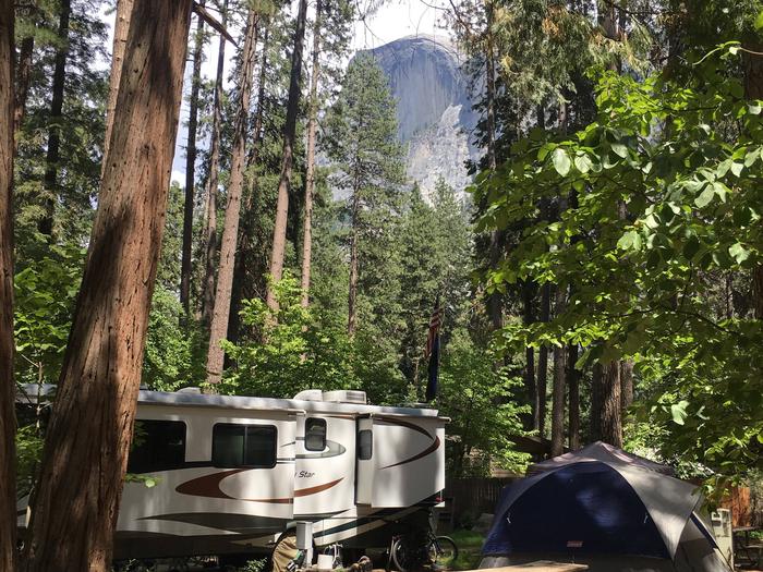
Upper Pines Campground is located in breathtaking Yosemite National Park in Central California’s rugged Sierra Nevada Mountain Range at an elevation of 4,000 feet. The site is situated in the heart of Yosemite Valley, an awe-inspiring landscape containing many of the famous features for which Yosemite National Park is known.
Within Yosemite, visitors can gaze upon waterfalls, sheer granite cliffs, deep valleys, grand meadows, ancient giant sequoias, vast wilderness areas and much more.
Yosemite National Parks reservable campsites are available up to five months in advance on the 15th of each month at 7:00 a.m. (PT) or 10:00 a.m. (ET). For example, on January 15, the time period May 15 to June 14 becomes available to reserve, and therefore, the full booking window would be from January 16 to June 14.
Yosemite National Park Campground Reservation Dates
For additional park information, call (209)372-0200 or visit www.nps.gov/yose
Recreation
Yosemite’s trails, cliffs, roads and rivers provide endless recreational activities for any kind of visitor. Hiking, biking, rock climbing, fishing, horseback riding, rafting, auto touring, cross-country skiing and photography are all very popular activities within the park.
Hiking trails range from the easy paved, two-mile roundtrip walk to Mirror Lake/Meadow, to the grueling but rewarding 14- to 16-mile trek to Half Dome (permit required). Both of these trails begin near the Pines Campgrounds, and there are many additional trailheads within Yosemite Valley.
Rafting the Merced River is a fun way to cool down on a summer day when water levels are sufficient. Yosemite Valley also offers numerous guided bus tours, educational programs, museums, ranger-led activities and an art center with workshops.
Facilities
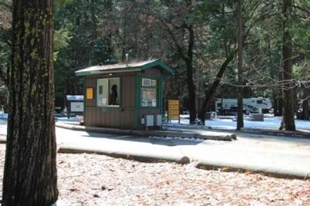
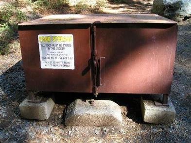
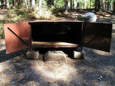
Upper Pines Campground is the largest of the three reservation campgrounds in Yosemite Valley. It offers paved roads and parking spurs, flush toilets, and drinking water. Each campsite contains a picnic table, fire ring, and a food storage locker. Yosemite’s free shuttle bus stops near the campground entrance.
Nearby, historic Curry Village offers a general store, restaurants and bar, amphitheater, showers, and a tour and activities desk.
Natural Features
Yosemite Valley is forested with a diverse mix of California black oak, Ponderosa pine, incense-cedar, White fir, and Whiteleaf Manzanita, which offers a pleasant combination of sun and shade. Through the trees, Yosemite’s telltale granite cliffs peek through, and the gentle, refreshing Merced River flows nearby.
Nearby Attractions
Glacier Point offers sweeping views of Yosemite Valley, Little Yosemite Valley, Half Dome, Vernal and Nevada Falls, and Clouds Rest, among other notable landmarks.
The Tioga Road offers a 39-mile scenic drive past forests, meadows, lakes and granite domes. Beautiful Hetch Hetchy Reservoir is home to spectacular scenery and numerous wilderness trailheads.
Charges & Cancellations
Cancellations more than 48 hours in advance of arrival date only incur a $10 transaction fee. Within 48 hours, $10 and the first night’s fee are charged (Exception: 1 night reservations do not incur an additional $10 fee, but do not receive a refund). No-shows will be assessed a $20 service fee along with the loss of the first night’s fee.