
Directions
Take Highway 41 north from Fresno, Highway 140 east from Merced, Highway 120 east from Manteca or west from Lee Vining (State Route 395) into Yosemite National Park. Tuolumne Meadows Campground is located 5 miles from the Tioga Pass Entrance station (Hwy 120 from the east), and is 55 miles (2 hours) from Yosemite Valley.
Phone
209-372-4025 OR 209-372-8502
Activities
CAMPING, DAY USE AREA
Keywords
Yosemite National Park
Related Link(s)
National Park Services Concessionaire
California State Road Conditions
Overview
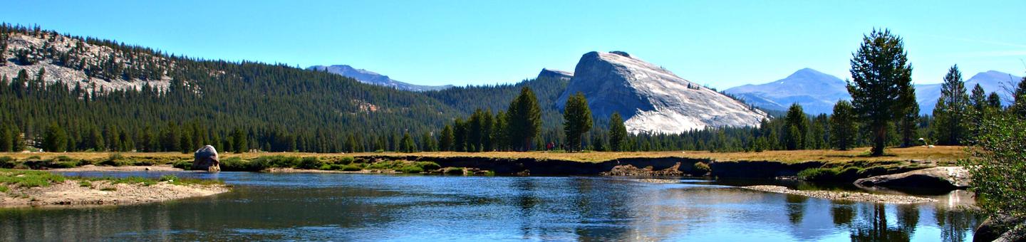
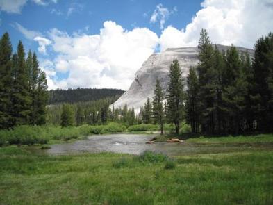
Tuolumne Meadows Campground is located in breathtaking Yosemite National Park in Central California’s rugged Sierra Nevada Mountain Range at an elevation of 8,600 feet. The site is situated along the scenic Tioga Road just five miles from the Tioga Pass Entrance Station. Within Yosemite, visitors can gaze upon waterfalls, sheer granite cliffs, deep valleys, grand meadows, ancient giant sequoias, vast wilderness areas, and so much more. Yosemite National Park’s reservable campsites are available up to five months in advance on the 15th of each month at 7:00 a.m. (PT) or 10:00 a.m. (ET). For example, on January 15, the time period May 15 to June 14 becomes available to reserve, and therefore, the full booking window would be from January 16 to June 14. Yosemite National Park Campground Reservation Dates
Recreation
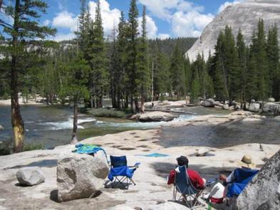
Popular activities in the area include hiking, rock climbing, backpacking and fishing. The 4.8-mile roundtrip trail to Elizabeth Lake begins in the campground and climbs to a glacier-carved lake at the base of Unicorn Peak.
Other trails in Tuolumne Meadows include Soda Springs and Parsons Lodge, Lyell Canyon via the John Muir Trail, Cathedral Lakes, Mono Pass, and Glen Aulin. Nearby Tenaya Lake is a magnificent spot for picnicking, swimming and canoeing.
Facilities
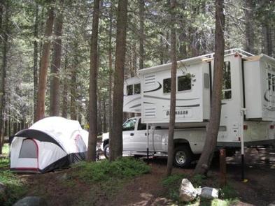
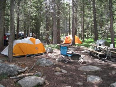
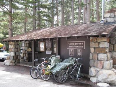
This large, popular campground contains family, horse and group camp sites with picnic tables, fire rings, and a food storage lockers. Flush toilets, drinking water, and an amphitheater are provided. Tuolumne Meadows Visitor Center is within walking distance, as is a general store and gas station.
Natural Features
Tuolumne Meadows embodies the high-country of the Sierra Nevada, with its broad sub-alpine meadows and granite domes and peaks. The Tuolumne River, Lyell For, and Dana Fork flow through the vast, colorful meadows bursting with seasonal wildflowers. The meadows are surrounded by stands of Western White pine, Mountain hemlock, and Lodgepole pine.
Nearby Attractions
Yosemite Valley, an awe-inspiring landscape containing many of the famous features for which Yosemite National Park is known, is 55 miles and two hours from Tuolumne Meadows. Hiking trails and bike paths are abundant in the valley. Rafting the Merced River is a fun way to cool down on a summer day when water levels are sufficient. Yosemite Valley also offers numerous guided bus tours, educational programs, museums, ranger-led activities, and an art center with workshops.
Glacier Point is an hour from Yosemite Valley, with sweeping views of both Yosemite and Little Yosemite Valley, Half Dome, Vernal and Nevada Falls, and Clouds Rest, among other notable landmarks.
A visit to Wawona and the Pioneer Yosemite History Center is like stepping back in time.
Charges & Cancellations
Cancellation of individual or equestrian site reservations will be charged a $10 service fee. If the cancellation is within 48 hours of the arrival date, the first night’s fee will also be charged. Cancellation of a group site reservation will incur a $10.00 service fee plus the first nights use fee when the reservation is cancelled within 14 days of the scheduled arrival date. Cancellations for a single nights use will not be assessed a service fee. No-shows for any type of reservation will be charged a $20 service fee and the first night’s fee.