

Directions
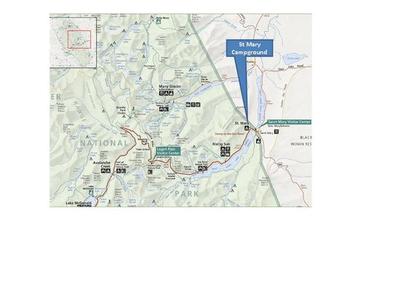
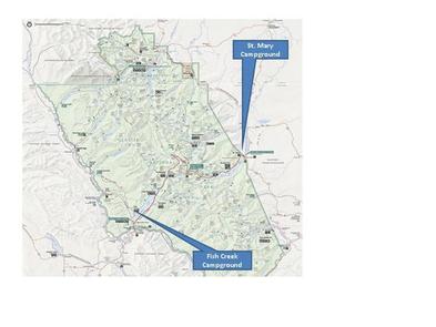
Located a half-mile west of the St. Mary entrance near St. Mary, Montana. Access is from U.S. Highway 89 approximately 33 miles northwest of Browning, Montana or over Logan Pass when open. Vehicle restrictions are in effect.
Phone
406-732-7708
Activities
CAMPING, INTERPRETIVE PROGRAMS, FISHING, HIKING, DAY USE AREA
Keywords
St. Mary Campground,St. Maries Campground,St. Mary’s campground,GLACIER,GLACIER NATIONAL PARK
Related Link(s)
National Park Services Concessionaire
Overview
St. Mary Campground is the largest campground on the east side of Glacier National Park, and is conveniently located approximately a half-mile from the St. Mary Visitor Center. The visitor center offers interpretive programs, shuttle service and Red Bus tours leaving from the center. The campground sits near the entrance of the popular scenic byway, the Going-to-the-Sun Road.
Recreation
St. Mary Campground is located on the east side of the park, which boasts some of the best trails available for day hiking. Trailheads start at a higher elevation than those on the west side, so less ascent is required to reach scenic vistas.
Facilities
Potable water is accessible in the campground, and restroom facilities provide flush toilets and sinks with running water.
A couple of miles down the road and outside the park, visitors will find all the comforts of home, including restaurants, gift shops, camp stores, gas and groceries.
Natural Features
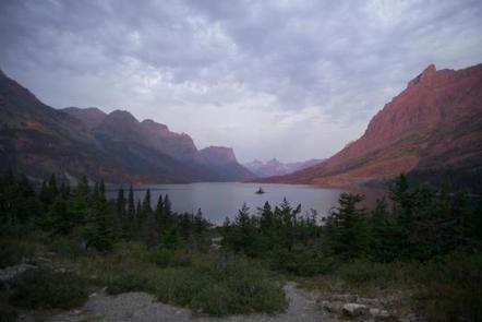
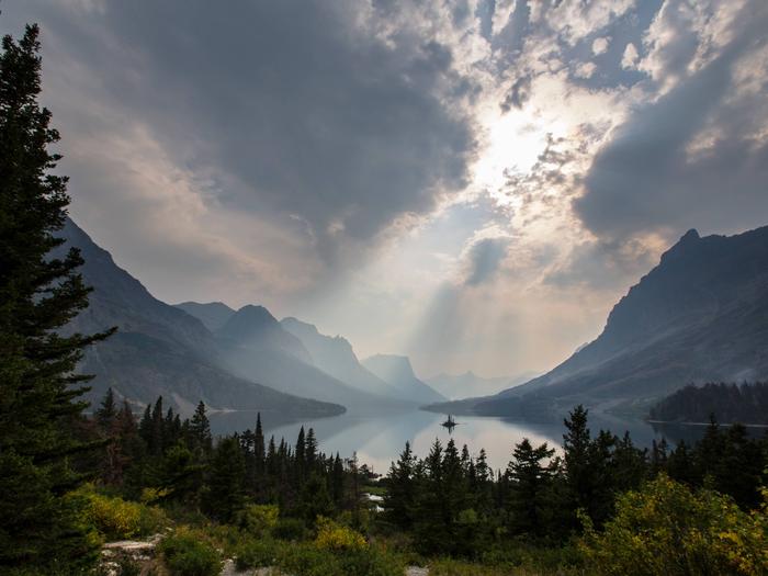
Though shade is sparse, the aspen trees that grace St. Mary Campground flutter in spring and summer breezes and provide colorful splashes of yellow late in the season. Views of Singleshot, East Flattop and Red Eagle Mountains provide a dramatic backdrop to the landscape.
St. Mary Lake which, although too cold and occasionally too rough to swim in, provides refreshing scenery on warm days.
Nearby Attractions
One must-see attraction is the sister park across the U.S.-Canadian border, Waterton Lakes National Park. As the other half of the Waterton-Glacier International Peace Park, Waterton Lakes offers fantastic hiking, scenic boat cruises and several scenic drives all centered around the Townsite of Waterton.
Immediately east of Glacier National Park lies the picturesque Blackfeet Indian Reservation, spanning 1.5 million acres. Visit the Museum of the Plains Indian, in Browning, Montana, for a fascinating introduction to the rich cultural heritage of the largest Indian tribe in Montana.