MILLERS FERRY CAMPGROUND, AL Campground Reservation, Info, Images, Map, Directions

MILLERS FERRY CAMPGROUND, Alabama Campground Images, Info & Reservations

Directions

From Camden, Alabama, take State Route 28 northwest for 12 miles. Turn right before the Lee Long Bridge and follow signs into the campground.

Phone

334-682-4191

Activities

BOATING, CAMPING, FISHING, HUNTING, SWIMMING SITE

Keywords

MILF,EAST BANK,ALABAMA RIVERS,MILLERS FERRY LAKE,WILLIAM DANNELLY,ALABAMA RIV. – DAN

Related Link(s)

Rec Area Info & Images

Alabama State Tourism

Alabama State Road Conditions

Overview

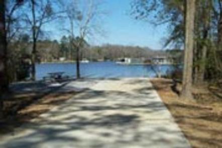
Millers Ferry Campground, also known as East Bank, is located on scenic Dannelly Reservoir in Alabama’s Black Prairie Belt. The reservoir sits on the Alabama River and covers roughly 27 square miles, boasting more than 500 miles of shoreline.

Boating, fishing, hunting and hiking are popular activities.

Recreation

The park offers excellent fishing for bass, crappie, bluegill and catfish, and numerous fishing tournaments and annual festivals are held in the immediate area.

Whitetail deer and wild turkeys roam the park, creating excellent bow-hunting opportunities.

Facilities

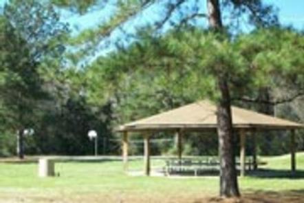
This campground offers 42 family sites with electric hookups. Amenities include flush toilets, showers, drinking water, laundry facilities and a dump station.

A fishing dock, boat ramp, fish cleaning stations and playground provide additional recreation opportunities for guests.

Natural Features

The Black Prairie Belt is characterized by rich, dark soils and a mosaic of rolling grasslands and dense hardwood and pine forests.

Reservation

More from CampingHiking.net:

MONTY CAMPGROUND, Oregon Campground Images, Info & Reservations

Directions From Sisters, OR: Travel 5.6 miles northwest on Highway 20, then 20.8 miles north on Forest Road 11, then 5.0 miles east on Forest Road 1170, and then 7.2 miles northwest on County Road 64. Phone 503-464-8515 Activities CAMPING, FISHING, WILDLIFE VIEWING Keywords Related Link(s) Rec Area Info &

COW MEADOW CAMPGROUND, Oregon Campground Images, Info & Reservations

Directions From Bend, OR: Travel about 45 miles south on Cascade Lakes Highway (46), 0.5 mile east on Forest Road 40, then 2 miles south on Forest Road 4000-790. Phone 541-323-1746 Activities CAMPING Keywords Related Link(s) Rec Area Info & Images Oregon State Tourism Oregon State Road Conditions Overview Cow

EUREKA, Kentucky Campground Images, Info & Reservations

Directions From Nashville, Tennessee take I-24 West to Exit 40. Turn left onto Highway 62 West for 2.9 miles then turn left onto Highway 810. Go 0.7 miles then turn right onto State Route 1271. Continue onto 1271 for 1.8 miles. The road leads directly into the campground. Phone 270-388-9459