

Directions
From Hartwell, GA, travel approximately 2.5 miles on Highway 29 North. Turn left onto Elrod Ferry Road, and after a mile follow the brown directional signs to the facility. 1387 ELROD FERRY ROAD, Hartwell GA 30643
Phone
888-893-0678 HARTWELL PROJECT OFFICE
Activities
BOATING, FISHING, PICNICKING, DAY USE AREA, SWIMMING SITE, SWIMMING, WATER ACCESS
Keywords
ELRO,HARTWELL LAKE PROJECT
Related Link(s)
Overview
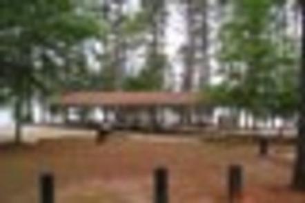
Elrod Ferry Recreation Area is a 39 acre site situated on a gently sloping point that overlooks the lake near Hartwell Dam. The site presently offers day use and boat launching facilities consisting of 1 gatehouse/entrance, 37 picnic sites, 2 standard picnic shelters with water and electric service, 1 boat ramp, 1 courtesy dock, 2 comfort stations, 2 playgrounds, 3 designated swim areas/beaches, 1 volleyball pit, and associated paved roads and parking areas throughout. The area experiences intense public use during the peak recreation season.
Recreation
Boating and water sports top the list of popular activities. A boat ramp is available for visitors’ convenience, and three designated swimming beaches are located around the facility.
Facilities
The site presently offers day use and boat launching facilities consisting of 1 gatehouse/entrance, 37 picnic sites, 2 standard picnic shelters with water and electric service, 1 boat ramp, 1 courtesy dock, 2 comfort stations, 2 playgrounds, 3 designated swim areas/beaches, 1 volleyball pit, and associated paved roads and parking areas throughout.
Natural Features
Hartwell Lake is a man-made lake bordering Georgia and South Carolina on the Savannah, Tugaloo and Seneca Rivers. The dam and lake area boasts 8 campgrounds and 11 day-use facilities that are operated by the US Army Corps of Engineers. The Hartwell Project was originally authorized for hydro-power, flood control, and navigation. Later, recreation, water quality, water supply and fish and wildlife management were added. Surrounding vegetation allows for plenty of shade, and the 962 miles of shoreline provide numerous swimming beaches, picnic areas and boat ramps.
Nearby Attractions
Charges & Cancellations
A $10 service fee will apply if you change or cancel a reservation more than 14 days in advance of arrival date. If you cancel a reservation within 14 days of your scheduled arrival date, you will forfeit the reservation fee.