HIGHWAY 125 PARK BULL SHOALS, AR Campground Reservation, Info, Images, Map, Directions

HIGHWAY 125 PARK BULL SHOALS, Arkansas Campground Images, Info & Reservations

Listen

Directions

From Yellville, AR. take SR 14 for 14 miles northwest to SR 125, go north on SR 125 for 13 miles. Follow signs into campground.

Phone

870-436-5711

Activities

BOATING, CAMPING, SWIMMING SITE

Keywords

H125,BULL SHOALS LAKE,BULL SHOALS LAKE

Related Link(s)

Rec Area Info & Images

Arkansas State Road Conditions

Arkansas State Tourism

Overview

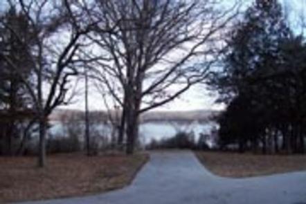
Enjoy the beautiful scenery overlooking Bull Shoals Lake, known in the area as a water sports paradise.

The park is a departure point for the Peel Ferry, which connects Highway 125 from Arkansas to Missouri. Peel Ferry is Arkansas’ last remaining free ferry. It runs year-round and saves drivers a 50-mile journey around the lake.

Recreation

The surplus of water activities keep visitors entertained for many days of vacation. Hiking and birding are also rewarding pastimes here.

Facilities

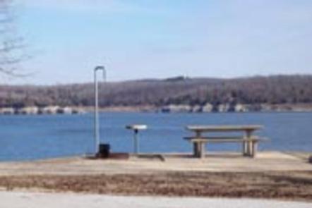
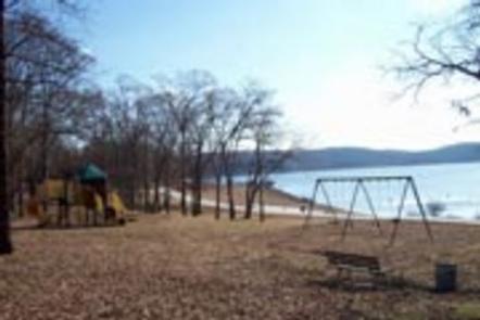
The 39 campsites are equipped with electric hookups, drinking water and showers. The site has a designated swimming area and marina.

Groups of up to 50 can reserve the group picnic shelter, which is beside the playground.

Natural Features

Blue Shoals Lake spans more than 71,000 acres across the northern edge of Arkansas and the southern edge of Missouri. The lake was created in 1951 with the completion of the massive concrete dam, Blue Shoals Dam.

The lake is surrounded by dense forest along the rolling foothills of the Arkansas Ozarks.

Nearby Attractions

Visit the Bull Shoals-White River State Park and explore its two hiking trails: the Big Bluff Trail and the Lakeside Trail. Consider a ferry ride to explore scenic drives on the Missouri side of the lake.

Reservation

More from CampingHiking.net:

Axolotl Cabin, Montana Campground Images, Info & Reservations

Listen Directions From Ennis – Most Direct Route – 4 WD/High Clearance Vehicle Strongly Recommended -Take State Highway 287 towards Virginia City – About 1/4 mile east of mile marker 11 (or 3/4 mile west of mile marker 10) turn South into the paved parking area near the top of

BROKEN ARROW CAMPGROUND, Oregon Campground Images, Info & Reservations

Listen Directions From Roseburg, OR, turn left onto OR-138 East / NE Diamond Lake Boulevard for approximately 80 miles. Turn right onto Forest Road 4795 / Diamond Lake Loop at the north entrance to Diamond Lake Recreation Area. Continue 3.2 miles and turn right after the pizza parlor. Drive half

SANTA CRUZ DEL NORTE BACKCOUNTRY, California Campground Images, Info & Reservations

Listen Directions Boat transportation can be arranged with Island Packers from Ventura Harbor. To park headquarters in Ventura, California: Highway 101, exit Victoria or Seaward to Ventura Harbor. Phone 805-658-5730 Activities CAMPING, HIKING, WILDLIFE VIEWING, WILDERNESS, PHOTOGRAPHY, BIRDING, BACKPACKING Keywords CG09,SANTA CRUZ DEL NORTE,DEL NORTE,CHANNEL ISLANDS,SANTA CRUZ,Channel Islands National Park,Channel

BUCKHORN CAMPGROUND, Kentucky Campground Images, Info & Reservations

Listen Directions Traveling north from Lexington, take I-64 to the Mountain Parkway. Exit at Slade, take KY 11 South through Beattyville. Continue on Highway 11 to Booneville, continuing past the courthouse to KY 28 West. Follow KY 28 about 23 miles to Buckhorn. Traveling east From Hazard, take KY 15