PICKENSVILLE CG (PICKENSVILLE AL), AL Campground Reservation, Info, Images, Map, Directions

PICKENSVILLE CG (PICKENSVILLE AL), Alabama Campground Images, Info & Reservations

Directions

From Tuscaloosa, Alabama, take Highway 82 west to the junction with Highway 86. Turn left on 86 west to Pickensville. The entrance road to the campground is 2.5 miles from the yellow caution light.

Phone

205-373-6328

Activities

BIKING, CAMPING, INTERPRETIVE PROGRAMS, FISHING, HIKING, HUNTING, WILDLIFE VIEWING

Keywords

PICK,TENNESSEE- TOMBIGBEE WATERWAY,TENN-TOM,PICKENSVILLE,TENNESSEE-TOMBIGBE

Related Link(s)

Rec Area Info & Images

Alabama State Road Conditions

Alabama State Tourism

Overview

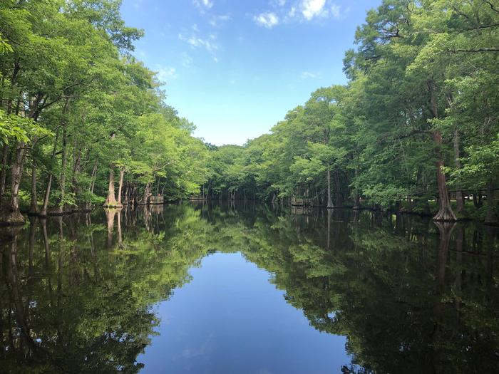
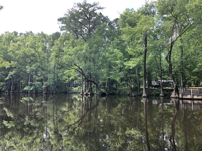
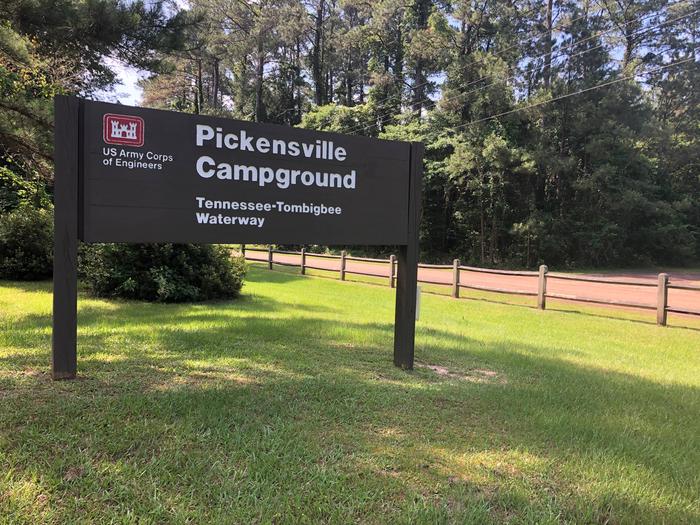
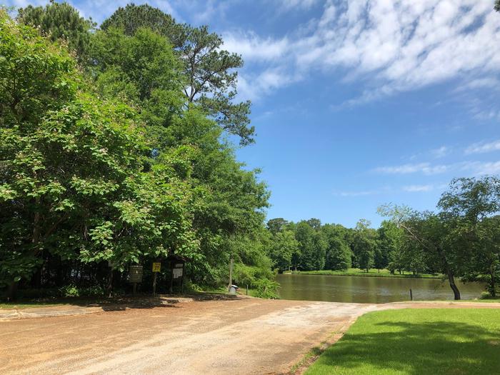
Pickensville Campground is located just west of Pickensville, Alabama, on Aliceville Lake on the Tennessee-Tombigbee Waterway.

This campground boasts both a campground and day use area with many activities and amenities for families and outdoor enthusiasts. Visitors enjoy hunting, fishing, picnicking, water sports and watching the barges go by on the waterway.

Recreation

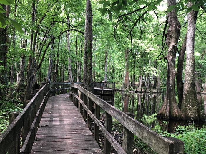
Families can swim at Pickensville’s beach, play on the multi-use court, walk along the wooded waterfront and learn about the natural and cultural history of the area at the amphitheater.

Anglers can try their luck on the accessible fishing dock or go off-shore in search of bass, walleye, crappie, catfish and sunfish.

Additionally, hunters can seek out a diverse range of high quality habitats for upland game and waterfowl species along the lands surrounding the waterway.

Facilities

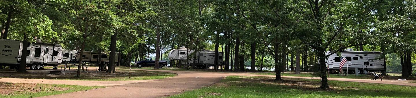
This facility offers 176 campsites that provide picnic tables, campfire rings with grills, electric and water hookups and plenty of shade. Some sites also provide sewer hookups for RV campers. There are accessible sites and restrooms.

Anglers can take advantage of an accessible fishing dock, boat ramp and fish cleaning station at the day use area just across the waterway from the campground. The day use facility also provides a swim beach, playground and picnic shelters.

Natural Features

The Tenn-Tom, as the waterway is known, extends 234 miles from the Tennessee River to the junction of the Tombigbee River in Alabama. The man-made waterway connects the nation’s midsection of commercial water transportation with the Gulf of Mexico.

Nearby Attractions

In Pickensville, Alabama, visitors can learn the history of the waterway at the Tom Bevill Visitor Center which depicts an 1830-1850 era antebellum-style home, as well as explore the U.S. Snagboat Montgomery, a National Historical Landmark.

Reservation

More from CampingHiking.net:

BERRY BEND EQUESTRIAN, Missouri Campground Images, Info & Reservations

Directions From Z Highway, travel approximately 2 miles south on the Berry Bend Access Road. Phone 660-438-7317 Activities BOATING, CAMPING, FISHING, HIKING, HORSEBACK RIDING, FISH HATCHERY Keywords BERE,TRUMAN LAKE,BERRY BEND NORTH,HARRY S TRUMAN Related Link(s) Rec Area Info & Images Missouri State Road Conditions Missouri State Tourism Overview BERRY BEND

UPPER SAGE FLAT, California Campground Images, Info & Reservations

Directions In Big Pine, on US Highway 395, turn west at the yellow flashing traffic light onto Crocker Street (Big Canyon Road). Continue on this road for 9 miles to campground, on your left. Phone 760-935-4339 Activities CAMPING, FISHING, HIKING, HORSEBACK RIDING, WILDLIFE VIEWING Keywords UPSF,UPPER SAGE CAMPGROUND,INYO NF –

ISLET CAMPGROUND, Oregon Campground Images, Info & Reservations

Directions Located 37.3 miles east of Oakridge, Oregon. From Oakridge, Oregon: At the intersection of Crestview Street and Oregon State Highway 58, travel east on Highway 58 for 23.3 miles. Turn left on the Waldo Lake Road/Forest Road 5897. Travel for 12.8 miles and turn left at the T intersection

CHIPPEWA LOOP, Minnesota Campground Images, Info & Reservations

Directions From Cass Lake, Minn., take U.S. Highway 2 east for 4 miles, to the Norway Beach Recreation Area. Turn left and follow the campground road until the signs indicate the Chippewa Loop. Phone 218-335-8600 Activities BIKING, BOATING, HISTORIC & CULTURAL SITE, CAMPING, INTERPRETIVE PROGRAMS, FISHING, WATER SPORTS, SWIMMING SITE

Aitch Picnic Shelter, Pennsylvania Campground Images, Info & Reservations

Directions Aitch is located near the town of Marklesburg, PA. From Huntingdon continue 10.5 miles southbound along Rt. 26 to Marklesburg. At Markelsburg turn left onto Aitch Road (marked by sign). Aitch Road leads directly to the Shelter location (0.8 miles). Phone 814-658-3405 Activities BOATING, HISTORIC & CULTURAL SITE, CAMPING,