
Directions
From GA 77/State Route 366, take the first right onto Knox Bridge Crossing Road/GA 59. After two miles make a slight right onto Powers Road. Turn right onto GA 398 North, follow for 3.5 miles, then follow the brown directional signs to the site. 2195 POPLAR SRPINGS RD Lavonia, GA 30643
Phone
888-893-0678 HARTWELL PROJECT OFFICE
Activities
BOATING, FISHING, PICNICKING, SWIMMING, WATER ACCESS
Keywords
POPL,HARTWELL LAKE PROJECT
Related Link(s)
Overview
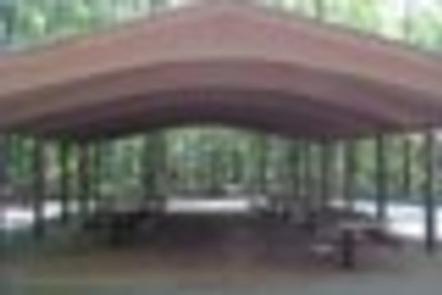
Poplar Springs Recreation Area is a 24 acre site with moderate slopes with relatively dense stands of pines and mixed hardwoods. The site presently offers day use and boat launching facilities, but is primarily used for boat launching and is one of the more popular launch sites in this area of Hartwell Lake. Facilities include 1 volunteer host campsite, 20 picnic sites, 1 standard picnic shelter with water and electric service, 1 two lane boat ramp, 1 courtesy dock, 2 comfort stations, and associated paved roads and parking areas throughout.
Recreation
Boating and water sports top the list of popular activities. A boat ramp is available year-round for visitors’ convenience.
Facilities
Facilities include 1 volunteer host campsite, 20 picnic sites, 1 standard picnic shelter with water and electric service, 1 two lane boat ramp, 1 courtesy dock, 2 comfort stations, and associated paved roads and parking areas throughout.
Natural Features
Hartwell Lake is a man-made lake bordering Georgia and South Carolina on the Savannah, Tugaloo and Seneca Rivers. The dam and lake area boasts 8 campgrounds and 11 day-use facilities that are operated by the US Army Corps of Engineers. The Hartwell Project was originally authorized for hydro-power, flood control, and navigation. Later, recreation, water quality, water supply and fish and wildlife management were added. Surrounding vegetation allows for plenty of shade, and the 962 miles of shoreline provide numerous swimming beaches, picnic areas and boat ramps.
Nearby Attractions
Nearby Tugaloo State Park offers swimming, boating and hiking, including the Crow Tree and Muscadine trails, which showcase beautiful blooms on oak, walnut, mulberry and cherry trees during the spring and summer months.
Charges & Cancellations
A $10 service fee will apply if you change or cancel a reservation more than 14 days in advance of arrival date. If you cancel a reservation within 14 days of your scheduled arrival date, you will forfeit the reservation fee.