QUARRY COVE, AR Campground Reservation, Info, Images, Map, Directions

QUARRY COVE, Arkansas Campground Images, Info & Reservations

Listen

Directions

From Ola, Arkansas, take Route 7 south for 9 miles. Turn west onto US-60, and continue for .5 miles and follow signs into campground.

Phone

479-272-4233

Activities

BOATING, CAMPING, FISHING, SWIMMING SITE

Keywords

QUAR,NIMROD LAKE,NIMROD LAKE

Related Link(s)

Rec Area Info & Images

Arkansas State Road Conditions

Arkansas State Tourism

Overview

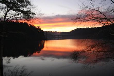
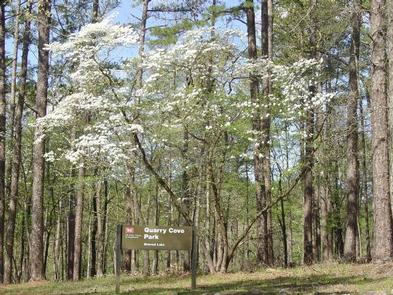
Quarry Cove Campground sits along the shores of Nimrod Lake and Dam, cradled between Arkansas’ Ouachita and Ozark Mountains. Visitors are greeted with shaded campsites, beautiful scenery and many outdoor recreation opportunities. Nimrod Lake provides the ideal spot to get away from it all, relax and enjoy yourself.

Recreation

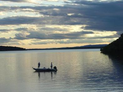
Fishing is one of the most popular activities at the lake, with an abundance of catfish, bluegill, bass and crappie available. Boating, water skiing and tubing are also popular, with 11 boat ramps conveniently located around the lake, however, skiing and tubing are only allowed from the tip of Carden Point eastward toward the dam because areas west of there are too hazardous. Campers are likely to spot white-tailed deer, eastern wild turkey, bobwhite quail, squirrel, rabbit, fox, mink, black bear, dove and waterfowl in the area. Seasonal hunting is also permitted throughout the lake, except in or near recreation areas.

Facilities

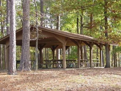
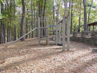
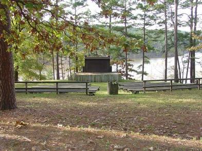
With 31 spacious and modern campsites and one large day use group picnic shelter, Quarry Cove Campground has plenty of room for the family. A swimming beach, boat ramp and playground are also provided.

Natural Features

Nimrod Dam was completed in 1942 as part of a comprehensive plan for flood control and development of water resources in the Fourche LaFave River. Although recreation was not part of the initial mission of the dam project, the lake and surrounding 21,000 acres of pristine land have now become a recreational oasis for outdoor enthusiasts.

Nearby Attractions

Nimrod Lake is conveniently located adjacent to State Highway 7, a National Scenic Byway and other nearby points of interest like Petit Jean State Park, Mount Nebo State Park and Hot Springs National Park.

Reservation

More from CampingHiking.net:

WALLASHUCK, Iowa Campground Images, Info & Reservations

Listen Directions 890 190th Ave Pella, Iowa 50219 Take County Highway G-28 4 miles west of Pella, then go 0.8 miles south on 190th Avenue. Phone 641-828-7522 Activities BIKING, BOATING, CAMPING, FISHING, HIKING, VISITOR CENTER Keywords WALA,LAKE RED ROCK Related Link(s) Rec Area Info & Images Iowa State Road Conditions

LONE PINE, California Campground Images, Info & Reservations

Listen Directions From U.S. Highway 395 in California, travel to the town of Lone Pine. The campground is 6 miles west of Lone Pine on Whitney Portal Road. Phone 760-937-6070 Activities BIKING, CAMPING, FISHING, HIKING, PICNICKING, WILDLIFE VIEWING Keywords LONP,INYO NF – FS Related Link(s) Rec Area Info & Images

GORDON REESE CABIN, Montana Campground Images, Info & Reservations

Listen Directions From Wisdom, travel west on Highway 43 for 26 miles, the parking area is located at the top of Chief Joseph Pass. The route has many signs. Maps of the area may be purchased by calling the Wisdom Ranger District. Phone 406-689-3243 Activities BIKING, HISTORIC & CULTURAL SITE,

SPRING CANYON GROUP SITE, Washington Campground Images, Info & Reservations

Listen Directions Take Highway 2 west of Spokane for 65 miles to the town of Wilbur, Washington. Turn north on Highway 174 (follow road signs). Travel 19 miles and turn right at the sign for Spring Canyon Campground. Phone 509-754-7889 Activities BIKING, BOATING, HISTORIC & CULTURAL SITE, CAMPING, INTERPRETIVE PROGRAMS,

PORTAL BUNKHOUSE, Arizona Campground Images, Info & Reservations

Listen Directions From Tucson, take I-10 east for 139 miles to Road Forks, NM. Turn right (south) on US 80 and drive 28 miles to Portal Road. Turn right (west) and drive 7 miles through the town of Portal. Turn left on Forest Road 42 for approximately 1 mile. The