ROCKY CREEK (SOMERVILLE LAKE), TX Campground Reservation, Info, Images, Map, Directions

ROCKY CREEK (SOMERVILLE LAKE), Texas Campground Images, Info & Reservations

Directions

From Austin, Texas, take US 290 east to Brenham. Follow HWY 36 north 11.5 miles to FM 1948. Turn left on FM 1948 and follow 5 miles to the park entrance.

Phone

979-596-1622; FOR BOOKING, CALL 1-877-444-6777

Activities

BOATING, CAMPING, FISHING

Keywords

ROC2,SOMERVILLE LAKE,LAKE SOMERVILLE,ROCKY CREEK SOMERVILLE LAKE,SOMERVILLE LAKE

Related Link(s)

Rec Area Info & Images

Texas State Road Conditions

Texas State Tourism

Overview

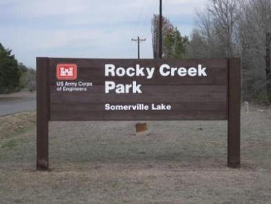
Rocky Creek Park is located at Somerville Lake near Somerville, Texas. The lake offers various types of recreation such as camping, fishing, boating, swimming, nature trails and much more.

Recreation

Somerville Lake offers many opportunities for outdoor recreation. Water sports, hiking and biking are popular activities.

The lake is great for crappie, catfish, white, hybrid-striped and largemouth bass fishing, with catches weighing up to 10 or more pounds.

Facilities

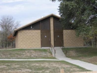
Rocky Creek Campground offers 192 sites: 30 sites have 30-amp electrical hookups, 127 sites have 50-amp hookups and 35 tent sites have 30-amp hookups. Flush toilets and showers are provided, as are picnic tables and fire rings. Two boat ramps, group picnic shelter, and dump station are located on-site.

Natural Features

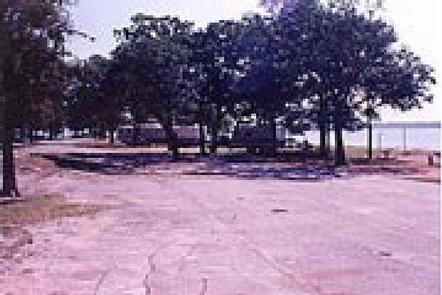
The campground is situated on a peninsula on scenic Somerville Lake. Some large trees cover the grounds, offering limited shade. Pelicans and other waterfowl frequent the shoreline.

Nearby Attractions

Yegua Creek Park is nearby, offering additional access to Somerville Lake and all its great water activities.

The city of Somerville, Texas is less than 10 miles from Rocky Creek, offering restaurants and shops.

Reservation

More from CampingHiking.net:

DAM WEST SPILLWAY, Illinois Campground Images, Info & Reservations

Directions From I-70, take State Route 127 south to Carlyle and turn east on William Road. Continue for 1/2-mile to Lake Road and turn south, following signs to the park. Phone 618-594-5253 Activities BOATING, CAMPING, FISHING Keywords DAWS,CARLYLE LAKE Related Link(s) Rec Area Info & Images Illinois State Tourism Illinois

HELLS CROSSING CAMPGROUND, Washington Campground Images, Info & Reservations

Directions From Naches, take Highway 410 approximately 38 miles northwest to milepost 83.4. Phone 541-338-7869 Activities CAMPING, FISHING, HIKING, WATER SPORTS, SWIMMING SITE Keywords HECR,OKANOGAN – WENATCHEE NF -FS,HELLS CROSSING,HELLS CROSSING CAMPGROUND Related Link(s) Rec Area Info & Images Washington State Tourism Forest Service Concessionaire Washington State Road Conditions Overview

BUSHYTAIL, California Campground Images, Info & Reservations

Directions From I-5, take 299 west to Weaverville. Then take State Highway 3 north for 16 miles. Turn right at Minersville/Bushytail, then turn left into campground. Phone 530-275-8113 Activities BOATING, CAMPING, FISHING, HIKING, WATER SPORTS, SWIMMING SITE Keywords BUSH,SHASTA-TRINITY -FS Related Link(s) Rec Area Info & Images Forest Service Concessionaire

Marble Creek Campground, Washington Campground Images, Info & Reservations

Directions From Seattle, take I-5 north for about 42 miles. Exit onto WA-530 East, then continue east on Highway 20 for about 40 miles. At the town of Marblemount, cross the bridge over the Skagit River and continue east approximately 8 miles to the Marble Creek Campground. Phone 360-804-1103 Activities