TOAD SUCK, AR Campground Reservation, Info, Images, Map, Directions

TOAD SUCK, Arkansas Campground Images, Info & Reservations

Listen

Directions

From Conway, Arkansas, travel west for 7 miles on SR-60 and follow signs into the campground.

Phone

501-759-2005

Activities

BOATING, CAMPING, FISHING, BIRDING

Keywords

TOAD,TOAD SUCK FERRY LOCK AND DAM-A,TOAD SUCK FERRY

Related Link(s)

Rec Area Info & Images

Arkansas State Road Conditions

Arkansas State Tourism

Overview

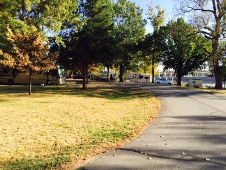
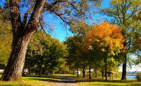
Toad Suck Campground, situated on the Arkansas River, is a popular destination for families and groups. Picnicking, boating and fishing all draw visitors to this shady campground.

Recreation

Fishing is excellent year-round, and record fish catches are common in the Arkansas River. The waters have an abundance of bream, crappie, white bass, largemouth bass and several species of catfish.

Facilities

Toad Suck provides 48 sites with electric and water hookups, plus five group picnic shelters. Additional amenities include hot showers, a playground and boat ramp.

Natural Features

Situated in the eastern edge of both the Ozark and Ouachita Mountains, the area is a haven for nature enthusiasts. Dogwood, redbud, wild plum and other native flowering trees offer breathtaking sights in springtime.

Nearby Attractions

The nearby Cadron Blockhouse in Cadron Settlement Park, a replica of a structure that was built in the late 18th century, is a popular tourist attraction.

The town of Conway hosts an annual Toad Suck Daze Festival, featuring a toad race competition.

Reservation

More from CampingHiking.net:

FORKS OF HUNTINGTON, Utah Campground Images, Info & Reservations

Listen Directions The campground is 16 miles west of Huntington, Utah, along Highway 31. Phone (435)384-2372 Activities BIKING, CLIMBING, CAMPING, FISHING, HIKING, WILDLIFE VIEWING Keywords FORH,MANTI-LASAL NF -FS Related Link(s) Rec Area Info & Images Utah State Tourism Utah State Road Conditions Overview Forks of Huntington Campground is located in

SHEEP BRIDGE, Oregon Campground Images, Info & Reservations

Listen Directions From Bend, Oregon: Travel 26.8 miles south on Hwy 97 to Wickiup Junction, then 11.0 miles west on County Road 43, then continue 4.6 miles west on Forest Road 42 , and finally 0.8 miles south on Forest Road 4260. Phone 541-323-1746 Activities BOATING, CAMPING, FISHING, HIKING Keywords

LAKE CAMPGROUND, California Campground Images, Info & Reservations

Listen Directions From Wrightwood, turn left on CA-2 W/Angeles Crest Highway and drive for 3.6 miles. Then turn right onto Big Pines Highway and drive 2.7 miles. Look for signs into the campground. Phone 760-249-3526 Activities CAMPING, HIKING Keywords LAKE,ANGELES NF – FS,LAKE,lake,california,Lake at Wrightwood,Lake at Big Pines,Jackson Lake Related