
Directions
From Estacada, travel east on Highway 224 for just over 10 miles to the campground.
Phone
503-630-5721
Activities
BOATING, CAMPING, FISHING, WATER SPORTS
Keywords
LAZY,MT. HOOD NF – FS
Related Link(s)
Overview
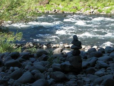
Lazy Bend Campground sits next to the Wild and Scenic Clackamas River, close to the city of Estacada. The adjacent river provides countless opportunities for rafting, kayaking, fishing and swimming. The lush, green campground is comfortable for individuals and families who want to escape into nature in Oregon’s Mt. Hood National Forest.
Recreation
Fishing is very popular on the Clackamas River. Anglers can expect a catch of winter steelhead, spring Chinook and late summer Coho salmon, as well as other species of freshwater fish.
The Clackamas bends and drops through the scenic Cascade Range and offers famous whitewater rafting opportunities. The Upper Clackamas Whitewater Festival is held annually in May and attracts rafters from all over the country.
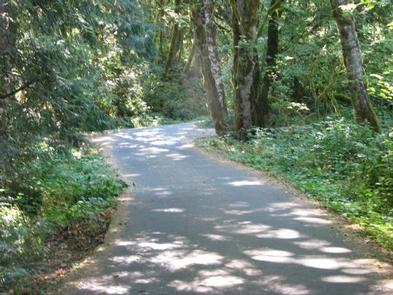
A hiking trail follows the river north and south and begins at nearby Fish Creek Campground. A boat ramp is also available there. Scenic driving is available on the West Cascades Scenic Byway, which follows the river.
Facilities
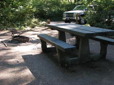
The campground offers single-family sites, most of which are designated for tent camping only. A few RV sites are available within the campground, though large RVs are not recommended and no hookups are available.
Each site is equipped with a table and campfire ring with grill. Accessible vault toilets and drinking water are provided. Some sites are available on a first-come, first-served basis.
Natural Features
The campground is the forest’s westernmost campground, situated at an elevation of 800 feet. It lies between the river and the adjacent highway, nestled among a dense stand of trees. Huckleberry bushes can be found throughout the region.
The forest provides habitat for the federally protected bald eagle and northern spotted owl, as well as an occasional peregrine falcon. A variety of wildlife makes its home in the area.
Nearby Attractions
North Fork Reservoir is just over 5 miles northeast of the campground. Boating and other water-related recreation opportunities are available there.
The campground is 10 miles from Estacada, which offers a variety of dining and shopping options, groceries and fuel.