


Directions
From Truckee, Calif., travel east on Interstate 80 for 10 miles, to the Hirschdale Road exit. Follow Hirschdale Road/Stampede Dam Road north for eight miles, to the Stampede Reservoir. Take a left on Dog Valley Road to go over Stampede Dam. Go past Emigrant Group Campground and in a quarter mile the campground will be on the right. Alternate Access (partially gravel road): From Truckee, go north on Hwy 89 for 5 miles and take a right on Hobart Mills Road. Follow Hobart Mills Road to Dog Valley Road and take a left. In approximately 3 miles, pass the boat ramp road, and in a half mile, the Campground Entrance will be on the left.
Phone
(530)587-3558. FOR RESERVATIONS, PLEASE CALL: 1 (877) 444-6777.
Activities
BOATING, CAMPING, INTERPRETIVE PROGRAMS, FISHING, HIKING, OBSERVATION SITE, SWIMMING, MOUNTAIN BIKING, WATER ACTIVITIES, KAYAKING, AMPHITHEATER
Keywords
LOGC,STAMPEDE,STEAM DONKEY,IRON OX,OX BOW,CROSS CUT,WHISTLE PUNK,CROSS CUT,TAHOE NF – FS
Related Link(s)
California State Road Conditions
Overview
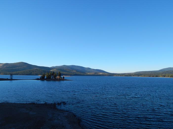
Logger Campground sits on beautiful Stampede Reservoir on the Tahoe National Forest, 30 minutes from Truckee, Calif. Visitors enjoy the area for its boating, fishing and abundant hiking and off-road trails. This facility is operated and maintained by the Tahoe National Forest.
Recreation
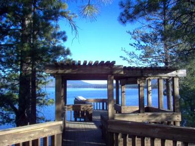
Boating, water skiing, swimming and fishing are popular activities on the reservoir. Anglers will find rainbow and brown trout and kokanee salmon. A boat ramp is located on-site. Many miles of hiking and off-road vehicle trails crisscross the surrounding area. The nearby Commemorative Emigrant Trail is open to hiking and mountain biking.
Facilities
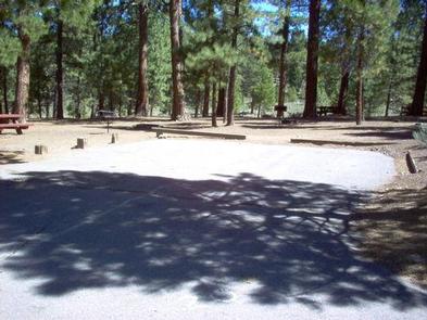
This large campground offers over 200 single, double, and triple family campsites. Campsites are arranged in six loops: Cross Cut (1-60), Iron Ox (61-115), Steam Donkey (116-161), Whistle Punk (162-187), Ox Bow (188-209), and Double Bit (210-252). Picnic tables and campfire rings with grills are provided, along with vault toilets and drinking water. A boat ramp and boat trailer parking is located less than a mile away. An amphitheater is located within the campground and is accessed by car or the shoreline hiking trail. The dump station is a quarter mile from the campground entrance and is $10 per dump, credit card only.
Natural Features
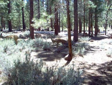
The campground is situated on the south side of Stampede Reservoir, which is located on the Little Truckee River, approximately eight miles above the confluence of the Little Truckee and Truckee Rivers. A forest of ponderosa pine, Jeffrey pine and fir trees covers the area. Sagebrush dots the forest floor.
Nearby Attractions
Boca Reservoir is 10 minutes south of the campground, offering additional boating, water skiing, swimming and fishing opportunities. Truckee, 30 minutes south, offers all the amenities of a year round recreational mountain town including Interstate highway connectivitiy, top notch restaraunts, resorts and hotels, grocery stores, gas stations, shopping, and historic sites. Lake Tahoe is located about an hour south and offers excellent boating, kayaking, fishing, hiking and scenic driving opportunities, as well as dining, shopping and lodging options. Other recreational opportunities include Boca Townsite Interpretive Trail, Donner Camp Interpretive Trail, Overland Emigrant Commemorative Trail, Prosser Reservoir Recreation Area, Prosser Pits OHV area, and numerous hiking, mountain biking, and OHV trails.