

Directions
From Sandy, travel east on Highway 26 for approximately 40 miles to Skyline Road (Road 42). Turn right and travel south for 4 miles. Turn right on Forest Road 58 and travel 2 miles to the campground.
Phone
503-630-5721
Activities
HISTORIC & CULTURAL SITE, CAMPING, FISHING, HIKING, WILDLIFE VIEWING
Keywords
LIT1,MT. HOOD NF – FS
Related Link(s)
Overview
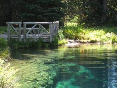
Little Crater Lake Campground is one of the most scenic spots in Mt. Hood National Forest and a very comfortable place to camp. It is not far from Little Crater Lake, a cold, crystal clear, spring-fed pond. Also nearby is Timothy Lake, where boaters and anglers enjoy recreating, all in the shadows of Mt. Hood, Oregon’s highest point.
Recreation
A short path to view Little Crater Lake begins in the campground. It connects to the Pacific Crest National Scenic Trail, which winds its way through the area, past Timothy Lake and up the slopes of Mt. Hood. The long-distance trail is popular among hikers and backpackers, stretches 2,650 miles through California, Oregon and Washington, from Canada to Mexico.
Visitors enjoy fishing at Timothy Lake, which covers roughly 1,400 acres. Anglers will find Kokanee salmon and a variety of stocked trout.
Facilities
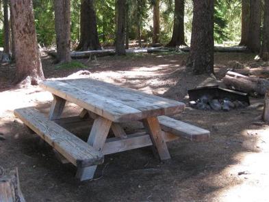
The campground offers more than a dozen single-family sites for tent and RV camping. Each site is equipped with a table and campfire ring with grill. Accessible vault toilets are provided. A hand-pump water spigot is located near the campground’s entrance and is the only source of water within the facility. Utility hookups are not available. Parking surfaces are grass, dirt and irregularly shaped.
Natural Features
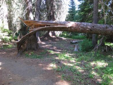
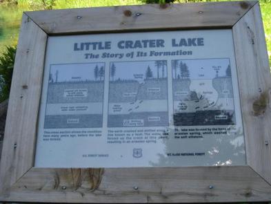
The quiet campground is nestled in an evergreen forest at an elevation of 3,300 feet. Little Crater Lake is a geologic oddity, possibly formed by artesian water forcing its way through soft, volcanic rock. The beautiful, turquoise water is a wonder to see.
The surrounding meadow is a great place for observing birds and other wildlife. The region is ripe for huckleberry picking as well.
Nearby Attractions
The Clackamas Lake Ranger Station Historic District is less than 10 miles from the campground. It was built to house forest service workers in the early 1900s. The rustic architecture and historic nature of the buildings and the surrounding area draws thousands of visitors each year.