
Directions
Access to the cabin is by floatplane only. It is about a 50-minute flight from Juneau. This cabin is in a designated Wilderness area, and access by helicopter is illegal. In fall, winter and early spring, the cabin may be inaccessible due to frozen lake surface (floatplanes cannot land). The lake is normally ice free from mid-May through November. Refer to USGS topographic map Sitka C-1, C-2.
Click here for information about reaching Forest Service cabins.
Phone
907-586-8800
Activities
BOATING, CAMPING, FISHING, HIKING, WILDLIFE VIEWING
Keywords
JAKE,JIM S LAKE CABIN,TONGASS NF – FS
Related Link(s)
Overview
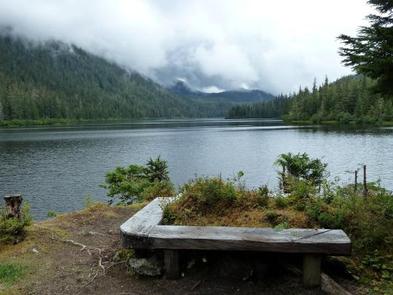
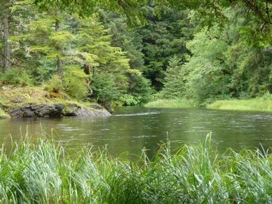
Jim’s Lake Cabin offers visitors recreation, relaxation and a remote wilderness lodging experience in the Tongass National Forest. The rustic cabin is located on the northwest end of Jim’s Lake, an isolated area in the south-central portion of Admiralty Island. The small lake is away from many flight paths.
Access to the cabin is by floatplane only. Visitors are responsible for their own travel arrangements and safety, and must bring several of their own amenities.
Recreation
Hiking, fishing and wildlife viewing are all within the vicinity of the cabin. Anglers will find Jim’s Lake to be a scenic setting for catching cutthroat trout, Dolly Varden and kokanee salmon.
Visitors are welcome to use the skiff with oars available at the cabin, and may choose to bring a small outboard motor. The motor must be less than 10 horsepower due to wilderness regulations. Personal floatation devices are not provided.
Facilities
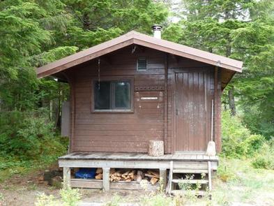
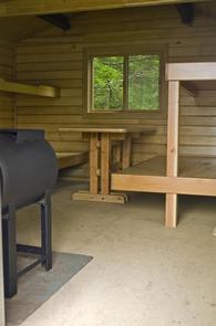
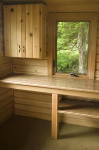
The primitive, pre-cut cedar pan-abode style log cabin sleeps up to six people on wooden bunkbeds without mattresses. The cabin is equipped with a table, benches, a wood stove for heat and an outside toilet. Firewood is generally stacked in a woodshed near the cabin, but it is not guaranteed. The cabin does not have running water or electricity. Visitors must bring their own food, water, sleeping bags, sleeping pads, cook stove, matches, cooking gear/utensils, light source, toilet paper, first aid kit and garbage bags. Water from any natural site must be filtered, boiled or chemically treated before drinking. Click here for more cabin details.
Natural Features
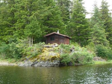
The cabin sits on a small rocky rise overlooking Jim’s Lake, at an elevation of 232 feet. It is hemmed in by dense old-growth forest with views to distant glacier-capped peaks
The cabin is located in the Kootznoowoo Wilderness which encompasses 956,255 acres of Admiralty Island. Dense spruce and hemlock forests, lakes and muskeg define the landscape, while distant rocky peaks tower along the island’s high crest, reaching elevations of over 3,000 feet.
Wildlife in the area abounds. Sitka black-tailed deer navigate dense forests and bald eagles perch in treetops along most beaches. Brown bear frequent the area as well.