

Directions
Located 37 miles northwest of Juneau, the cabin is on shore of Berners Bay, 8 miles north from boat launch at Echo Cove at mile 40 Glacier Highway.
Access is by boat, kayak and float plane only. Consult tide charts, as some parts of the bay become extremely shallow at low tide. Click here for more information. A sand beach is available at low-medium tides for float plane drop-off.
Phone
907 586-8800
Activities
BOATING, CAMPING, FISHING, HUNTING, WILDLIFE VIEWING
Keywords
BBAY,TONGASS NF – FS
Related Link(s)
Overview
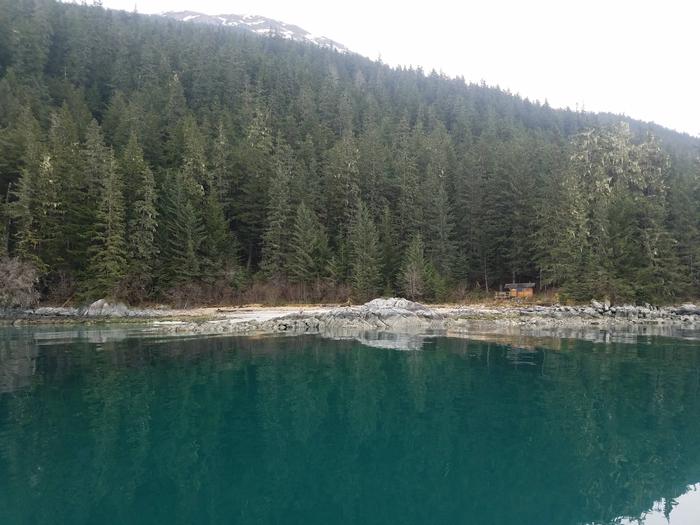
Berners Bay Cabin is situated near the mouth of the Antler River on scenic Berners Bay, an area that is popular with locals and tourists alike. The cabin has a peak season from late April through late September, but it is open year-round for relaxation, sightseeing, and recreation. The site can be accessed by float plane, boat or kayak, depending on conditions. Visitors are responsible for their own travel arrangements and safety and must bring several of their own amenities.
Recreation
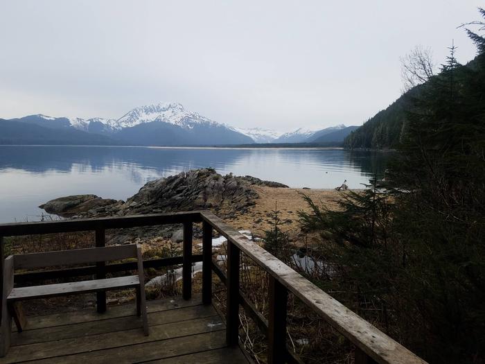
Berners Bay offers opportunities for saltwater fishing and crabbing, sea kayaking, beachcombing and wildlife watching. Kayakers and boaters should check tide charts prior to any excursion, since parts of the bay may be too shallow during low tide. Click here for more information. Berry pickers can harvest the abundant blueberries that grow around the cabin in the summer. Mountain goat, moose and bear hunting are possible in designated seasons with the proper permit. A primitive trail exists that travels north from the cabin. The one mile trail starts at the woodshed and leads to an ocean overlook under a large waterfall.
Facilities
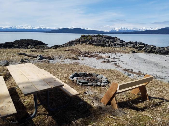
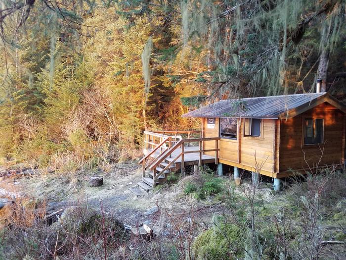
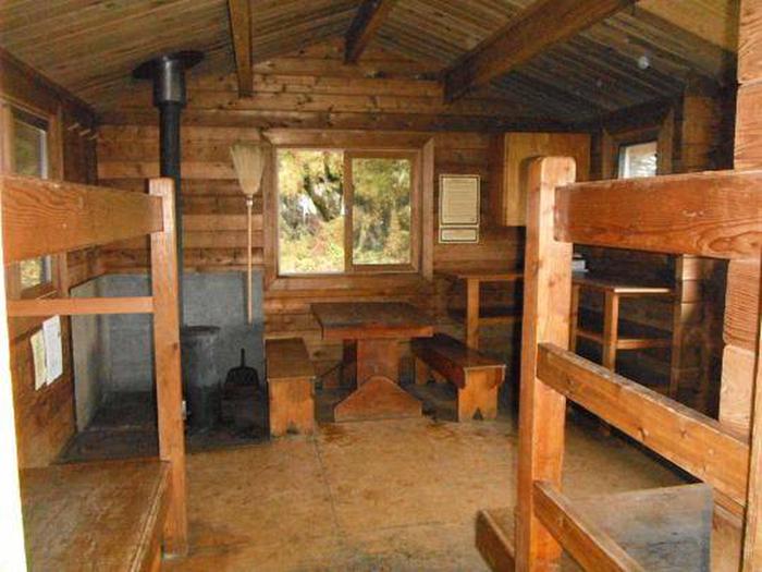
This pan-abode style cabin is 13 ft. by 14 ft. and sleeps five people with three single bunks and one double bunk. Visitors with a cabin reservation may use the tent camping locations around the cabin, as needed. It also has a table with benches, oil stove for heat (#1 stove oil), bucket and shovel, broom and dustpan, splitting maul, cold storage box and an outhouse. A mooring float is provided for visitors with a cabin reservation only. This mooring goes dry at a 0′ tide but anchoring locations are available as well. A campfire ring is located outside. A sandy beach is available in front of the cabin at low and medium tides, which is ideal for kayak launching and float plane drop-off. Water and electricity are not provided. Water is available from a nearby stream, but visitors should be sure to treat water before drinking or cooking with it ( water safety tips ). It is recommended that visitors bring their own water supply. Heating oil is not supplied by the Forest Service. In addition to bringing a supply of #1 stove oil (a gallon per day on low setting), visitors should pack sleeping bags, sleeping pads, a cooking stove, lanterns or flashlights, cookware, plates, utensils, food, toilet paper, garbage bags, a fire extinguisher and fire starter. Visitors are expected to pack out trash, empty the cabinets and clean the cabin before leaving ( click here for more cabin details).
Natural Features
Four rivers drain into Berners Bay, including the Antler and Berners Rivers. The cabin sits just south of a waterfall and offers excellent views of both the Antler and Berners River deltas, as well as Lions Head Mountain. Natural features in this area include old-growth hemlock and Sitka spruce forest, the snow-capped Chilkat Mountains, saltwater estuaries, freshwater marshes, meadows and cottonwood floodplains. Each spring, the spawning of herring and euchalon (hooligan) in Berners Bay attracts huge populations of bald eagles, brown and black bears, harbor seals, humpback whales and endangered Steller sea lions ( bear safety information ). Moose, wolves, deer, mountain goats and a variety of waterfowl also make their home here.