
Directions
Access to the cabin is by float plane. The cabin is approximately 15 miles from Ketchikan within the Naha Recreation Area. Cabin is located on the southeast shore of Heckman Lake about a half mile across from the inlet of the Naha River. Refer to USGS map Ketchikan C-5. In fall, winter, and early spring, the cabin may be inaccessible due to frozen lake surface (float planes cannot land). Please contact the Ketchikan-Misty Fjords Ranger District for information prior to making reservations during these periods.
Phone
907-225-2148
Activities
BOATING, CAMPING, FISHING, WILDLIFE VIEWING
Keywords
SOHE,TONGASS NF – FS
Related Link(s)
Overview
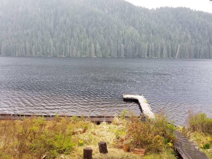
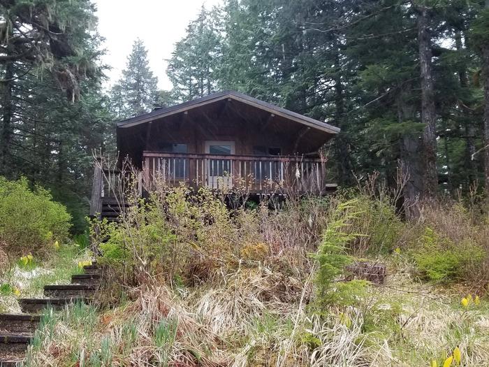
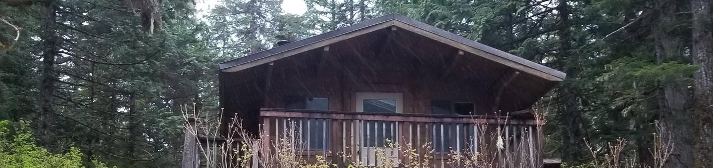
Southeast Heckman Cabin is situated on the southeast shore of Heckman Lake within the Naha Recreation Area approximately 15 miles from Ketchikan. The cabin is open year-round and makes an excellent base for experiencing this corner of Alaska with its recreation options, beautiful scenery and abundant wildlife.
The cabin is remote and accessible only by float plane, depending on conditions. This primitive cabin has no electricity, indoor plumbing or cell phone coverage. Visitors are responsible for their own travel arrangements and safety, and must bring several of their own amenities.
Recreation
Fishing and boating are popular activities at this cabin. The Naha River is noted for steelhead and salmon runs and offers resident trout and Dolly Varden. For information about fishing permits and seasons, visit the Alaska Department of Fish and Game website.
Guests have use of the cabin’s 14-foot aluminum skiff with oars, but they must provide their own life jackets. A short-shaft motor can be used with the skiff, but one is not provided.
Facilities
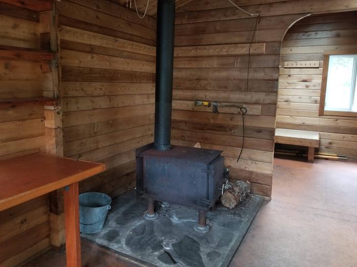
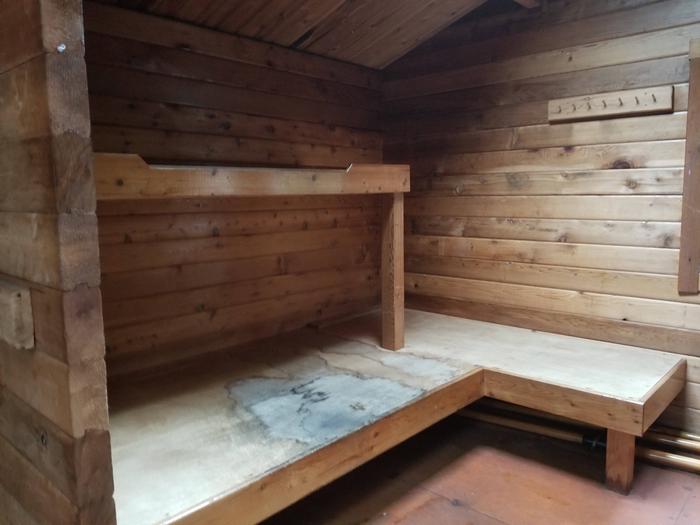
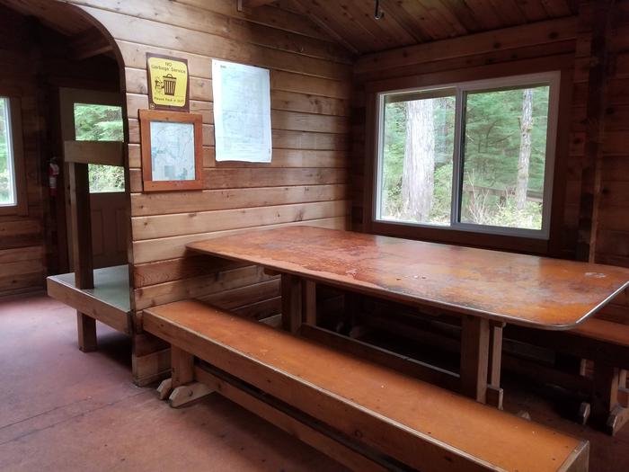
The 16×22-ft. ( pan-abode style ) log cabin accommodates 8 people with 3 single and 2 double bunks. Other amenities include a table and benches, a cooking counter, broom, splitting maul, and outhouse. A wood stove is provided for heat. NOTE: Firewood may be available, but visitors are encouraged to contact the Ketchikan Misty Fjords Ranger District to check the status of the woodshed. This cabin is designed to be barrier-free, with accessible boardwalks connecting the dock, cabin and outhouse. The boardwalk has an incline between 5 and 15 percent. Drinking water is not available at the cabin. Visitors must bring their own water supply, but water is also available from the lake and should be treated before drinking or cooking with it ( water safety ). Visitors should also bring sleeping bags, sleeping pads, cooking gear, lanterns or flashlights, food, toilet paper, garbage bags, a fire extinguisher and fire starter. Rain gear and boots are recommended. Visitors are expected to pack out their trash, gear and food and clean the cabin before leaving (additional cabin details).
Natural Features
The cabin sits in a clearing overlooking the lake, backed by old-growth Sitka spruce and western hemlock. The terrain is sloped above and below the cabin. Visitors can gaze out over the lake to the densely forested slopes on the other side.
Sitka black-tailed deer, black bear, marten, mink, beaver and wolf are common to the area (bear safety and precautions). A variety of birds may be seen in and around the lake.