
Directions
Access to the cabin is by motor vehicle and a short walk from the McKinley Trail trailhead. From Cordova, drive 21 miles east on the Copper River Highway. The trailhead for the cabin is located at mile 21. The cabin is approximately 80 yards from the road on the McKinley Lake Trail.
Phone
1 (907) 424-7661
Activities
BOATING, CAMPING, FISHING, HIKING, HUNTING, WILDLIFE VIEWING
Keywords
MKIN,CHUGACH NF – FS
Related Link(s)
Overview
Located just off the Copper River Highway in the Chugach National Forest, McKinley Trail Cabin offers guests year-round recreation and relaxation. Although the cabin isn’t in the remote wilderness, it makes a good base camp for exploring the Copper River Delta and the surrounding areas. Fishing, hiking, hunting and wildlife viewing are within the vicinity.
Access to the cabin is by motor vehicle. The trailhead to the cabin is located at Mile 21 of the Copper River Highway. The cabin is approximately 80 yards from the road on the McKinley Lake Trail. Visitors are responsible for their own travel arrangements and safety, and must bring several of their own amenities.
Recreation
For hikers and anglers wanting to explore the area, McKinley Trail provides access to nearby lakes and a historical mining site.
Approximately 1.25 miles from the McKinley Trail trailhead is the junction for the Pipeline Lakes Trail, which wanders through muskeg meadows and spruce-hemlock forests below steep mountainsides. In the spring, brown bears can be seen grazing on the new grass on the south-facing slopes.
The trail also reaches McKinley Lake and McKinley Lake Cabin, about 2.25 miles from the trailhead. The trail meets the shoreline of the lake at both its southern end, and at the cove at its upper area. Hiking approximately a quarter-mile beyond the cabin, visitors will find remnants of the Lucky Strike Mine. Rusting machinery, pipes and a collapsed tunnel are the most obvious evidence of the mine site.
The closest fishing area to the McKinley Trail Cabin is just across the highway in the upper part of Alaganik Slough. The highway is a two-lane dirt road with anywhere from 10 to 75 vehicles per day. Coho salmon move into the slough with the high tides downstream. In late August and September, they start moving up the slough to the spawning grounds, passing near the cabin. Other coho salmon fishing spots are found in the area as well.
Hunters can take advantage of a long hunting season in the surrounding national forest. Bear season occurs during spring and fall, while deer season begins in late summer and lasts through late fall.
Facilities
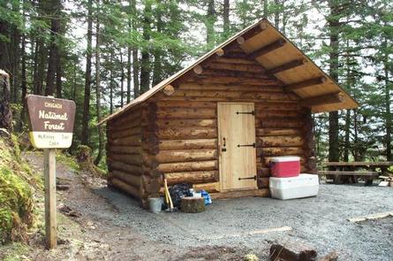
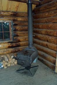
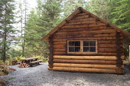
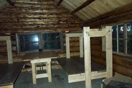
The 12-by-14 log cabin is equipped with wooden bunkbeds that sleep up to six guests. The cabin is furnished with a table, a wood stove for heat and an outdoor pit toilet. The cabin does not have running water, electricity or cut firewood. Visitors must bring their own supply of drinking water and firewood. Visitors must bring food, sleeping bags, sleeping pads, a cook stove, matches, cooking gear, lanterns or flashlights, toilet paper, a first aid kit and garbage bags. All trash and food must be packed out, and visitors are expected to clean the cabin before leaving.
Natural Features
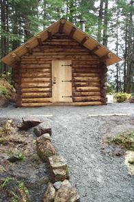
McKinley Trail Cabin is located at the start of the McKinley Lake Trail in a dense spruce and hemlock forest. Steep mountainous terrain surrounds the area.
Guests will be treated to an abundance of wildlife near the cabin. Waterfowl, Sitka blacked-tailed deer, moose, black and brown bear find habitat in the surrounding forest and nearby lakes. Learn more about bear and moose safety in Alaska.