
Directions
Access to Log Jam Bay Cabin is by float plane or wheeled plane only, typically 45 minutes from either Cordova or Seward.
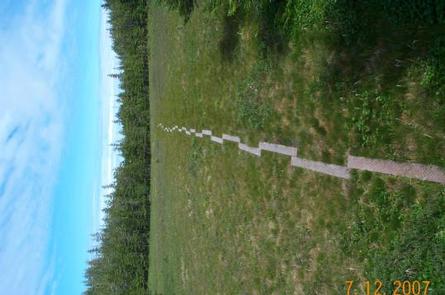
Wheeled planes land on the outside beach strip at low tide. If a wheeled plane is used, access is limited by tides and gear must be hiked to the cabin from the landing area, located three-quarters of a mile from the cabin via trail. Click here for local tide information.
Float planes land on the lake next to the cabin. In fall, winter and early spring, the cabin may be inaccessible to float planes due to the frozen lake surface. Please contact the local Forest Service Ranger District office at (907) 424-7661 for information prior to making reservations for these periods.
Phone
1 (907) 424-7661
Activities
CAMPING, FISHING, HIKING, HUNTING, WILDLIFE VIEWING
Keywords
LOG1,CHUGACH NF – FS
Related Link(s)
Overview
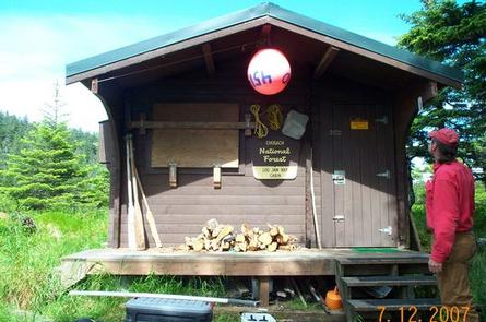
Log Jam Cabin offers guests a remote lodging experience on Montague Island in southeastern Alaska. Located on the northeast side of Stump Lake, the cabin offers guests year-round recreation and relaxation. Fishing, hunting, kayaking, beachcombing and wildlife viewing are within walking distance of the facility.
Access to the cabin is by float plane or wheeled plane only, typically 45 minutes from either Cordova or Seward. Those arriving by wheeled plane should be prepared to hike three-quarters of a mile to the cabin. Visitors are responsible for their own travel arrangements and safety, and must bring several of their own amenities.
Recreation
Anglers will find that Montague Island is a prime fishing location. Cutthroat trout and Dolly Varden are the most abundant fish near the cabin. They can be caught off of the rocky points or near the pond lily beds around the lake with fly fishing or spinning gear. Pink, coho and sockeye salmon come into the lake, but the populations are relatively small. The best spot for coho and pink salmon fishing is in the ocean or at the mouth of the creek at high tide.
Hunters can take advantage of a long hunting season in the surrounding national forest. Bear season occurs during spring and fall, while deer season begins in late summer and lasts through late fall.
The cabin is just under a mile walk from the Gulf of Alaska and the open ocean. The sandy beach is a good place for beachcombers to search for glass Japanese fishing floats and other sea-borne treasures.
Guests are welcome to use the facility’s rowboat, though life vests are not provided.
Facilities
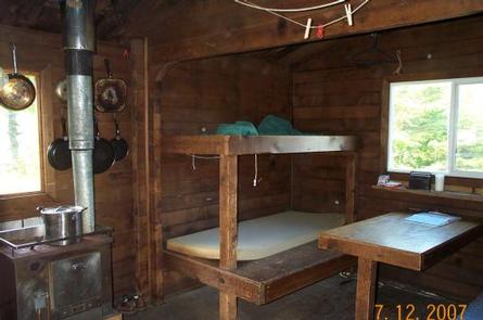
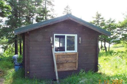
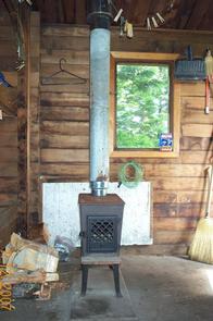
The cabin is a 12-by-14 foot rustic structure equipped with wooden bunks that sleep up to six guests. It is equipped with a table, benches, wood and oil stove for heat, saw, axe, splitting maul, a rainwater catchment barrel and an outdoor pit toilet.
The cabin does not have running water, electricity, cut firewood or heating oil. Visitors must bring their own supply of drinking water, firewood and #1 stove oil for the oil stove.
Visitors must bring food, sleeping bags, sleeping pads, a cook stove, matches, cooking gear, lanterns or flashlights, toilet paper, a first aid kit and garbage bags. All trash and food must be packed out, and visitors are expected to clean the cabin before leaving.
Natural Features
Montague Island is in the Gulf of Alaska at the entrance to Prince William Sound. The cabin is situated on 80-acre Stump Lake near low hills rising from a thick spruce and hemlock forest. An understory of muskeg, shrubs and grasses blanket the area.
Wildlife is abundant, including migratory waterfowl, Sitka black-tailed deer and brown bear (learn more about bear safety).