

Directions
Access is by boat (13 miles from Kake), or float plane (39 miles from Petersburg). Float planes generally land near the mouth of the bay and require up to a 2-mile hike across the tide flat. An 18-foot or higher tide is required for direct boat or float plane access to the cabin. Refer to USGS topographic maps Petersburg D6, C6 and Port Alexander D1. Maps are available online or by calling the Petersburg Ranger District at (907) 772-3871.
Phone
907-772-3871
Activities
BOATING, CAMPING, FISHING, HUNTING, WILDLIFE VIEWING
Keywords
KADK,TONGASS NF – FS
Related Link(s)
Overview
Kadake Bay Cabin provides spectacular scenery of the surrounding region. It is situated in a secluded bay off the coast of Kuiu Island in southeast Alaska. Visitors enjoy a variety of recreational activities, including fishing, hunting and viewing wildlife.
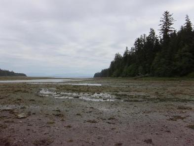
The cabin can be accessed by float plane from Petersburg or by boat from the town of Kake. Tides will affect access to the cabin, sometimes requiring a 2-mile walk over a mud flat left at low tides. Guests are responsible for their own travel arrangements and safety, and must bring several of their own amenities.
Recreation
Visitors to the area enjoy hunting for bears and waterfowl. Anglers may find coho and pink salmon, steelhead, Dolly Varden and cutthroat trout in Kadake Creek. Boating is a popular way to explore the area. An 18-foot tide is required to navigate the tide flats in front of the cabin, so visitors should consult tide tables in advance ( local tide tables ).
Facilities
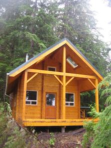
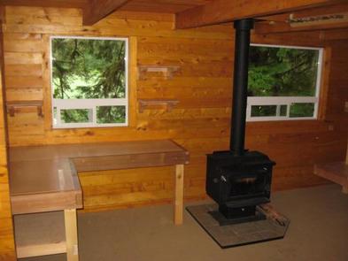
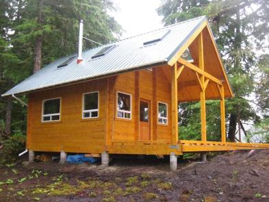
The modified hunter-style cabin has bunk beds to sleep up to six people. It is equipped with a table, benches and a wood stove. An outhouse with a pit toilet is provided. Firewood may be available, but is not guaranteed. A broom, dust pan, axe and splitting maul are typically available, but may be missing or damaged. Water for drinking, cooking and cleaning is not provided at the cabin. Water taken from the nearby stream should be treated or boiled. Visitors are encouraged to bring their own drinking water. Items to bring include sleeping bags and pads, a cook stove and cooking gear, towels, food, clothing, fire starter and garbage bags, among other necessities. All trash and food must be packed out, and visitors are expected to clean the cabin before leaving. Click here for more cabin details and maps.
Natural Features
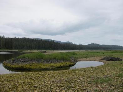
The cabin is located at the mouth of Kadake Creek on northeastern Kuiu Island (pronounced CUE-you) inside a large tide flat. The surrounding terrain is a combination of grassy tidal flats and low-elevation, old-growth forest.
A variety of wildlife makes its home in the area, including waterfowl, grouse and black bears (learn about bear safety).