


Directions
Accessible year round, weather permitting. Located 10 miles west of Sitka on the southeast shore of Kruzof Island. Access is 30 minutes by boat from Sitka. Helicopter landing on beach is possible at lower tides. Refer to USGS topographic maps Sitka A-5, A-6.
Local wave action on the beach may make landing dangerous or impossible. Please consult local tide tables. It is recommended that boaters avoid approaching the beach and unloading while the tide is turning. Inexperienced boaters or out-of-town visitors are encouraged to use the services of a local charter boat operator.
For boat or air charters, contact the Sitka Convention and Visitors Bureau at 907-747-5940 or online.
Phone
907-747-6671
Activities
CAMPING, HIKING, HUNTING, WILDLIFE VIEWING
Keywords
FRED,Fred’s Creek,Freds Creek,FRED S CREEK CABIN,TONGASS NF – FS
Related Link(s)
Overview
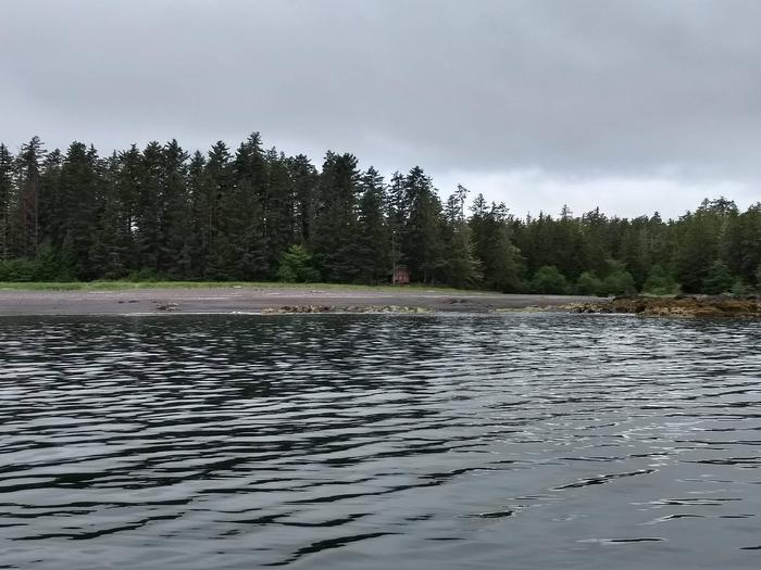
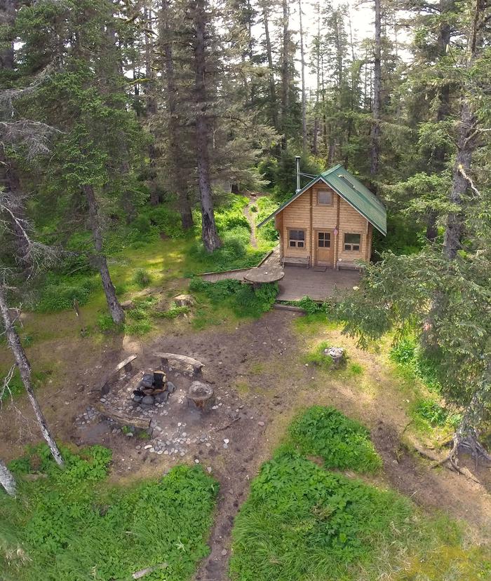
Fred’s Creek Cabin is located 10 miles west of Sitka on the southeastern shore of Kruzof Island and is available year round, weather permitting. Its proximity to a creek and a hiking trail that leads to the cone of a dormant volcano makes the cabin an excellent base to experience and explore this beautiful area in Alaska. The cabin can be accessed by boat, though erratic waves on Kruzof Island can make landings difficult. Helicopters may land during low tide.
Recreation
The 6.7-mile Mount Edgecumbe Trail offers a gradual hike to the cone of Mount Edgecumbe through miles of muskeg and forest. At the cone, the trail becomes very steep but hikers are rewarded with panoramic views on clear days. Cabin visitors may encounter tour groups passing near the cabin to access the trailhead.
In addition to hiking, guests enjoy beachcombing, viewing the breaking surf on the rugged shoreline and exploring varied pumice and volcanic rock formations on the beach and in Fred’s Creek.
Deer hunting is also an option. For information about fishing and hunting permits and seasons, visit the Alaska Department of Fish and Game website.
Facilities
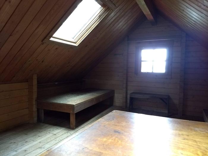
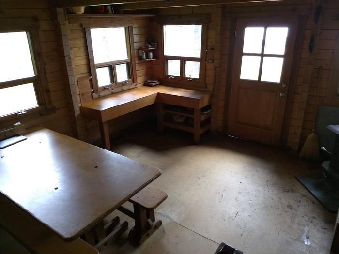
The 15 by 18-foot Pan-abode-style wood cabin can accommodate 8 people. It is equipped with plywood bunks downstairs and a full sleeping loft accessed by a staircase. A wood stove for heat, axe or splitting maul, table, benches, cooking counter and an outhouse are provided. A deck extends off the front of the cabin. The cabin does not include mattresses or cooking utensils. Visitors must bring sleeping bags and pads, a cooking stove, pots, pans, plates, utensils, food, toilet paper, a lantern, garbage bags, fire extinguisher, fire starter, raingear and rubber boots. Water is available from Fred’s Creek but must be treated before using. It’s recommended that visitors bring their own water. A mooring buoy is available on a first come, first served basis. Cabin reservations do not include exclusive use of the buoy. Mooring buoys are configured using a 4200-lb concrete block with 90 feet of 1 5/8th-inch stud link chain. Mariners are responsible for determining how suitable an anchoring system is for the size of their craft. Care should be taken when unloading and anchoring, as the surf breaks along a pumice-rock shoreline. No protected anchorage is available. Click here for more cabin information and maps.
Natural Features
The oceanfront cabin is situated on Sitka Sound on a rocky Kruzof Island shoreline surrounded by fairly flat terrain. Fred’s Creek flows to saltwater just north of the cabin. A spruce and hemlock forest covers the area. The cabin is 5 miles south of Brent’s Beach Cabin.
The cabin is just east of Mount Edgecumbe, a 3,200-foot dormant volcano that dominates the landscape.
Humpback whales can often be seen offshore in early spring and late fall. Sea otters, sea lions, puffins and other sea birds can also be seen. Brown bear frequent the area.