


Directions
Accessible year round, weather permitting. Located 48 air miles north of Sitka, within Hoonah Sound on the north end of Moser Island, north of Peril Strait. Access from Sitka is 30 minutes by floatplane, or 2 hours by boat. For geographic features surrounding the cabin, refer to USGS topographic map Sitka C-6.
Please consult local tide tables before departing for the cabin.
Phone
907-747-6671
Activities
CAMPING, FISHING, HIKING, HUNTING, WILDLIFE VIEWING
Keywords
MOSE,TONGASS NF – FS
Related Link(s)
Overview
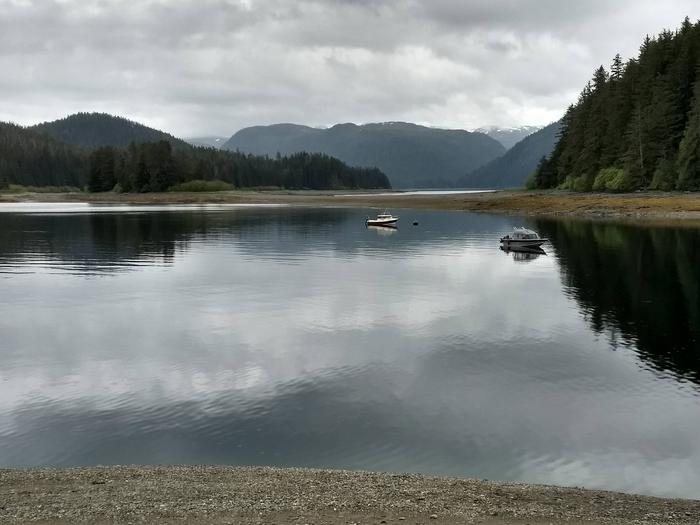
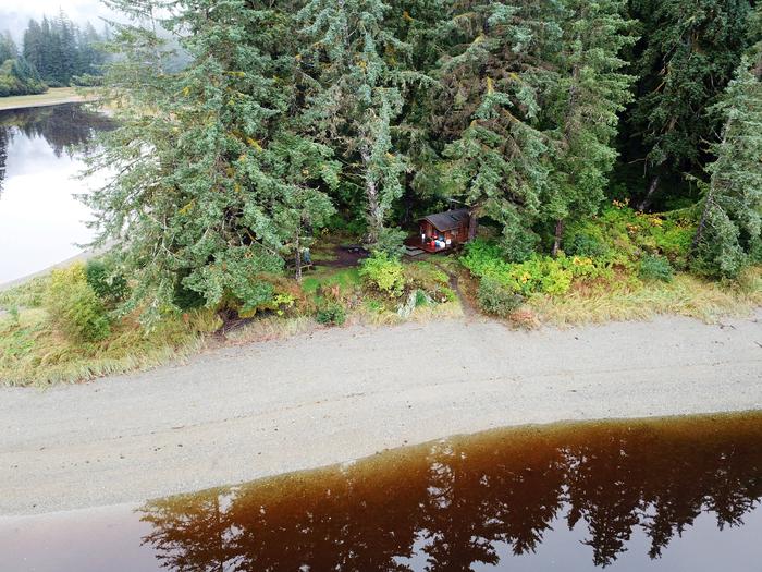
Moser Island Cabin sits on the northern shore of Moser Island in upper Hoonah Sound, 48 miles north of Sitka, Alaska. The wood cabin, built in 1991 by volunteers from Sitka, is available year-round and makes an excellent base for experiencing and exploring this corner of Alaska.
This is a remote site. The cabin can be accessed only by floatplane or boat, weather permitting. From Sitka, it’s a 30-minute plane ride or a two-hour boat ride. Visitors are responsible for their own travel arrangements and safety, and must bring their own amenities.
Recreation
Beachcombing, seal watching, hunting and fishing are popular activities at Moser Island Cabin.
Shrimp fishing is available south and east of the island, and crabbing is available in nearby bays. Local rivers can be fished for Dolly Varden and pink and chum salmon. Deer, bear and waterfowl hunting is allowed on Chichagof Island, accessible from the cabin during low tide.
For information about fishing and hunting permits and seasons, visit the Alaska Department of Fish and Game website.
Facilities
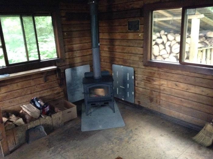
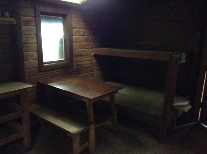
The wood, 12′ by 14′ Pan abode-style cabin can accommodate up to six people with two double and two single plywood bunks. A wood stove for heat, a table with benches, a cooking counter, cupboard, broom and an axe or splitting maul are provided. An outhouse toilet is close to the cabin.
Mattresses and cooking utensils are not provided. Visitors should bring sleeping bags and pads, a cooking stove, pots, pans, plates, utensils, food, toilet paper, a lantern, garbage bags, a fire extinguisher and fire starter. Rain gear and boots are recommended.
Water is available from a nearby stream but must be treated before using. It’s recommended that guests bring their own water.
A mooring buoy is available on first-come, first-served basis. Cabin reservations do not include exclusive use of the buoy. Mooring buoys are configured using a 4200-lb concrete block with 90 feet of 7/8th-inch stud link chain. Mariners are responsible for determining how suitable an anchoring system is for the size of their craft.
Click here for more cabin information and maps.
Natural Features
Moser Island is a small island covered by a spruce and hemlock forest in upper Hoonah Sound. At low tide, the shoreline near the cabin leads to Chichagof Island.
Wildlife, including deer, brown bear and waterfowl, is abundant in the surrounding area.