
Directions
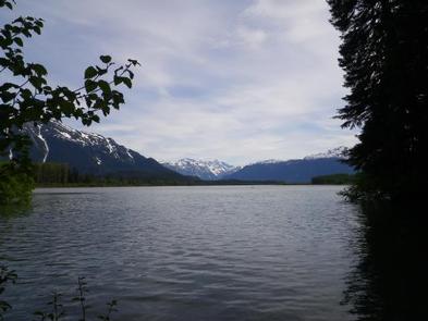
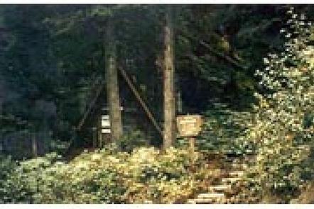
The cabin is located on the south shore of the Stikine River within the Stikine-LeConte Wilderness. It is two miles downriver from the border between the United States and Canada. Distance from Wrangell is 32 miles by shallow draft boat. Low river levels can affect access; consult local tide tables . A tide of 14 feet or higher is required for shallow draft boats to cross the tide flats. The river is normally ice-free from May to October. Check local conditions ahead of time by calling the Wrangell Ranger District at (907) 874-2323. A short boardwalk trail and staircase provides access to the cabin from the river.
Phone
907-874-2323
Activities
BOATING, CAMPING, FISHING, HUNTING, WILDLIFE VIEWING, PADDLING, BIRDING
Keywords
FLEM,TONGASS NF – FS
Related Link(s)
Overview
Mount Flemer Cabin is near the confluence of Clearwater Slough and the Stikine River. It is only two miles from the border between the United States and Canada, and is popular with paddlers floating the Stikine River. The cabin is located within the Stikine-LeConte Wilderness and offers spectacular views. The site can be accessed by a shallow draft boat, depending on conditions. The tide must be at least 14 feet in order to cross the Stikine River tide flats. Visitors are responsible for their own travel arrangements and safety, and must bring several of their own amenities.
Recreation
The waters around the cabin are ideal for navigating by kayak and canoe, and the cabin is often used by paddlers on multi-day float trips of the Stikine River from Telegraph Creek, BC, or the US/Cananda border to the town of Wrangell. Tide tables should be consulted before any boating excursion. Nearby sloughs and streams provide access to fishing for cutthroat trout and Dolly Varden. Opportunities for hunting exist in the area with the proper permits.
Facilities
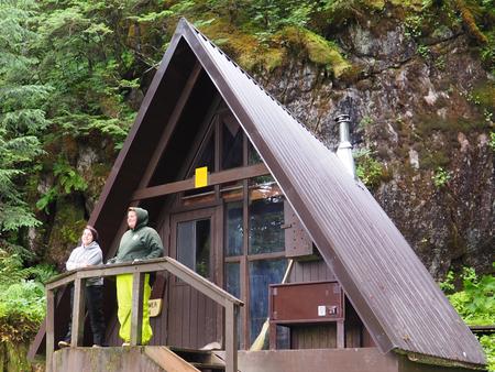
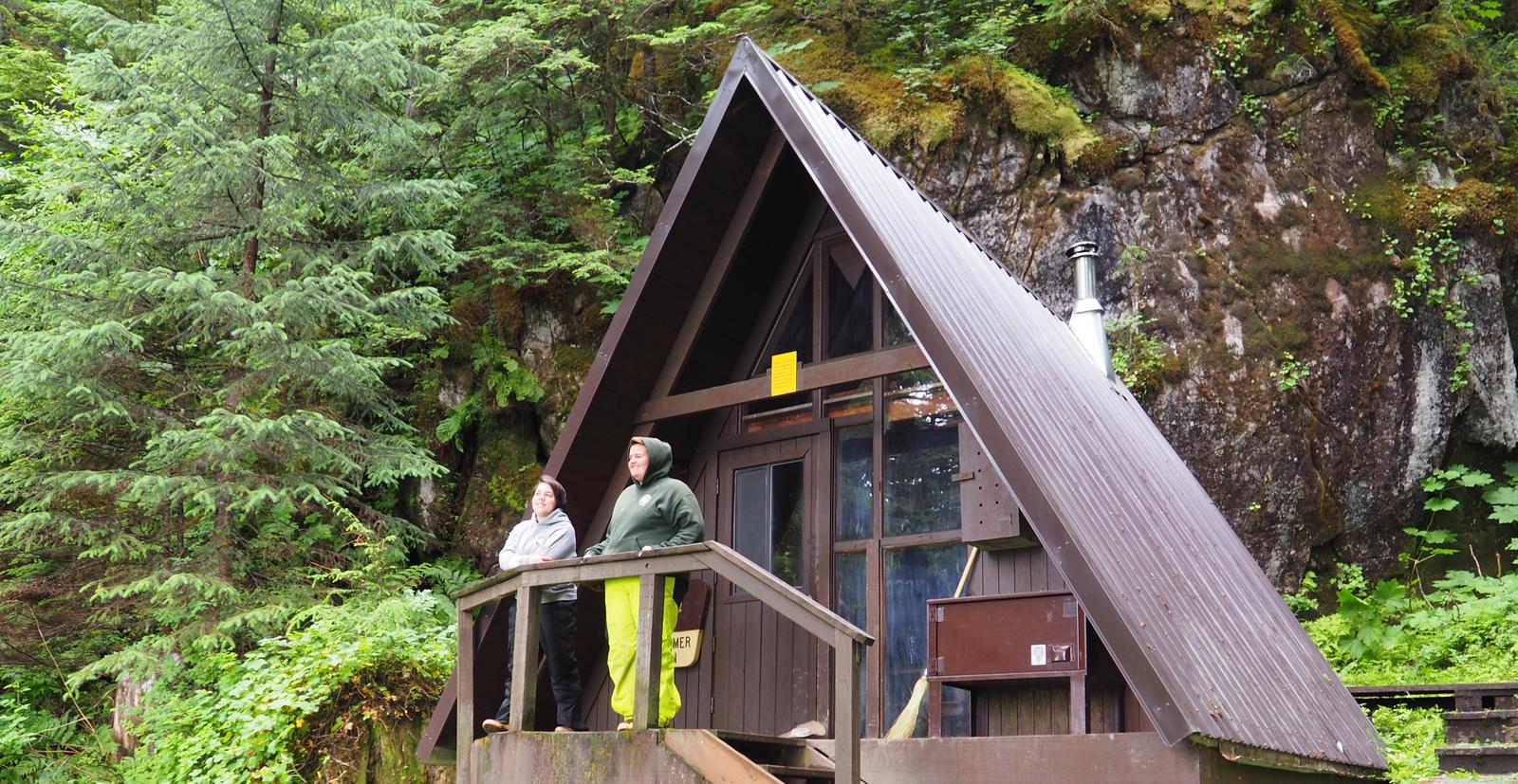
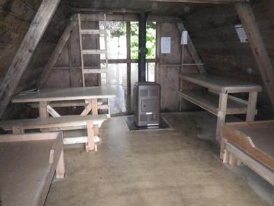
The 16-by-16 cabin (A-frame style) was built in 1963 and has two single bunks (one with a trundle bed) and a sleeping loft to accommodate up to seven people. It is also equipped with a table with benches, an oil heater (No.1 oil only), a broom and an outhouse. The partially covered front porch has a built-in bench and a bear-proof locker for food storage. Water and electricity are not provided. Water is available from an adjacent stream, but guests should be sure to treat water before drinking or cookingwith it ( water safety tips ). It is recommended that guests bring their own water supply. Heating oil is not supplied by the Forest Service. In addition to bringing No.1 stove oil, guests should pack a cook stove, sleeping bags, sleeping pads, lanterns or flashlights, cookware, plates, utensils, food, toilet paper, garbage bags, a fire extinguisher and matches, among other necessities. Guests are expected to pack out trash and clean the cabin before leaving ( click here for more cabin details).
Natural Features
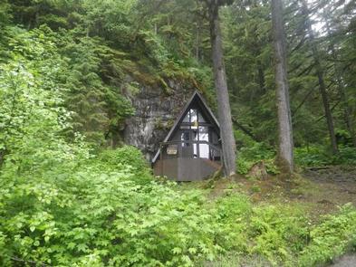
The cabin sits on moderately steep land at the base of Mount Flemer, among a stand of spruce trees on the bank of the Stikine River. Guests can enjoy spectacular views along the river, towards the border, including Elbow and Whitehead Mountains and others in the Coast Range. The backdrop of this area is faces of steep, granite rock. The surrounding rainforest is primarily Sitka spruce and western hemlock. Cottonwood is found extensively along the river’s edge throughout the valley. Brown and black bears, moose and mountain goats are common to this area ( bear safety information ). The Stikine River serves as a travel corridor for birds between the interior forests and the coast and attracts a variety of migratory songbirds.