


Directions
This cabin is on the south shore of Frosty Bay, which is on the Cleveland Peninsula of the mainland. Access is 32 miles by float plane or 36 miles by boat from Wrangell. There is a mooring buoy anchored in the bay for use by cabin guests only. Anchorage is good on Frosty Bay, but guests coming by boat may want to check tide tables prior to arrival.
Phone
907-874-2323
Activities
BOATING, CAMPING, FISHING, HIKING, HUNTING, WILDLIFE VIEWING
Keywords
FROS,TONGASS NF – FS
Related Link(s)
Overview
Frosty Bay Cabin offers an ideal base camp for hiking, fishing, crabbing, hunting and exploring. Frosty Bay is 36 miles south of Wrangell, Alaska, and can be accessed by float plane or boat, depending on conditions. Frosty Bay offers good anchorages. Visitors are responsible for their own travel arrangements and safety, and must bring several of their own amenities.
Recreation
Anglers can fish for King salmon from May to July, pink salmon in July and August, and silver salmon in August and September. Crab, halibut and shrimp are also available in nearby saltwater. From the cabin, hikers can find a surfaced planked trail that goes 600 feet to an unmaintained 10 miles of road system built in the early 1990s. Hunting is also available in the area during designated seasons.
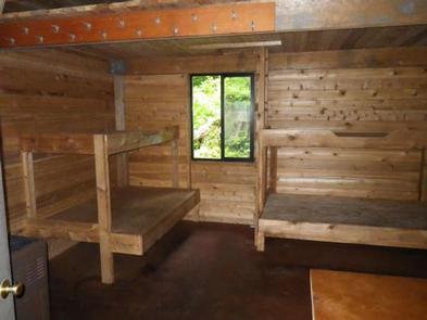
Facilities
This 14-by-16 cabin ( hunter-style ) sleeps six and comes equipped with two single bunks, two double bunks, a table and benches, broom, oil stove for heat (No. 1 oil only) and an outhouse toilet. A small loft provides additional storage space. A small deck wraps around two sides of the cabin, and a wooden cooler box is provided for food storage. A mooring buoy is available for cabin guests. Water and electricity are not provided. Water is available from an adjacent stream, but guests should be sure to treat any water taken from an outside source before consumption ( water safety tips ). It is recommended that guests bring their own water supply. Heating oil is not supplied by the Forest Service. In addition to bringing a supply of No. 1 stove oil, guests should pack sleeping bags, sleeping pads, a cooking stove, lanterns or flashlights, cookware, plates, utensils, food, toilet paper, garbage bags, a fire extinguisher and matches, among other necessities. Guests are expected to pack out all trash and clean the cabin before leaving ( click here for more cabin details).
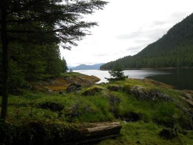
Natural Features
The cabin is situated overlooking Frosty Bay and a portion of Deer Island, which is just across Seward Passage. The surrounding rainforest is primarily Sitka spruce and western hemlock with some cedar, and the landscape features hills and mountains, with elevations reaching 2,800 feet. Brown and black bears, moose and Sitka black-tailed deer make their home in the area around the cabin ( bear safety information ). The area is known for having a high density of brown bears. Bird species in the area may include swans, geese and bald eagles.