

Directions
The cabin is located 8 air miles east of Yakutat on the east bank of Situk River. Access is by trail, boat or wheeled aircraft.
From Nine Mile Bridge on Forest Highway 10, hike the 3-mile trail or boat 3.2 miles downriver (1.5 hour float). The cabin is 9.6 miles upriver from Situk Landing (terminus of Lost River Road).
The Forest Service-maintained airstrip is about 300 feet from cabin. It is 1,800 feet long and 50 feet wide.
Phone
907-784-3359
Activities
BOATING, CAMPING, FISHING, HIKING, HUNTING, WILDLIFE VIEWING
Keywords
RAVE,MIDDLE SITUK SOUTH CABIN,TONGASS NF – FS
Related Link(s)
Overview
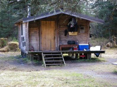
Raven Cabin, formerly known as Middle Situk South Cabin, is located on the east bank of the Situk River. It is open year-round and makes an ideal base for fishing or hunting. The site can be accessed by wheeled plane, boat or a 3-mile hiking trail. An airstrip is located near the cabin. Visitors are responsible for their own travel arrangements and safety, and must bring several of their own amenities.
Recreation
The trail leading to the cabin is relatively flat and can flood. Numerous root wads across it make walking moderately difficult. The trail also fords the Old Situk River, but it does not follow the banks of Situk River. This cabin is an ideal destination for hunters and anglers. The Situk River offers outstanding fishing for rainbow trout, Dolly Varden and steelhead, as well as sockeye, pink, king and coho salmon. Moose hunting is good to excellent. Visitors can bring inflatable rafts, kayaks and canoes. There are also guided boating trips and boat rentals available from nearby lodges. The river can be dangerous for inexperienced boaters, and river conditions should be checked prior to any boating excursion ( Situk River conditions ).
Facilities
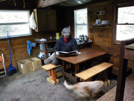
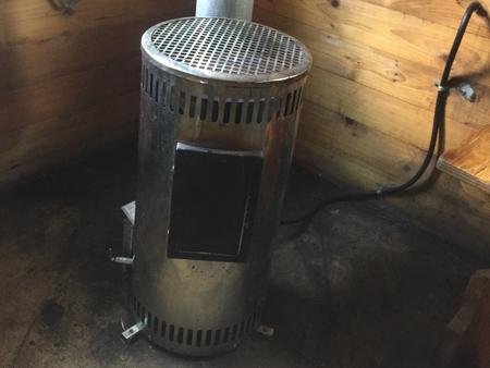
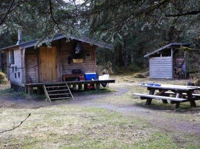
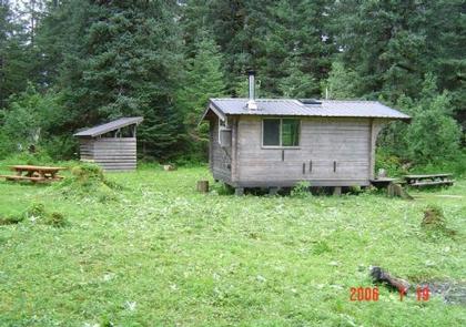
This 14×16-ft. pan-abode style cabin sleeps five people with three single bunks and one double bunk. The cabin also has a table and benches, broom, an oil heater, picnic table, outhouse and campfire ring. A 10×10-ft. meat shed is located outside. Water, heating oil and electricity are not provided. Water can be taken from the Situk River, but it should be treated before using. Visitors must supply #1 diesel oil or kerosene for the heater. One gallon can last 2-10 hours, depending on the heat setting. Other items to bring include sleeping bags, sleeping pads, food, a cooking stove, cookware, plates, utensils, lanterns, flashlights, toilet paper, garbage bags, first aid kit, a fire extinguisher and fire starter. Visitors are expected to pack out trash and clean the cabin before leaving. Click here for more cabin details.
Natural Features
The cabin sits on relatively flat terrain in old-growth forest consisting of spruce, hemlock and cottonwood. Blueberry bushes make up the understory. The river is nearby, but it cannot be seen from the cabin. Large populations of moose and brown bears live in this area. Bald eagles and ravens are common, and gulls are often seen along the Situk River.