

Directions
Accessible nearly year round, depending on mode of access. Located 11 miles southeast of Sitka on Baranof Island, approximately 10 minutes by floatplane.
Access by boat from Sitka to Silver Bay is 10 miles, and a 2-mile trail leads to the cabin. Trail begins near mooring buoy at the end of Silver Bay. Plan arrival and departure during high tide, unload gear at east shore at estuary head, then tie up boat at mooring buoy. Please consult local tide tables before departing for the cabin.
For geographic features surrounding the cabin, refer to USGS topographic map Port Alexander D-4 and Sitka A-4.
Phone
907-747-6671
Activities
CAMPING, FISHING, HIKING, HUNTING
Keywords
SALA,TONGASS NF – FS
Related Link(s)
Overview
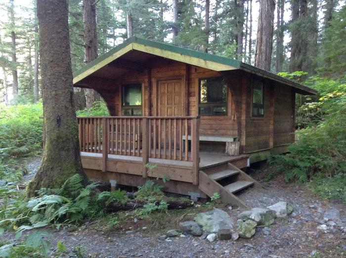
Salmon Lake Cabin sits on the east shore of Salmon Lake on Baranof Island, 11 miles southeast of Sitka, Alaska. The cabin was built in 1998 by volunteers from the U.S. Coast Guard.
This remote site is generally accessible year-round by boat to Silver Bay, then walking 2 miles along the Salmon Lake-Redoubt Lake Trail. The cabin can also be accessed via float plane, a 10-minute ride from Sitka. Visitors are responsible for their own travel arrangements and safety, and must bring their own amenities.
Recreation
Recreation options include fishing, hiking and seasonal deer hunting. The lake offers good cutthroat trout and Dolly Varden fishing, while its outlet stream has pink and sockeye salmon runs from July to mid-August and coho salmon from late August through September.
Visitors enjoy hiking along the 2-mile Salmon Lake-Redoubt Lake Trail, which leads from the cabin to Silver Bay.
For information about fishing and hunting permits and seasons, visit the Alaska Department of Fish and Game website.
Facilities
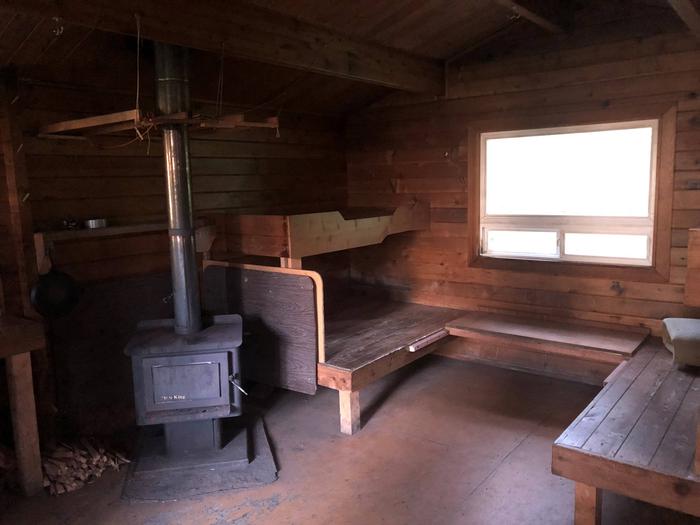
The 15’x17′ wood Pan Abode-style cabin accommodates up to six people with two double and two single plywood bunks. Amenities include a wood stove for heat, a table with benches, cooking counter, cupboard, broom, an axe or splitting maul and an outhouse toilet.
A mooring buoy is located at the head of Silver Bay for boat anchorage. Cabin reservation does not include exclusive use of the buoy. Mooring buoys are configured using a 4200-lb concrete block with 90 feet of 7/8th-inch stud link chain. Mariners are responsible for determining how suitable an anchoring system is for the size of their craft.
The cabin does not include mattresses or cooking utensils. Visitors should bring sleeping bags and pads, a cooking stove, pots, pans, plates, utensils, food, toilet paper, garbage bags, a lantern, fire extinguisher, fire starter and personal flotation devices (PFDs). Rain gear and boots are recommended.
Water is available from the lake but must be treated before using. It’s recommended that visitors bring their own water.
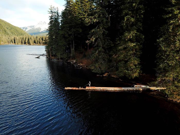
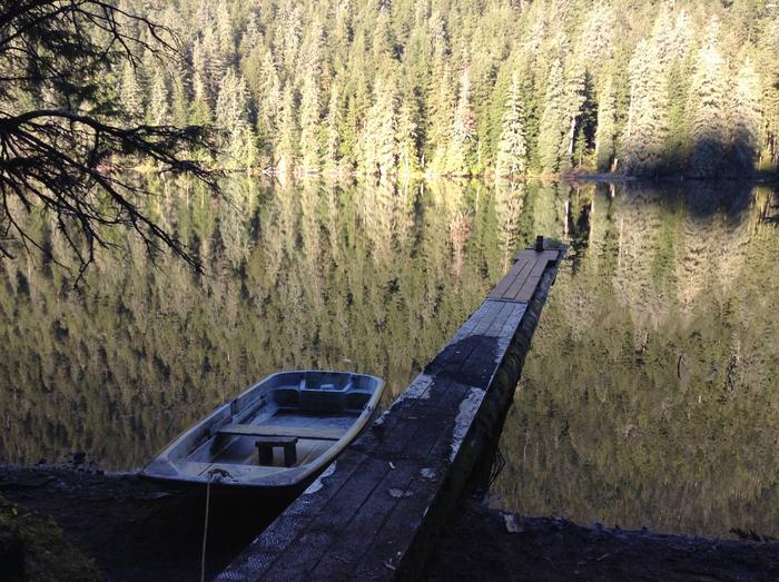
A small but heavy square-bowed skiff with oars is provided. A long-shaft 2-10 hp outboard motor enhances use of the skiff, but is not provided. Each person in the skiff should wear a Coast Guard approved personal flotation device (PFD). Tie the skiff well up on the shore and pull the plug before leaving so the boat does not fill with rain water.
Click here for more cabin information and maps.
Natural Features
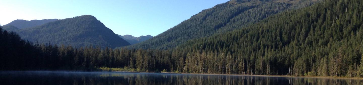
Spruce and hemlock-forested mountains rise to 2500′ in elevation around Salmon Lake and the cabin. Salmon Lake is approximately 3/4-mile long and 1/4-mile wide. The cabin is 2 miles from the end of Silver Bay, which may freeze mid-November through mid-February. Brown bear frequent the area.