
Directions
From Interstate 35 in Temple, Texas take State Highway 53/36 west towards Gatesville (approximatey 10 miles). Just after Leon River Bridge, turn right on White Flint Park Road. Turn left on Winkler Park Road and follow it to the park entrance.
Phone
254-986-1579
Activities
BIKING, BOATING, CAMPING, FISHING, WILDLIFE VIEWING, PHOTOGRAPHY
Keywords
WPGC,Winkler
Related Link(s)
Overview
Winkler Park is a small, primitive campground on the northern shore of Belton Lake in central Texas. This facility does not have electricity, but does have individual water hookups, paved back-in sites and a central restroom with showers. There are 14 sites available for RVs and tents.
Belton Lake was created by the U.S. Army Corps of Engineers with the construction of Belton Dam in 1954. The 12,300-acre lake is located on the Leon River, just upstream of the confluence of the Leon River and the Little River. Belton Lake is a long, narrow and winding lake with many curves and coves, providing some of the best camping, fishing and boating in central Texas.
Recreation
With 136 miles of shoreline, Belton Lake offers a wide variety of recreational activities. Winkler Park is a popular fishing camp for hybrid striped bass, largemouth bass, white bass, catfish and sunfish. Visitors also enjoy birding, wildlife viewing and basking in the sun and scenery.
Facilities
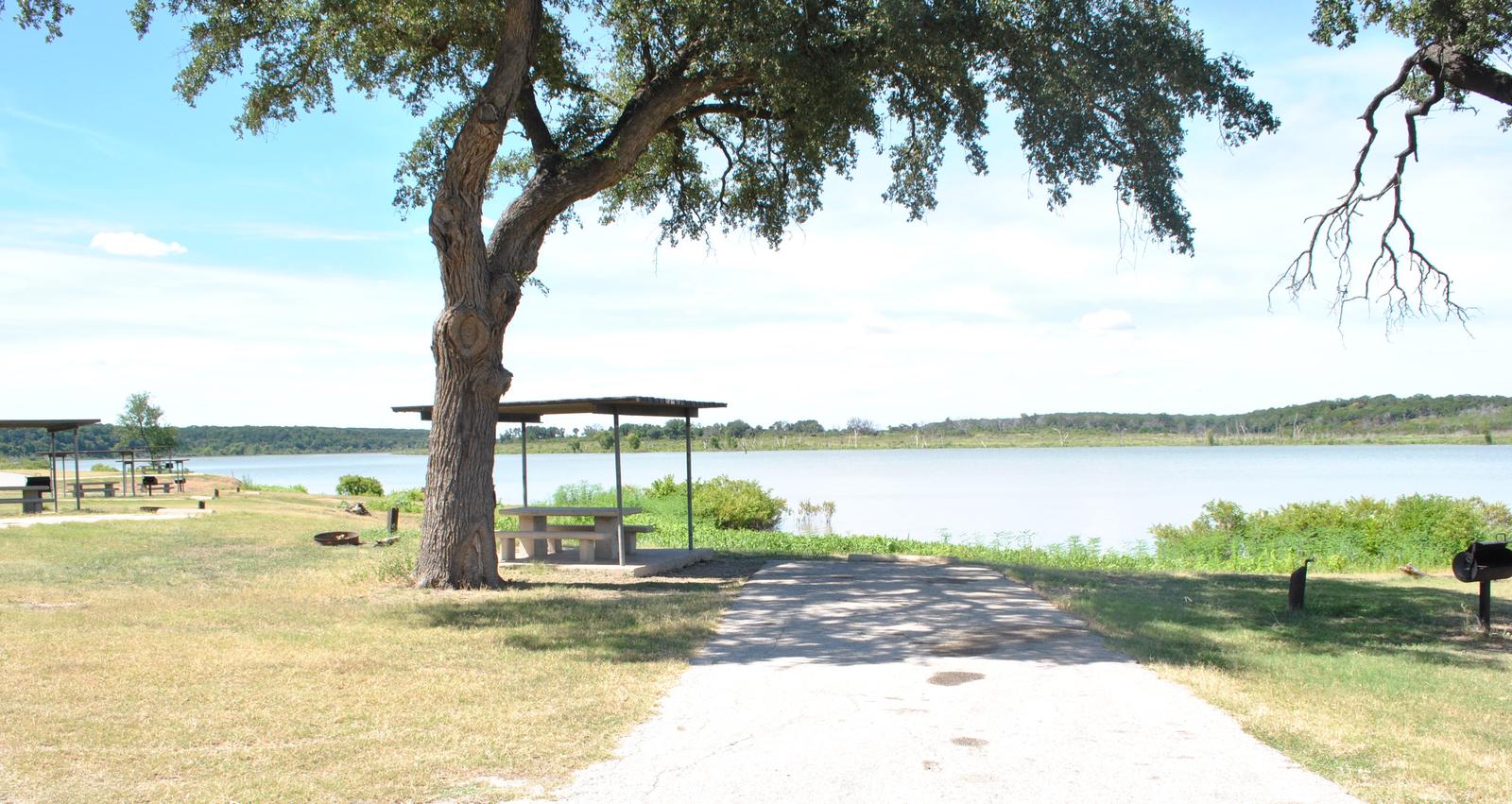
The campground is small with 14 sites, all with drinking water access. The park also provides restrooms with flush toilets and showers, as well as covered picnic tables and grills.
A dump station and boat ramp are available for use by registered campers at White Flint Park, approximately one mile south of the campground.
Natural Features
The campground is fairly isolated on the lake. All sites are lakefront and provide a view of the water. Though the campsites themselves are not shaded, the perimeter of the facility and parts of the shoreline are forested.
The lake area is a habitat for deer, wild turkey and water birds such as Great blue herons, ducks, geese, many species of songbirds and even an occasional bald eagle. A man-made wetland on the opposite side of the lake was constructed to provide an additional 25 acres of wildlife habitat in the lake area.
Nearby Attractions
Belton Lake is located adjacent to the Fort Hood Army Base, which has several points of interest for the military buff.
The mural painted on the spillway wall of Belton Dam depicts the history of the Bell County area.