
Directions
Travel Highway 61 along Lake Superior’s north shore to Tofte, Minnesota. In Tofte, turn north (away from Lake Superior) on Sawbill Trail (CCHS 2). Follow the Sawbill Trail for 16 miles to The Grade (Forest Road 170). Turn right onto the The Grade and proceed east for 7 miles. The campground is on your right and is marked by a large sign.
Phone
218-663-7150
Activities
BOATING, CAMPING, FISHING
Keywords
CRSL
Related Link(s)
Minnesota State Road Conditions
Overview
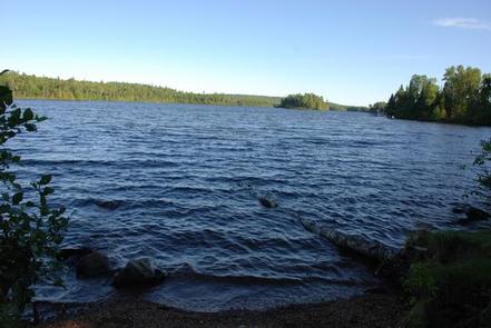
Crescent Lake is an undeveloped lake surrounded entirely by the remote Superior National Forest. This quiet campground has waterfront campsites with easy access to fishing, exploring the nearby wilderness and simply enjoying the beauty of the natural area.
Superior National Forest, located in northeastern Minnesota’s arrowhead region, is comprised of 3 million acres. The forest spans 150 miles along the United States-Canada border.
Visitors can find recreation opportunities year-round, including travel in the famous Boundary Waters Canoe Area Wilderness.
Recreation
The fishing is good for walleye, northern pike and muskie. Crescent Lake allows motorized boat use without limit on horsepower, but is most appropriate for small fishing or similar type boats.
The surrounding national forest offers a wide variety of recreational opportunities, including hiking in secluded woodlands and canoeing in pristine lakes and rivers.
View recreation guides and maps of hiking trails and canoe routes in the national forest.
Facilities
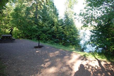
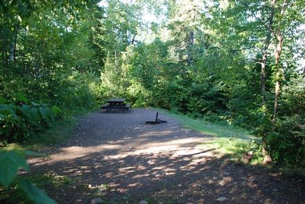
The campground has 32 sites situated on a peninsula that juts out into the lake, providing many sites with nice views of the water and some sites with access to the water.
A few sites are first-come, first-served, including one primitive backcountry camping site that campers can boat into; access is a boat ramp on the northwest side of the lake.
Picnic tables, campfire grates, water pumps and vault toilets are provided. A fishing pier is located within the campground.
Natural Features
Superior National Forest is known for its boreal forest ecosystem, numerous clean lakes and diversity of plants and animals. The entire campground is heavily wooded with white pines, red pines, spruce, balsam, birch and aspen. Birds and wildlife are abundant, from moose and bear to bald eagles and loons.
Nearby Attractions
The concessionaire Sawbill Canoe Outfitters maintains a store with showers, laundry, fishing licenses, fishing bait and tackle, ice, grocery and convenience items, canoe and camping gear rental and a pay telephone. It is 13 miles from the campground.
Numerous outdoor recreation opportunities lie within Superior National Forest, including the nearby Boundary Waters Canoe Area Wilderness. Over one million acres in size, the Boundary Waters extend nearly 150 miles along the United States-Canada border and contain over 1,200 miles of canoe routes, 12 hiking trails and over 2,000 designated campsites.