


Directions
From Ferron, head west on West Canyon Road. Heading out of town, you will pass the golf course and Millsite Park. The pavement ends near the forest boundary. Stay on this road till you get to Ferron Reservoir, about 27 miles. Go to the left around the reservoir and you will see a sign for the guard station.
From Mayfield, head east through Twelve Mile Canyon, on Forest Development Road 022. Near the top of the plateau, you’ll see Twelve Mile Flat Campground on the right. Across from the campground, make a left and continue on Forest Development Road 022, over the plateau and down the other side, about 3 miles. You’ll see the guard station on the left before you pass the reservoir.
Phone
435-384-2372
Activities
BIKING, BOATING, CAMPING, FISHING, HIKING, HUNTING, WILDLIFE VIEWING, SWIMMING SITE
Keywords
C057,Ferron Reservoir Guard Station
Related Link(s)
Overview
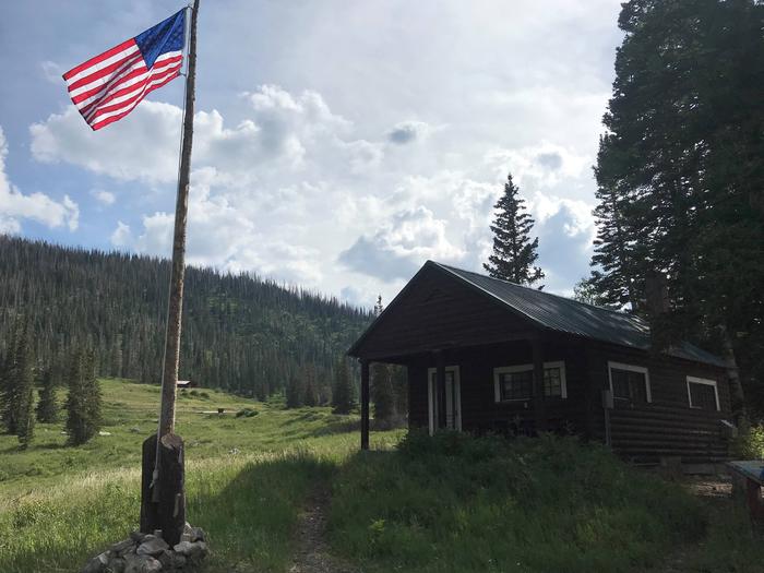
Indian Creek Guard Station is located next to Ferron Reservoir, just below the Wasatch Plateau on the Manti-La Sal National Forest in central Utah. The cabin was built by the Civilian Conservation Corps in the 1930s and was used by generations of forest rangers serving in the back country.
Guests enjoy year-round recreational activities, including fishing, hiking, off-roading, snowmobiling and skiing.
Recreation
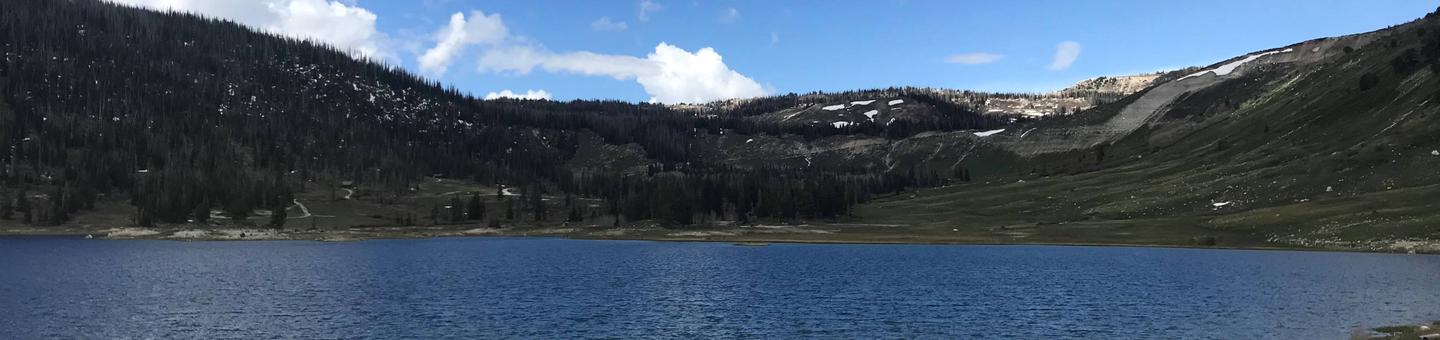
Ferron Reservoir is adjacent, providing canoeing, boating (small craft only) and fishing for rainbow and cutthroat trout. Skyline Drive passes above the campground on top of the plateau.
The expansive Arapeen ATV Trail System can be accessed close by, and offers more than 350 miles of designated, maintained trails suitable for all riding levels.
In the winter, the surrounding area becomes a playground for snowmobile enthusiasts. Cross-country skiing, back country skiing and snowshoeing are also popular activities.
Facilities
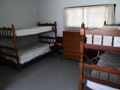
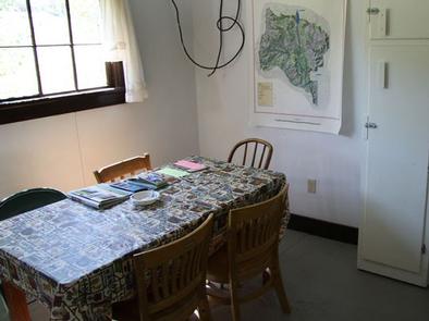
The guard station complex can accommodate a maximum of 10 people, with six inside and four camped in tents outside of the facility. RVs are not allowed. The guard station contains single bunks with mattresses for four people. Guests must bring their own linens, bedding and pillows. The kitchen is equipped with a table and chairs, sink, wood stove, propane lighting and propane appliances, including a stove and oven and hot water heater. Limited utensils and cookware are available but guests are encouraged to bring their own supplies and matches. Drinking water and an indoor flush toilet and shower are available from July through mid-September. A vault toilet is available 50 feet from the cabin during the winter months.
Natural Features
The guard station is situated facing Ferron Reservoir and the front porch offers partial lake views through the trees. Stands of Englemann spruce, fir and aspens cover the area.
Skyline Drive runs along the top of the Wasatch Plateau for more than 60 miles, rewarding visitors with beautiful mountain scenery, glacial cirques, spruce-fir and aspen forests, numerous lakes and reservoirs. Wildlife and summer wildflowers are plentiful, and autumn leaves put on quite a show.
Due to the guard station’s high elevation of 9,400 feet, guests should be prepared for all types of weather including snow or hail, especially after September.
Nearby Attractions
Ferron Campground is located less than a half-mile away from the guard station. Rush Pond and Willow Lake are a short drive east, both with additional fishing and scenic views.