Directions
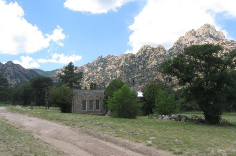
From Tucson, take I-10 east to Exit #318 (Dragoon Road). Turn right onto Dragoon Road and travel for approximately 10 miles to the Cochise Stronghold Road. Turn right on Cochise Stronghold Road and travel for approximately 6 miles to Ironwood Road. The paved road dead ends at Ironwood Road. Turn right on Ironwod Road and travel for approximately 4 miles.The Shaw House is the large rock house located off to the left of Ironwood Road behind a locked gate.
Phone
(520) 364-3468
Activities
BIKING, HISTORIC & CULTURAL SITE, CAMPING, HIKING, HORSEBACK RIDING, WILDLIFE VIEWING
Keywords
SWHC
Related Link(s)
Overview
Shaw House is a stone masonry cabin located in East Cochise Stronghold in the Dragoon Mountains of the Coronado National Forest. The house is nestled in a dramatic landscape of canyons and rock formations offering guests to the area a unique lodging experience. Nearby trails provide excellent hiking, mountain biking, and horseback riding opportunities.
Recreation
With rugged granite formations, wooded slopes, seasonal streams, and an amazing variety of plants and wildlife, the Cochise Stronghold area is a popular recreation destination. Long considered a haven for rock climbing and bouldering, the area features backcountry and protected routes ranging from one to seven pitches in length, and from 5.6 to 5.12 in difficulty. Most approaches are 30-60 minutes in length, although there are a number of known areas that are easily accessible from the roads. Nearby trails also provide excellent hiking, mountain biking, and horseback riding opportunities. There are signed interpretive trail for both natural and cultural resources at the nearby Cochise Stronghold Campground.
Facilities
Shaw House is an eight-room residence, suitable for groups of up to 10 people. The house has three bedrooms, two bathrooms, a living room, a dining room and a kitchen. The master bedroom has a queen-size bed; the second bedroom has two twin-over-double bunk beds, and there is a double-sized futon in the third bedroom. The living room contains two full-sized futons, and several end tables. Both bathrooms have showers, sinks, and toilets. . The dining room is furnished with a table and seating for six. The kitchen is equipped with a stove, oven, microwave, refrigerator, pots, pans, utensils, dishes, and coffeepot. The house has electricity and running water, as well as two wood stoves – one in the living room, the other in the master bedroom (firewood is provided). Outside, guests will enjoy using the propane grill and picnic table for outdoor dining. The cabin also has a screened in porch. Although the cabin has amenities for comfortable lodging, guests do need to provide some of their own supplies, including food, sleeping bags, linens, pillows, towels, dish soap, matches, a first aid kit, toilet paper and garbage bags. Although electricity is available, it is recommended that guests bring an additional light source in case of emergencies. Horse corrals are available near the cabin. Up to four horses/mules are permitted in the corrals, and feed for the horses must be certified weed-free.
Natural Features
Shaw House is surrounded by the rugged beauty of East Cochise Stronghold. The sparsely wooded Dragoon Mountains form a protective rampart of granite spires, sheer cliffs, balanced rocks and boulders, which were once the refuge of the Apache Chief, Cochise. The area is abundant with wildlife, including white-tailed and mule deer, rabbits, wild turkeys, and squirrels. Bats, black bear, Coati, foxes, ring-tailed cats, bobcats, and mountain lion find habitat in the area as well, but are more often seen in the twilight and nocturnal hours.
Nearby Attractions
The Shaw House is located approximately ten miles west of Sunsites, Arizona. Attractions in the area include the Chiricahua National Monument, Fort Bowie National Historic Site, the Amerind Foundation, and the Willcox Playa.


