
Directions
From I-10, take exit 250 for Orange Grove Road. Go east on Orange Grove Road and proceed about 6.5 miles. Turn right on Skyline Drive. After about 1 mile, continue right onto Sunrise Drive. Follow for 6.3 miles and turn onto Sabino Canyon Road. Continue to the entrance just north of Sunrise Drive.
Phone
520-749-8700
Activities
BIKING, HISTORIC & CULTURAL SITE, CAMPING, INTERPRETIVE PROGRAMS, HIKING, PICNICKING, VISITOR CENTER, WILDLIFE VIEWING
Keywords
Cactus Picnic Area,Cactus,Cactus Environmental Education Center,Group Picnic,Cactus Environmental Ed Center,Cactus Ramada # 2 Group Picnic,Cactus Ramada # 2,SABINO CANYON RECREATION AREA CACTUS RAMADA 2
Related Link(s)
Overview
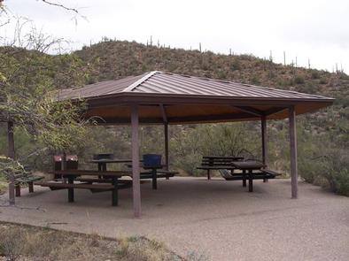
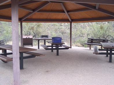
Cactus Ramada 2 is a reservable group picnic site within the extremely popular Sabino Canyon Recreation Area at the edge of Tucson, Arizona. The facility is accessible and can accommodate up to 25 people. Groups can picnic, hike and ride horseback in this desert oasis of Coronado National Forest.
Recreation
Hikers are drawn to Sabino Canyon for its beauty, scenery and challenge. Three popular trails begin at the recreation area and offer access to the dramatic landscape of the Santa Catalina Front Range, famous for its deep canyons and soaring ridges. A sunset hike reveals the lights of Tucson framed by the black silhouette of surrounding mountains.
The self-guided Desert Nature Trail at the Sabino Canyon Visitor Center provides an excellent way to get to know the plants that have adapted to living in this demanding environment.
Several area trails can also be used for mountain biking and horseback riding.
Facilities
The group site can accommodate up to 25 people. Amenities include a vault restroom, picnic shelter, three accessible picnic tables, one serving table, one bear-proof trash can and one large grill. Access to Cactus Ramada 1 is through the use of the Sabino Canyon shuttle service or by foot travel 1/3-mile to the Cactus Picnic Area from the parking area. There are also many individual first-come, first-served picnic sites scattered throughout area. A visitor center and bookstore are nearby.
Natural Features
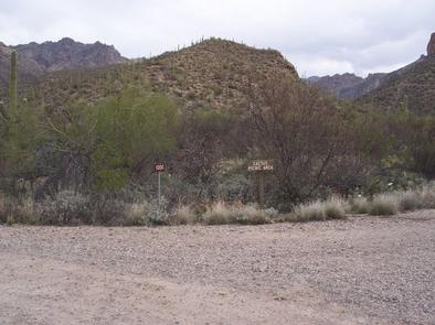
The recreation area is located along Sabino Creek at an elevation of 2,800 feet at the foot of the Santa Catalina Mountains. For many who come to visit the Southwest, this area provides their first close encounter with the Sonoran Desert and the fascinating variety of plants and animals that make it their home.
Winter temperatures are pleasant, and springtime brings the desert to life with numerous flowering cacti and desert wildflowers.
Nearby Attractions
The recreation area or visitor center can be used as a home base for exploring scenic and natural areas of Sabino Canyon. The city of Tucson is just a short drive away and has many attractions and amenities. Other notable places nearby include Saguaro National Park and Colossal Cave.