


Directions
From Crescent, Oregon, travel 12.2 miles west on Road 61, then 3.5 miles north on Highway 58, then 8.1 miles west on Road 60 to the campground.
Phone
541-323-1746
Activities
BIKING, BOATING, CAMPING, FISHING, HIKING, VISITOR CENTER, WATER SPORTS, SWIMMING SITE
Keywords
None
Related Link(s)
Overview
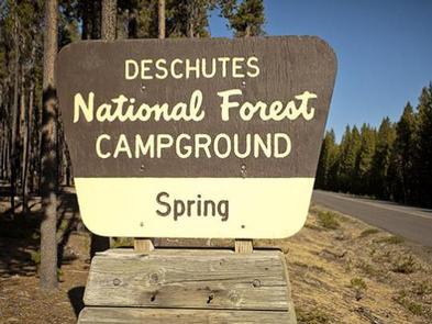
Nestled in Deschutes National Forest, Spring Campground offers visitors some of the most stunning scenery in central Oregon and easy access to an abundance of recreational activities in the Cascade region.
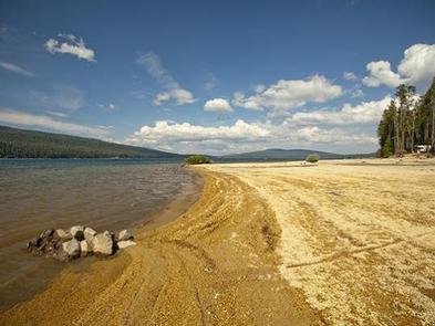
A favorite among visitors, the sites in this campground are widely-spaced and scattered among a mixed conifer forest, giving it an open and sunny character. The campground looks out to the stunning water of Crescent Lake, and several tent-only sites are on the lake front.
Recreation
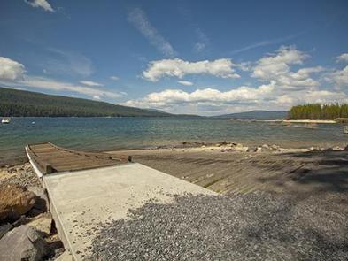
In addition to being a prime location for boating, fishing, swimming, hiking and biking in summer and early fall, Spring Campground offers excellent skiing, snowshoeing and snowmobiling in the winter months.
Crescent Lake Snowpark offers skiers and snowmobilers a base camp for winter excursions. Summit Lake Trail, 9 miles one- way, follows the road leading from Crescent Lake to Summit Lake, offering excellent views across Crescent Lake and highlighting Diamond Peak.
Anglers enjoy fishing from boats or the shoreline. Fish species found in the lake include kokanee salmon, mackinaw, rainbow trout, brown trout and mountain whitefish. Summer months offer the best fishing opportunities.
Facilities
Sites at Spring Campground are plentiful, and some can be reserved on a first-come, first-served basis. The campground is rarely full, offering a bit more solitude than neighboring campgrounds.
Larger groups may reserve a block of 12 campsites. These sites are somewhat isolated from the others and can fit up to about 70 campers and 25 vehicles.
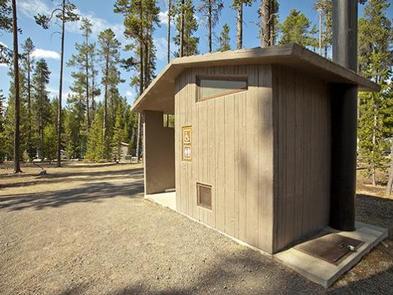
Sites are equipped with tables and campfire rings with grills. Vault toilets and drinking water are available.
A nearby resort on Crescent Lake offers lodging and a general store.
Natural Features
Cresent Lake, nestled in a naturally glaciated basin behind a moraine dam, lies east of the towering Cascade Mountain Range. Its brilliant blue-green water, sandy beaches and water temperature are exceptional for a high-elevation lake.
Fantastic nearby peaks, lava flows and old-growth forests provide visitors with breathtaking landscapes, showcasing ecosystems typical of central Oregon.
Wildlife found in the area include deer, porcupine, native fish and migratory birds.
Nearby Attractions
Visitors can explore wilderness areas, wild and scenic rivers, lakes and reservoirs and approximately 1,600 miles of trails that comprise nearly 2.5 million acres the Deschutes National Forest and the adjacent Ochoco National Forest.
Lava Lands Visitor Center in nearby Bend, Oregon, and the Newberry National Volcanic Monument draw visitors to the region as well.
Visitors may also enjoy traveling the Cascade Lakes Scenic Byway, known as Oregon’s Highway in the Sky. The 66-mile drive through the Cascade Mountain range weaves through snow-capped peaks and alpine lakes, highlighting the beauty of central Oregon.