DAVIS CANYON CAMPGROUND, UT Campground Reservation, Info, Images, Map, Directions

DAVIS CANYON CAMPGROUND, Utah Campground Images, Info & Reservations

Listen

Directions

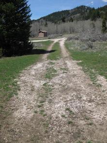
Take U.S. Highway 89 north from Garden City, Utah, or south from Montpelier, Idaho, to St. Charles. Drive west from St. Charles along Forest Road 412 about 6 miles to the campground.

Phone

541-351-1182

Activities

BOATING, CAMPING, FISHING, HIKING, HUNTING

Keywords

None

Related Link(s)

Rec Area Info & Images

Forest Service Concessionaire

Idaho State Tourism

Idaho State Road Conditions

Overview

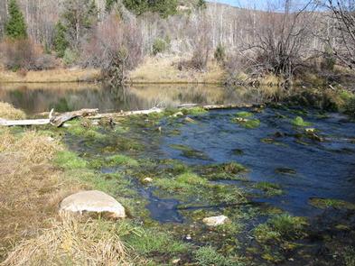
Davis Canyon Campground is situated on St. Charles Creek a scenic canyon in the forests of southeast Idaho.

Recreation

Nearby, the North Fork Trail and its associated trails access the Highline Trail #316. The Highline Trail is part of the National Trail System and is the area’s premier trail. It stretches 55 miles along the backbone of the Wasatch Mountains and is open to hikers, mountain bikers, horseback riders and motorcyclists, attracting trail users from around the world.

The Idaho Department of Fish and Game manages the river fisheries, providing excellent fishing most of the year, including in St. Charles Creek. In-season big game hunting is also a popular activity.

Facilities

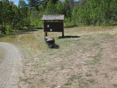
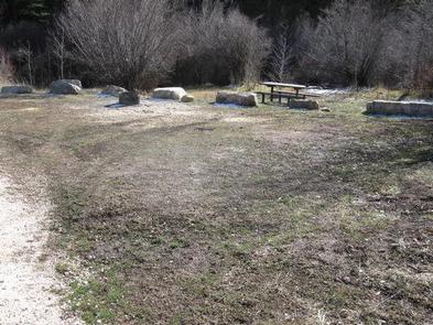
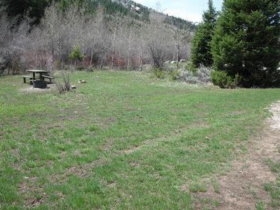
This campground contains one accessible group site that can accommodate up to 40 people. The group site is made up of three smaller individual sites. Picnic tables and fire rings are provided, as are vault toilets. Roads and parking spurs are gravel.

Natural Features

A mixed-growth conifer and aspen forest covers the campground. St. Charles Creek flows gently past the site.

Nearby Attractions

Minnetonka Cave, one of only two developed caves in the Forest Service, is a few miles from the campground. Guided cave tours are scheduled every 30 minutes daily from early June until Labor Day.

The Bear Lake National Wildlife Refuge is just north of Bear Lake, offering excellent bird watching.

Bear Lake’s Raspberry Days Festival occurs the first weekend in August every year, with a parade, fireworks, craft booths and a rodeo.

Reservation

More from CampingHiking.net:

QUINN MEADOW HORSE CAMP, Oregon Campground Images, Info & Reservations

Listen Directions From Bend, travel southwest on Cascade Lakes Scenic Byway for 31.2 miles to the campground entrance. Phone 541-323-1746 Activities BIKING, CAMPING, FISHING, HIKING, HORSEBACK RIDING, DAY USE AREA Keywords QUIN,DESCHUTES NF – FS Related Link(s) Rec Area Info & Images Oregon State Road Conditions Oregon State Tourism Forest

BLUE BILL POINT, Oklahoma Campground Images, Info & Reservations

Listen Directions Address for GPS: Blue Bill Point Campground, 67260 S. 307 Rd., Wagoner, Oklahoma 74467. From the intersection of US Highway 69 and State Highway 51 in Wagoner, Oklahoma, travel north on Highway 69 for 5.5 miles. Turn right on East 680 Road and travel east for 1 mile.

WAITSBORO CAMPGROUND, Kentucky Campground Images, Info & Reservations

Listen Directions From Somerset Kentucky, take Highway 27 south for 5 miles. Turn right on Waitsboro Road and follow signs to the campground. Phone 606-561-5513 Activities BOATING, CAMPING, FISHING, DAY USE AREA Keywords WAIT,LAKE CUMBERLAND,WOLF CREEK DAM Related Link(s) Rec Area Info & Images Kentucky State Road Conditions Kentucky State

MONARCH PARK, Colorado Campground Images, Info & Reservations

Listen Directions From Poncha Springs, travel west on Highway 50 for about 15 miles, then turn left on County Road 231 and drive south to the Monarch Park Campground. Phone CAMPGROUNDS DO NOT HAVE PHONE SERVICE, CALLING TO CHECK AVAILABILITY PRIOR TO ARRIVAL IS NOT POSSIBLE. FOR RESERVATIONS CALL: 1-877-444-6777