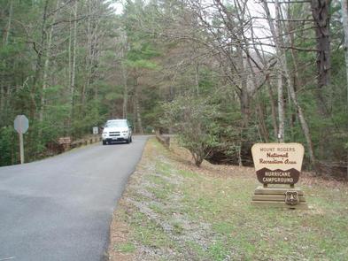
HURRICANE CAMPGROUND, VA Campground Reservation, Info, Images, Map, Directions

HURRICANE CAMPGROUND, Virginia Campground Images, Info & Reservations

Listen

Directions

From I-81: Take Marion exit 45 onto Virginia State Route 16 South. Follow SR 16 for 15 miles to SR 650 (5 miles south of Sugar Grove). Turn right on gravel SR 650, and follow for 2 miles to the paved campground entrance road.

Phone

276-783-5196

Activities

BIKING, CAMPING, FISHING, HIKING, HUNTING

Keywords

huricane

Related Link(s)

Rec Area Info & Images

Virginia State Road Conditions

Virginia State Tourism

Overview

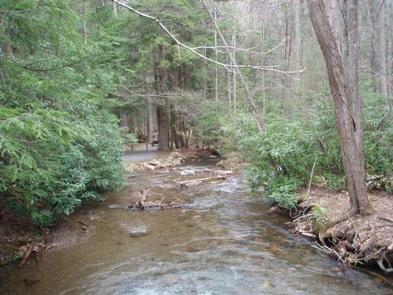
Hurricane Campground is one of the best kept secrets in southwest Virginia. Located along a rushing mountain stream under the shade of hemlock and rhododendron, this campground offers a peaceful setting for those looking to relax as well as visitors looking for outdoor adventure.

From the campsite, hikers can access many trails including the Appalachian Trail. This well-known trail extends more than 2,189 miles throughout the Appalachian Mountains across 14 states. It is a protected greenway and owns the title as the first National Scenic Trail.

Recreation

Visitors frequently explore the Hurricane Knob Trail. The loop trail, at 1.1 miles, parallels Hurricane Creek for about half a mile, crosses two wooden bridges and ascends to the picturesque Hurricane Knob. The creeks are stocked with trout for a relaxing day of fishing.

Facilities

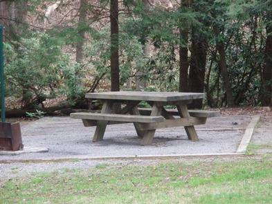
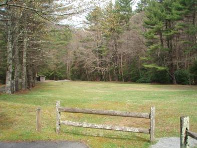
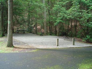
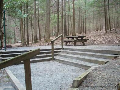
Hurricane has drinking water, flush toilets, hot showers and a playing field. Large RVs are not recommended. Each site comes with a lantern pole, picnic table and campfire ring.

Natural Features

The campground is perched along Hurricane Branch and Comers Creek, among colorful rhododendron. Several groomed, grassy fields unfold at the campground, but the campsites are nicely shaded by mixed woods of oak and hemlock. Hurricane Knob is nearby with an elevation from 2800 to 3050 feet.

Nearby Attractions

Virginia Creeper Trail, Grayson Highlands State Park and Hungry Mother State Park.

Reservation

More from CampingHiking.net:

CAMPTON CAMPGROUND, New Hampshire Campground Images, Info & Reservations

Listen Directions From Highway 93 in central New Hampshire, take exit 28 and follow Highway 49 (Mad River Road) east for 2 miles. Phone 603-536-6100 Activities CAMPING, INTERPRETIVE PROGRAMS Keywords CAMP,WHITE MOUNTAIN NF -FS Related Link(s) Rec Area Info & Images Forest Service Concessionaire New Hampshire State Tourism New Hampshire

CARTER COVE, Arkansas Campground Images, Info & Reservations

Listen Directions From Plainview, Arkansas, take Route 60 for 3 miles east to the Access Road. Continue 1 mile south and follow signs into campground. Phone 479-272-4983 Activities BOATING, CAMPING, FISHING, SWIMMING SITE Keywords CART,NIMROD LAKE,NIMROD LAKE Related Link(s) Rec Area Info & Images Arkansas State Road Conditions Arkansas State

LAKESIDE (TRUCKEE), California Campground Images, Info & Reservations

Listen Directions From Interstate 80 in Truckee take exit 188, Highway 89 north toward Sierraville. In approximately 3.5 miles turn right at the sign for Prosser Recreation Sites. In one mile the campground will be on the left.. Phone (530)587-3558. FOR RESERVATIONS, PLEASE CALL: 1 (877) 444-6777. Activities BOATING, CAMPING,

BAR GULCH, Montana Campground Images, Info & Reservations

Listen Directions Bar Gulch Cabin is located 24 miles from Helena and 30 miles from Townsend on Magpie Road (#425). From Helena, take Canyon Ferry Road over the dam, past Kim’s Marina. Continuing east, watch for a left-hand turn onto Magpie Road. From this intersection, proceed up Magpie Road 3.9

OLD FOLKS FLAT, Utah Campground Images, Info & Reservations

Listen Directions The campground is located 21 miles from Huntington, Utah, along Highway 31. Phone 435-384-2372 Activities BIKING, CAMPING, HIKING, WILDLIFE VIEWING Keywords OLFF,MANTI-LASAL NF -FS Related Link(s) Rec Area Info & Images Utah State Road Conditions Utah State Tourism Overview Old Folks Flat Campground is nestled in beautiful Huntington

BROWNE LAKE GROUP SITES, Utah Campground Images, Info & Reservations

Listen Directions From the Wyoming: Take Highway 43, turn right at the McKinnon Junction up through Sols Canyon. Turn left onto Sheep Creek Road; follow signs to Browne Lake. From Vernal, Utah: Take Highway 191, which turns into Highway 44. Shortly past the Dowd Mountain overlook, turn left onto the