
Directions
From Missoula, Montana, travel east on Interstate 90 for about 20 miles to exit 126. Drive south on Rock Creek Road for about 30 miles. Rock Creek Road is a hardened surface for 12 miles and the remainder is a gravel, single-lane road, with intermittent pull-outs. It is not suitable for RVs or trailers, due to blind turns, steep grades and narrow width. Maps are available online or for purchase by calling the Missoula Ranger District.
During winter, take the Drummond exit 153 on Interstate 90 and follow Scenic Highway 1 south toward Philipsburg. One mile north of Philipsburg, turn west on State Road 348. Travel 13 miles west, cross Rock Creek and turn north onto Rock Creek Road. Continue 10 miles to the homestead. Winter access is plowed within 2 miles of the cabin. A four-wheel drive vehicle equipped with chains is recommended. Travelers may also want to bring an alternate form of transportation (skis or snowshoes) to complete the route.
Phone
406-329-3814
Activities
HISTORIC & CULTURAL SITE, CAMPING, FISHING, HIKING, HUNTING, WINTER SPORTS, WILDLIFE VIEWING
Keywords
None
Related Link(s)
Overview
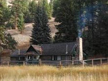
Morgan-Case Homestead is a rustic log cabin situated on approximately 320 acres along Rock Creek. The cabin is listed on the National Register of Historic Places for its significance relating to early homesteading and ranching in Granite County and western Montana. It was an active work site from 1890 to 1951.
In addition to being a great home base for big game hunters, the cabin provides access to a variety of recreational opportunities, including blue-ribbon trout fishing and trails that are open to hiking and horseback riding, as well as cross country skiing and snowshoeing.
Recreation
The area surrounding the cabin offers both summer and winter recreation opportunities including hiking, fishing, hunting, cross country skiing and snowshoeing. The Sandstone/Wyman trailhead is located within a mile of the homestead, providing access to an extensive network of trails.
Rock Creek is well known for its excellent trout fishing opportunities. Proper licenses are required to enjoy hunting and fishing in the state of Montana. The surrounding meadows provide great opportunities for wildlife viewing as well.
Facilities
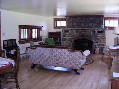
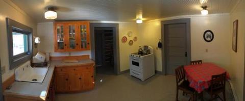
The single-story log cabin is wheelchair accessible and can accommodate up to five people. The rental has two bedrooms, a living room, dining room and a kitchen. It is equipped with beds and mattresses, a table and chairs, counter and cupboard space, period furniture and an accessible outdoor vault toilet. Drinking water is not provided. It is recommended that you bring an adequate supply of your own water.
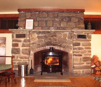
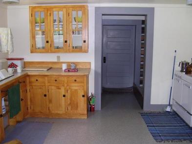
The kitchen is outfitted with an electric range and oven, refrigerator and electric lights. In the winter the cabin is heated to 50 degrees with electric baseboard heaters. It is equipped with a wood stove for additional heat. Cleaning supplies, kitchen utensils cookware, utilities and other amenities may be available, but are not guaranteed; call for availability, (406) 329-3814.
Guests will need to bring their own bedding, including blankets and pillows, as well as towels, soap, garbage bags, toilet paper and some cooking and eating utensils and equipment. Guests are responsible for cleaning the cabin prior to departure.
The cabin is accessible by vehicle, depending on conditions. During the winter, travelers may have to hike, ski or snowshoe about a mile to the cabin. Guests are responsible for their own travel arrangements and safety.
Natural Features
The homestead is located in the rugged Sapphire Mountains at an elevation of 4,700 feet. The Missoula Ranger District began preservation work on the cabin in 2001, restoring its historic charm.
The Sapphire Mountains contain large stands of Douglas fir and lodgepole pine forests and are home to a variety of wildlife, including bighorn sheep, mountain goats, elk, moose, deer and black bears.