SLIDE CREEK, OR Campground Reservation, Info, Images, Map, Directions

SLIDE CREEK, Oregon Campground Images, Info & Reservations

Listen

Directions

From Blue River, travel 4 miles east on Hwy 126 to Aufderheide Drive (FS road 19). Proceed on Aufderheide Drive for 9.5 miles to FS road 1900-500 and continue for 1.5 miles to Slide Creek Campground.

Phone

801-226-3564

Activities

BOATING, FISHING, WATER SPORTS, WILDLIFE VIEWING, SWIMMING, BIRDING

Keywords

Slide Creek Campground,Slide Creek,Slide

Related Link(s)

Rec Area Info & Images

Oregon State Tourism

Oregon State Road Conditions

Forest Service Concessionaire

Overview

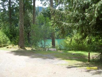
Slide Creek Campground is a unique camping destination just 50 miles from Eugene, Oregon. Located on the east bank of the Cougar Reservoir, it is known for handy access to boating and many water activities. It is also near Terwilliger Hot Springs, a pristine area with 5 soaking pools fed by the Rider Creek waterfall.

Recreation

Activities on the reservoir include water skiing, swimming, fishing and canoeing. Anglers might catch some quality rainbow trout. The campground is close to a large network of hiking trails in the Olallie Trail Area. Half of the trails are open to biking as well.

Facilities

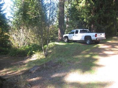
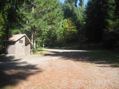
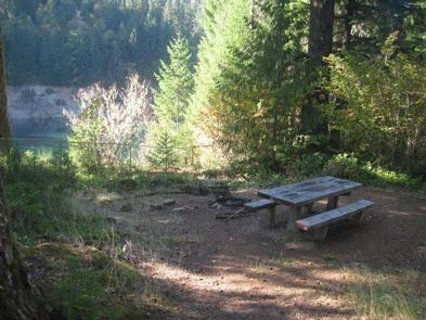
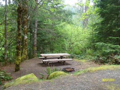
Both campground and the day use area guests have access to drinking water, vault toilets, a boat ramp, ample parking and a swimming beach. A separate parking lot is available for boat trailers. The facility has 15 campsites that can accommodate tents, trailers or RVs and come equipped with campfire rings and picnic tables.

Natural Features

The Willamette National Forest stretches for 110 miles with varied landscapes of high mountains, narrow canyons, cascading streams, and wooded slopes. Native wildlife includes Roosevelt elk, black bear, bald eagles, black tail deer and bobcats. Cougar Reservoir sits at 1,700 feet in elevation and is an estimated 1,280 acres. Some campsites have views of Cougar Reservoir and all sites are an easy walk to the swimming area.

Reservation

More from CampingHiking.net:

SARGE CREEK, Oklahoma Campground Images, Info & Reservations

Listen Directions From Kaw City, Oklahoma, travel nearly 3 miles east on Highway 11, then follow signs to the campground. Phone 580-762-5611 Activities BOATING, CAMPING, FISHING, HIKING, WILDLIFE VIEWING, DAY USE AREA Keywords SARG,KAW LAKE,KAW LAKE Related Link(s) Rec Area Info & Images Oklahoma State Tourism Oklahoma State Road Conditions

CRESCENT CREEK CAMPGROUND, Oregon Campground Images, Info & Reservations

Listen Directions From Crescent, OR: Travel 8.7 miles west on County Road 61/Crescent Cut-off Road. Phone 541-323-1746 Activities CAMPING Keywords Related Link(s) Rec Area Info & Images Oregon State Road Conditions Oregon State Tourism Overview Crescent Creek is a small campground that is somewhat isolated from other campgrounds in the

HILLTOP, Nevada Campground Images, Info & Reservations

Listen Directions From Las Vegas, travel north on Highway 95 to the junction with Highway 157/Kyle Canyon. Turn left and travel approximately 17 miles to the junction with Highway 158/Deer Creek. Turn right and travel about 4 miles to the campground on the right side of the road. Phone 702-872-5486

DUCK CREEK, Utah Campground Images, Info & Reservations

Listen Directions Take Highway 14 from Cedar City, Utah, 28 miles east to Duck Creek campground. Campground turnoff will be on the left hand side of the highway, before you reach Duck Creek Village. Phone 801-226-3564 Activities BIKING, BOATING, CAMPING, FISHING, HIKING, HUNTING, VISITOR CENTER, WILDLIFE VIEWING, PHOTOGRAPHY, MOUNTAIN BIKING,