OAK PARK DAY USE, TX Campground Reservation, Info, Images, Map, Directions

OAK PARK DAY USE, Texas Campground Images, Info & Reservations

Listen

Directions

From Waco or Corsicana, Texas, take State Highway 31 to the intersection with FM 667. Turn north on FM 667 and travel about 1.5 miles to the park entrance on the left side of the road.

Phone

254-578-1431

Activities

SWIMMING

Keywords

Oak park

Related Link(s)

Rec Area Info & Images

Texas State Road Conditions

Texas State Tourism

Overview

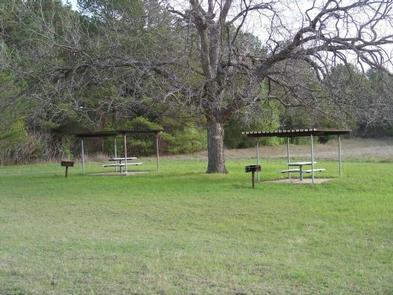
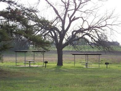
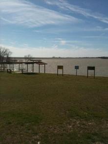
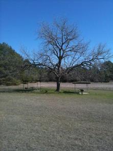
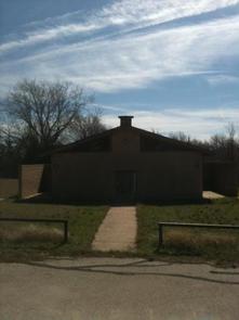
Oak Park is located on the northeastern shore of Navarro Mills Lake in central Texas. Oak Park Day Use area is open from April through September with picnic tables, restrooms, and a swimming beach. Visitors can enjoy a view of the lake from the facility and participate in popular outdoor actives like swimming and picnicking. The lake area provides the perfect setting to get away from it all, especially for city-dwellers from the nearby Dallas-Fort Worth metro area.The brilliant array of native flowers draws visitors from all over to the lake area during the spring. Bluebonnets, paintbrushes and a myriad of other native plants transform the often-bleak winter landscape into an incredible palette of colors.
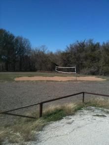
Recreation

Oak Park offers day use swimming and picnic tables from 10:00am- Sunset, April 1- September 30.

Natural Features

A wide variety of habitat provides a home and abundant food supply to diverse wildlife. Visitors might stumble across squirrels, rabbits, coyotes, foxes, bobcars, white-tailed deer, raccoon or armadillo. Birding is a favorite year- round pastime for lake guests. Many species of songbirds, hawks, great blue heron, ducks, geese, other shorebirds and even an occasional bald eagle visit the area.

Reservation

More from CampingHiking.net:

MIDDLE RIDGE CABIN, Alaska Campground Images, Info & Reservations

Listen Directions Middle Ridge Cabin is located on Wrangell Island, approximately 20 miles from Wrangell, Alaska. There are no roads to Wrangell. Access is by the Alaska Marine Highway or via Alaska Airlines. From Wrangell, head south on Zimovia Highway approximately 11 miles to Pat’s Creek Road (Road 6259) and

COLD RIVER, New Hampshire Campground Images, Info & Reservations

Listen Directions From Fryeburg, Maine, take Highway 113 north 15 miles to the campground. Phone 603-447-2166 Activities BIKING, BOATING, CAMPING, FISHING, HIKING, PICNICKING Keywords COLD,WHITE MOUNTAIN NF -FS Related Link(s) Rec Area Info & Images Forest Service Concessionaire New Hampshire State Road Conditions New Hampshire State Tourism Overview Cold River

SHORELINE, Idaho Campground Images, Info & Reservations

Listen Directions From Boise, Idaho, travel 85 miles north on Highway 55 to Cascade. Turn east on Warm Lake Highway and go 25 miles to Forest Road 489. Turn south and continue a half-mile to the campground. Phone 208-382-7400 Activities BIKING, BOATING, CAMPING, FISHING, HIKING, HUNTING, WILDLIFE VIEWING, SWIMMING SITE

CALF CREEK CABIN, Montana Campground Images, Info & Reservations

Listen Directions From White Sulphur Springs, head east on Highway 12 for 3 miles and turn left (north) on Highway 89. Continue about 15 miles, then head west (left) on Road 119 for 9 miles to the cabin. From Great Falls, head east on Highway 87/89 about 23 miles to