


Directions
From Ashton, Idaho, head east out on ID-47 (Mesa Falls Scenice Byway). Stay on the main road – it will make one big curve and head north, then cross Warm River (don’t turn right onto the Fish Creek Road). Turn left at the Lower Mesa Falls Overlook. The campground is to the left with the overlook parking area to the right.
Phone
208-558-7658 OR 208-270-0094
Activities
BIKING, CAMPING, FISHING, HIKING, VISITOR CENTER
Keywords
Mesa Falls
Related Link(s)
Overview
Grand View Campground is located on the Mesa Falls Scenic Byway, adjacent to the Lower Mesa Falls Overlook, approximately 13 miles northeast of Ashton, Idaho. Upper Mesa Falls is within a mile. Visitors enjoy exploring the trails at the falls, viewing wildlife and hiking.
Recreation
Mesa Falls Recreation Area offers walkways and overlooks for all to enjoy. Upper Falls has an accessible path and close-up overlook of the falls, as well as a staffed Interpretive Center. Visitors enjoy viewing the power and beauty of the falls, as well as watching the osprey and eagles that frequent the area.
An abandoned railroad bed acts as a trail for hiking, biking and horseback riding from the Bear Gulch parking lot to West Yellowstone, Montana. Several entry/exit points are found along the trail. Numerous additional trails are in the vicinity.
Facilities
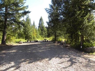
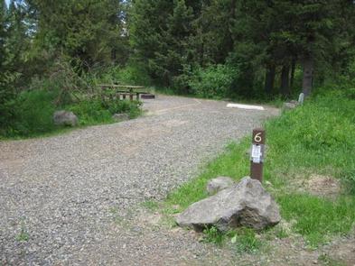
The campground offers seven single sites and one double site. Picnic tables and campfire rings are provided, as are vault toilets and drinking water. Electric hookups are available.
Natural Features
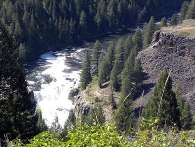
The Mesa Falls Scenic Byway leads through Idaho’s backcountry to the 85-foot Lower Mesa Falls and 110-foot Upper Mesa Falls, both on the Henry’s Fork of the Snake River. A beautiful rainbow created by sunlight passing through the mist is visible from approximately 9 a.m. to 1 p.m. during sunny days at Upper Mesa Falls.
The byway is home to an abundance of seasonal wildflowers. A variety of wildlife makes it home in the area, including moose, bear, deer, elk, marmots, coyotes, martens, eagles, osprey and many other small mammals and birds.
Nearby Attractions
Harriman State Park, a wildlife refuge featuring Blue Ribbon trout fishing (fly fishing, catch and release), trumpeter swans, elk, moose and various waterfowl, is located approximately 11 miles north on the Mesa Falls Scenic Byway.
Island Park is within a short drive beyond Harriman, with outdoor activities for visitors of all ages. Hundreds of miles of hiking, biking, horseback riding and off-road vehicle trails crisscross the area. Island Park Reservoir and Henry’s Lake are nearby, with boat ramps, fish cleaning stations, boating, water skiing and fishing.
Yellowstone National Park and West Yellowstone, Montana, are an hour’s drive away. Yellowstone offers hiking, wildlife viewing and fishing in a breathtaking natural setting.