
Directions
From Roanoke, Virginia, take the Blue Ridge Parkway north for 26 miles to Milepost 86.
From Bedford, Virginia, follow Route 43 to Blue Ridge Parkway; the campground is on the left before reaching the Parkway.
Phone
540-586-7321 (MAY – OCTOBER)
Activities
HISTORIC & CULTURAL SITE, CAMPING, INTERPRETIVE PROGRAMS, FISHING, HIKING, PICNICKING, VISITOR CENTER, WILDLIFE VIEWING, DAY USE AREA, HOTEL/LODGE/RESORT PRIVATELY OWNED, PHOTOGRAPHY, STAR GAZING, BIRDING
Keywords
Peaks of Otter Campground,Peaks Campground,Blue Ridge Parkway
Related Link(s)
Virginia State Road Conditions
Overview
The Peaks of Otter Campground is nestled between the bases of two dominating mountains in the rolling hills of Virginia.
Recreation
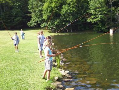
The 24-acre Abbott Lake is one of the biggest attractions the Peaks of Otter Park has to offer. The lake is well-stocked with small mouth bass and bluegill. A crystal-clear mountain stream winds through the nearby picnic area.
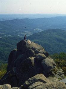
Numerous hiking opportunities range from demanding, scaling the area’s high mountain peaks, to the moderate short, flat trail around Abbott Lake. Hikers are likely to stumble upon one of the mountain meadows, filled with wildflowers and migrating butterflies in the spring and a fantastic assortment of colors in the fall.
Abundant wildlife like deer and wild turkey are spotted daily at the Peaks of Otter Campground, and many rare species of birds reside or migrate along the mountain ranges. Summer interpretive programs are provided for visitors to learn about the wildlife as well as the history of the area.
Facilities
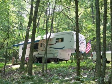
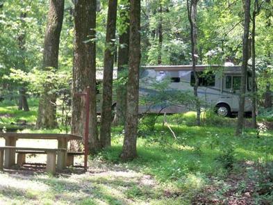
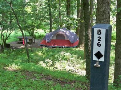
Campsites are shaded under an umbrella of thick trees, and provide campers with picnic tables, lantern poles, and campfire rings/grills. The campground also offers modern conveniences like flush toilets, drinking water and a dump station. Peaks of Otter Campground almost always has campsites available. In addition to the 60 sites available for advanced reservation, there are 79 first-come, first-served campsites available.
Natural Features
Three mountain peaks sitting atop a thick blanket of forest make up the Peaks of Otter– a recreational oasis spanning acre upon acre of rolling landscapealong the famous Blue Ridge Parkway.
The Blue Ridge Parkway is a scenic byway that follows the high crests of the central and southern Appalachians for 469 miles from Shenandoah National Park in Virginia, to the Great Smoky Mountains National Park in North Carolina.
Nearby Attractions
The Peaks of Otter Lodge and Restaurant are located within walking distance of the campground, as is the Sharp Top Country Store. Restaurant dining, grab-and-go meals, snacks, souvenir items, camping supplies, firewood, and ice are all readily available to campground patrons.
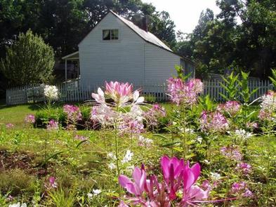
The Johnson Farm, an old mountain farmstead restored and preserved to look as it did in the mid-1800s, is just a short walk away. Another restored historic structure, Aunt Polly’s Ordinary, sits on the northeastern shore of Abbott Lake.