BULLTOWN CAMP, WV Campground Reservation, Info, Images, Map, Directions

BULLTOWN CAMP, West Virginia Campground Images, Info & Reservations

Listen

Directions

From North of Charleston, WV and I-79, take Exit 67 (Flatwoods) and travel north on U.S. Highway 19 for 10 miles. Follow signs into campground. From Clarksburg, WV and I-79, take Exit 91 (Roanoke), travel south on U.S. 19 for 28 miles. Follow signs into campground. Physical Address: Bulltown Campground 1183 Bulltown Campground Road Napier, WV 26631 USA

Phone

(304) 452-8006

Activities

BIKING, BOATING, CAMPING, HIKING, HUNTING, WATER SPORTS, WILDLIFE VIEWING, SWIMMING SITE

Keywords

BULT,BURNSVILLE LAKE,BURNSVILLE LAKE

Related Link(s)

Rec Area Info & Images

West Virginia State Road Conditions

West Virginia State Tourism

Overview

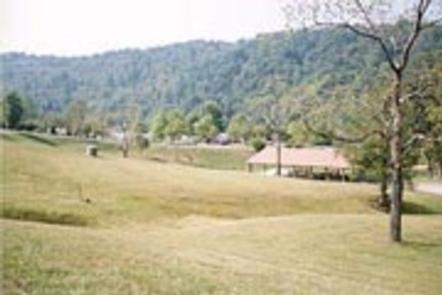
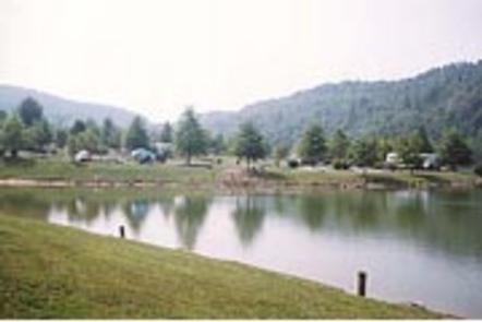
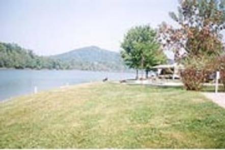
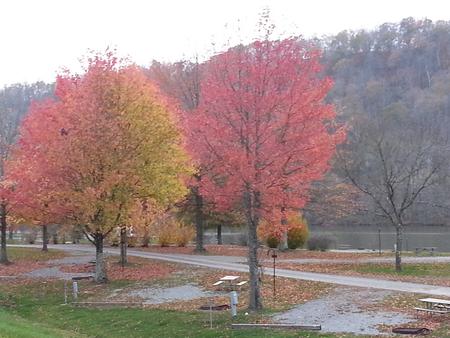
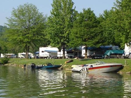
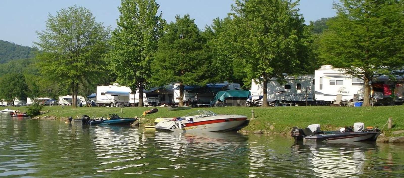
Head to Bulltown Campground to experience the scenery and historic significance of this central West Virginia region. The large campground is on the edge of Burnsville Lake, just beside the Bulltown Historic Area. This spot occupies the site of a Civil War battle, where reenactments of the historic event take place twice a year.

Recreation

Take a trip back in time at the Bulltown Historical Village to get a taste of life during the Civil War era. Other activities include hiking, boating, wildlife viewing, fishing, hunting and picnicking.

Facilities

The campground offers nearly 200 campsites. Playgrounds and showers on located within each loop. A boat ramp is within the campground and a beach is about a mile away.

Natural Features

The campground is near the headwaters of Burnsville Lake on the Little Kanawha River. The hilly, forested region lies at the foothills of the Allegheny Mountains, just west of the Allegheny Plateau.

Nearby Attractions

A trip to the Bulltown Historic Area Visitor Center is highly recommended. The Burnsville Lake Wildlife Management Area is due east. For camping convenience, two general stores are located within three miles of the campground.

Reservation

More from CampingHiking.net:

GROUSE VALLEY, California Campground Images, Info & Reservations

Listen Directions The county road from Springville to the cabins is narrow with many sharp turns, and vehicles over 22 feet are not advised. Take Highway 190 east from Porterville to Springville. After passing through Springville, take a left on Balch Park Road. Drive approximately 10.5 miles, then turn left

WILDWOOD RECREATION SITE, Oregon Campground Images, Info & Reservations

Listen Directions Wildwood Recreation Site is located 39 miles east of Portland on Highway 26 near Welches, Oregon. Phone 503-622-3696 Activities BIKING, HISTORIC & CULTURAL SITE, FISHING, HIKING, PICNICKING, WILDLIFE VIEWING, FISH VIEWING SITE, DAY USE AREA, ENVIRONMENTAL EDUCATION, PHOTOGRAPHY, MOUNTAIN BIKING, BERRY PICKING, BIRDING, WATER ACCESS, BACKPACKING Keywords WIWO,Wildwood

FORT PICKENS CAMPGROUND, Florida Campground Images, Info & Reservations

Listen Directions Physical Address (NO MAIL SERVICE): 1400 Fort Pickens Road, Pensacola Beach, FL 32561 From I-10, take I-110 S to Pensacola. Take U.S. Highway 98S/FL Highway 30 over Pensacola Bay to Gulf Breeze. Follow 98 through Gulf Breeze, turn right onto FL Highway 399 to Pensacola Beach. Pay $1/vehicle

RIVER FOREST GROUP SITE, Florida Campground Images, Info & Reservations

Listen Directions From Deland, Florida, drive west on State Route 44 to the first intersection after crossing the St. Johns River. Turn right on County Road 42, and the entrance to the campground is on the right. Phone 352-625-2520 Activities CAMPING, FISHING, HIKING Keywords RFGS,NFs IN FLORIDA – FS Related

PENDLETON BEND, Arkansas Campground Images, Info & Reservations

Listen Directions From Dumas, Arkansas, take US-165 north for 9 miles to State Route 212. Head east for 2 miles and follow signs to the park. Phone 870-548-2291 Activities BOATING, CAMPING, FISHING, HIKING, HUNTING, DAY USE AREA, BIRDING Keywords PEND,PENDELTON,WILBUR D.MILLS LOCK AND DAM,WILBUR D MILLS LOCK Related Link(s) Rec