BURNS RUN EAST, OK Campground Reservation, Info, Images, Map, Directions

BURNS RUN EAST, Oklahoma Campground Images, Info & Reservations

Listen

Directions

From Highway 75 in Denison, Texas, take Exit 72 to Highway 91, travel north on 91 across Denison Dam 5 miles, take first exit left. Physical address: 525 East Burns Run Road Cartwright, OK 74731.

Phone

580-965-4660

Activities

CAMPING, SWIMMING SITE

Keywords

BURR,TEXOMA LAKE,EAST BURNS RUN,BURNS RUN,TEXOMA LAKE

Related Link(s)

Rec Area Info & Images

Oklahoma State Road Conditions

Oklahoma State Tourism

Overview

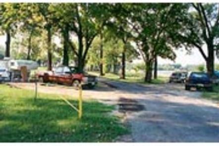
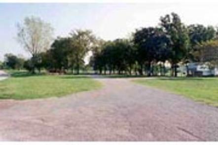
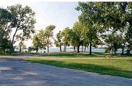
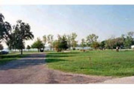
Burns Run East Campground is located on Lake Texoma in Oklahoma’s Cross Timbers Region.

The lake is said to be the "Playground of the Southwest," where outdoor activities like fishing, boating, hiking and hunting abound.

Recreation

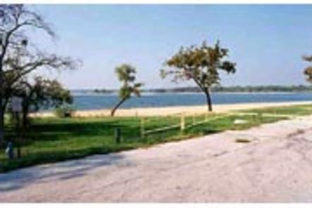
Lake Texoma is a large reservoir with an excellent fishery and many access points. Boating, swimming, water skiing, hunting, birding and relaxing on the sandy beaches are the typical pursuits of most visitors.

The lake is known as the "Striper Capital of the World," one of the few reservoirs in the nation where Striped bass reproduce naturally. Other popular species include largemouth and smallmouth bass, white bass, hybrid striped bass, white crappie, black crappie, channel catfish and blue catfish.

Also available is the scenic Cross Timbers hiking trail, a very popular trail that winds for 14 miles above the lake on rocky ledges and through blackjack woodland. Forty miles of equestrian trails surround the lake as well.

Facilities

Burns Run East offers to 47 campsites, 44 of which have electrical and water hookups. A large, day-use group picnic shelter with electricity is available as well.

Other amenities include flush and vault toilets, showers and drinking water. A dump station, two boat ramps, a dock, playground, and beach are located on-site. Restaurants and stores are available 1/2-mile from the campground.

Natural Features

The campground is situated on the southeastern shores of Lake Texoma. Post and blackjack oaks forest the rolling hills of the region. Deer, turkeys, bobcats, hawks, waterfowl and songbirds are abundant around the lake.

Nearby Attractions

The lake features two wildlife refuges, two state parks and 23 commercial concession areas dedicated to the enjoyment of over six million visitors annually.

Reservation

More from CampingHiking.net:

DENVER CABOOSE CABIN, Alaska Campground Images, Info & Reservations

Listen Directions The cabin is approximately 5.5 miles north of Skagway along the East Fork of the Skagway River. The cabin is beside the railroad tracks at the Denver Glacier Trailhead. Access is via the White Pass and Yukon Route Railroad from May 1 through September 30. Make reservations at

CURLEW CAMPGROUND, Idaho Campground Images, Info & Reservations

Listen Directions Take the Snowville, Utah, exit off Interstate 84, northwest of Tremonton. Continue north on the paved highway for 6.5 miles. Turn left (north) at the Curlew Campground sign, then go another half-mile on a gravel road to the campground. From Holbrook, Idaho, travel 24 miles west of Malad

BASIN MONTANA CAMPGROUND, Montana Campground Images, Info & Reservations

Listen Directions From US Hwy 212 (Beartooth Scenic Byway), travel to the south end of Red Lodge, MT. Turn west on West Fork Rock Creek Road (Forest Road 2071), and proceed approximately 7 miles to the campground entrance on the right. Phone 406-587-9054 Activities BIKING, FISHING, HIKING Keywords BASIN MONTANA

MCKINNEY CAMPGROUND, Georgia Campground Images, Info & Reservations

Listen Directions Physical address: 6659 McKinney Campground Road, Acworth, GA 30102 From I-75 take exit 278 and turn north onto Glade Road. Continue for approximately 3 miles, then turn left onto King’s Camp Road. After about a mile continue left at the fork and follow signs to the campground. Phone

HUNTER PEAK, Wyoming Campground Images, Info & Reservations

Listen Directions From Cody, Wyo., travel north on State Highway 120 to Highway 296. The campground is approximately 60 miles from Cody, and located on the left side of the highway. From the northeast entrance of Yellowstone Park or Red Lodge, Mont, travel on U.S. Highway 212 to the junction

FALL RIVER GUARD STATION, Oregon Campground Images, Info & Reservations

Listen Directions Entry to the cabin is by combination lock box. Please call the Forest Service office at 541-383-5300 if you are having difficulty with the combination provided. You can also stop by the office, located at 63095 Deschutes Market Rd. Bend, OR 97701. From Bend, Oregon, take Highway 97