CADDO DRIVE, AR Campground Reservation, Info, Images, Map, Directions

CADDO DRIVE, Arkansas Campground Images, Info & Reservations

Listen

Directions

From Interstate 30 take exit 78. Merge onto State Highway 7 north for 6 miles. Turn left onto Edgewood Road and continue 3 miles to Caddo Drive.

Phone

870-246-5501

Activities

BOATING, CAMPING, FISHING, WILDLIFE VIEWING, SWIMMING SITE

Keywords

CADV,DEGRAY LAKE,DEGRAY LAKE,CADDO,DeGray Lake

Related Link(s)

Rec Area Info & Images

Arkansas State Tourism

Arkansas State Road Conditions

Overview

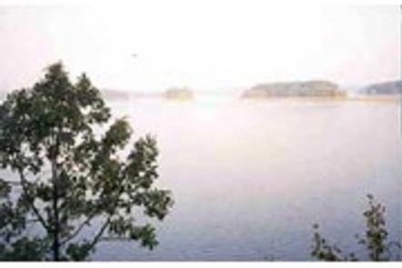
Caddo Drive Campground sits along the pristine shores of Degray Lake in the foothills of the Quachita Mountains. The area offers stunning scenery and panoramic views, and Caddo was awarded one of Americas Top 25 Scenic Views.

Recreation

DeGray Lake hosts thousands of professional fishing tournaments, triathlons and it is one of the most popular swimming destinations in the region. The area is also ideal for boating and jet skiing.

Facilities

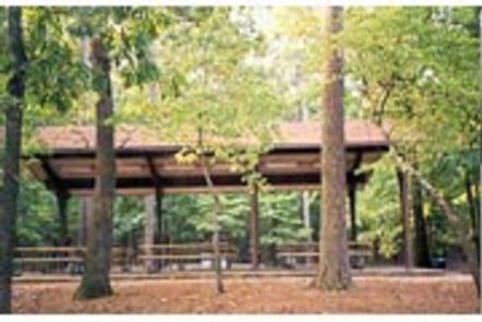
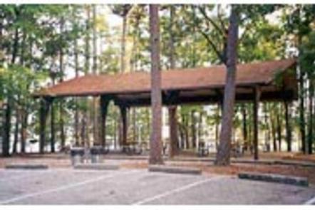
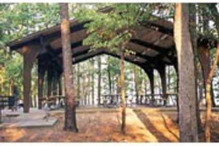
Caddo Drive offers a mix of RV, standard and tent-only campsites, each with electric hookups. Other amenities include flush toilets, heated showers, a boat ramp and swimming beach.

To see USACE DeGray Lake Virtual Tour, click here.

Natural Features

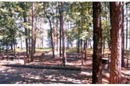
The campground is situated on a tree-covered ridge that joins a bluff. Degray Lake encompasses 13,500 water acres, with 207 miles of shoreline and an average depth of 47 feet.

Nearby Attractions

The DeGray Lake State Resort Park lies on the northern shores of the lake, and kayaking tours, golf, tennis courts and a horseback riding trail are available.

Reservation

More from CampingHiking.net:

MONOCLE LAKE, Michigan Campground Images, Info & Reservations

Listen Directions 12600 E Lakeshore Drive Brimley Michigan 49715 From Bay Mills, travel west on County Road 42 (Whitefish Bay Scenic Byway) for approximately half a mile, then turn south on Forest Road 3699 to the campground entrance. Phone 906-203-9872 Activities BOATING, HISTORIC & CULTURAL SITE, CAMPING, FISHING, HIKING, WATER

OSAGE BLUFF, Missouri Campground Images, Info & Reservations

Listen Directions From Highway 83, travel about a mile on Osage Bluff Road. Follow signs into park. Phone 660-438-3873 Activities BOATING, CAMPING, FISHING, FISH HATCHERY Keywords UBAG,TRUMAN LAKE,HARRY S TRUMAN Related Link(s) Rec Area Info & Images Missouri State Road Conditions Missouri State Tourism Overview Osage Bluff Park sits on

MOLINO, Arizona Campground Images, Info & Reservations

Listen Directions From Tucson, Arizona, take Catalina Highway off Tanque Verde Road in Tucson. Drive 4.2 miles northeast to the Coronado National Forest boundary and continue 5.7 miles to the campground. The campground is between mileposts 5 and 6. All campsites are adjacent to paved roads. Phone 520-749-8700 Activities BIKING,

MINERSVILLE CAMPGROUND, California Campground Images, Info & Reservations

Listen Directions From Weaverville: take Highway 3 north for 15 miles. Turn right on Minersville/Bushtail Road for 1 mile. Phone 530-623-2121 Activities BOATING, CAMPING, FISHING, HIKING, WATER SPORTS, SWIMMING SITE Keywords Trinity Lake,Clair Engle Lake,Minersville Related Link(s) Rec Area Info & Images California State Road Conditions California State Tourism Forest

LIMBERLOST CAMPGROUND, Oregon Campground Images, Info & Reservations

Listen Directions From McKenzie Bridge, travel east on Hwy 126 to Hwy 242. Follow Hwy 242 approximately 2 miles east to Limberlost Campground. Phone 801-226-3564 Activities BIKING, BOATING, HIKING Keywords Limberlost Campground Related Link(s) Rec Area Info & Images Forest Service Concessionaire Oregon State Road Conditions Oregon State Tourism Overview