DENT ACRES, ID Campground Reservation, Info, Images, Map, Directions

DENT ACRES, Idaho Campground Images, Info & Reservations

Listen

Directions

From Hwy 12: Cross the bridge at Orofino and turn left onto Hwy 7.  Travel 200 yards and turn right on Dent Bridge Road and travel 19 miles.  At the sign for the campground, turn left.  Campground is 2 miles ahead.

Phone

208-476-9029

Activities

BOATING, CAMPING, FISHING, HIKING, HUNTING, WATER SPORTS, WILDLIFE VIEWING

Keywords

DENT,DWORSHAK,DWORSHAK DAM & RESERVOIR,DENT ORCHARDS

Related Link(s)

Rec Area Info & Images

Idaho State Road Conditions

Idaho State Tourism

Overview

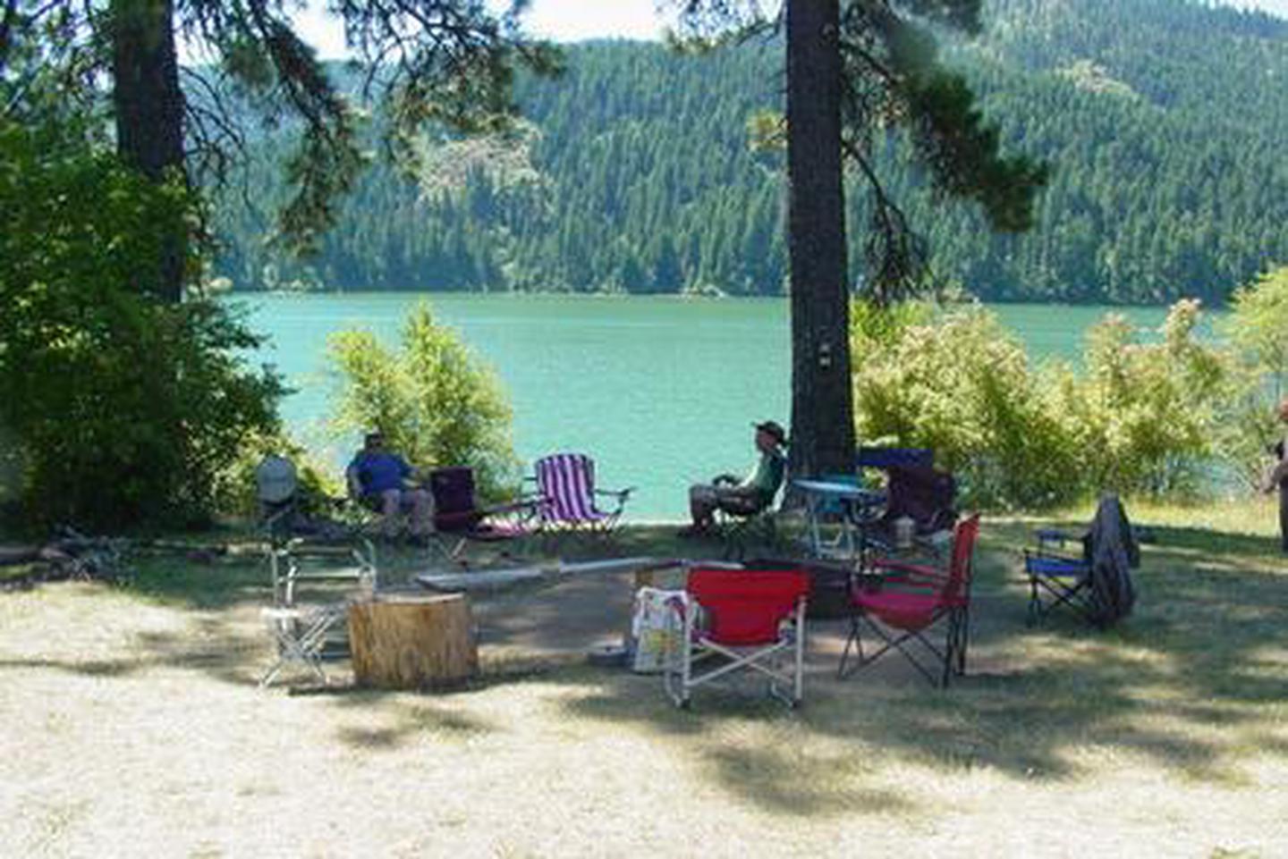
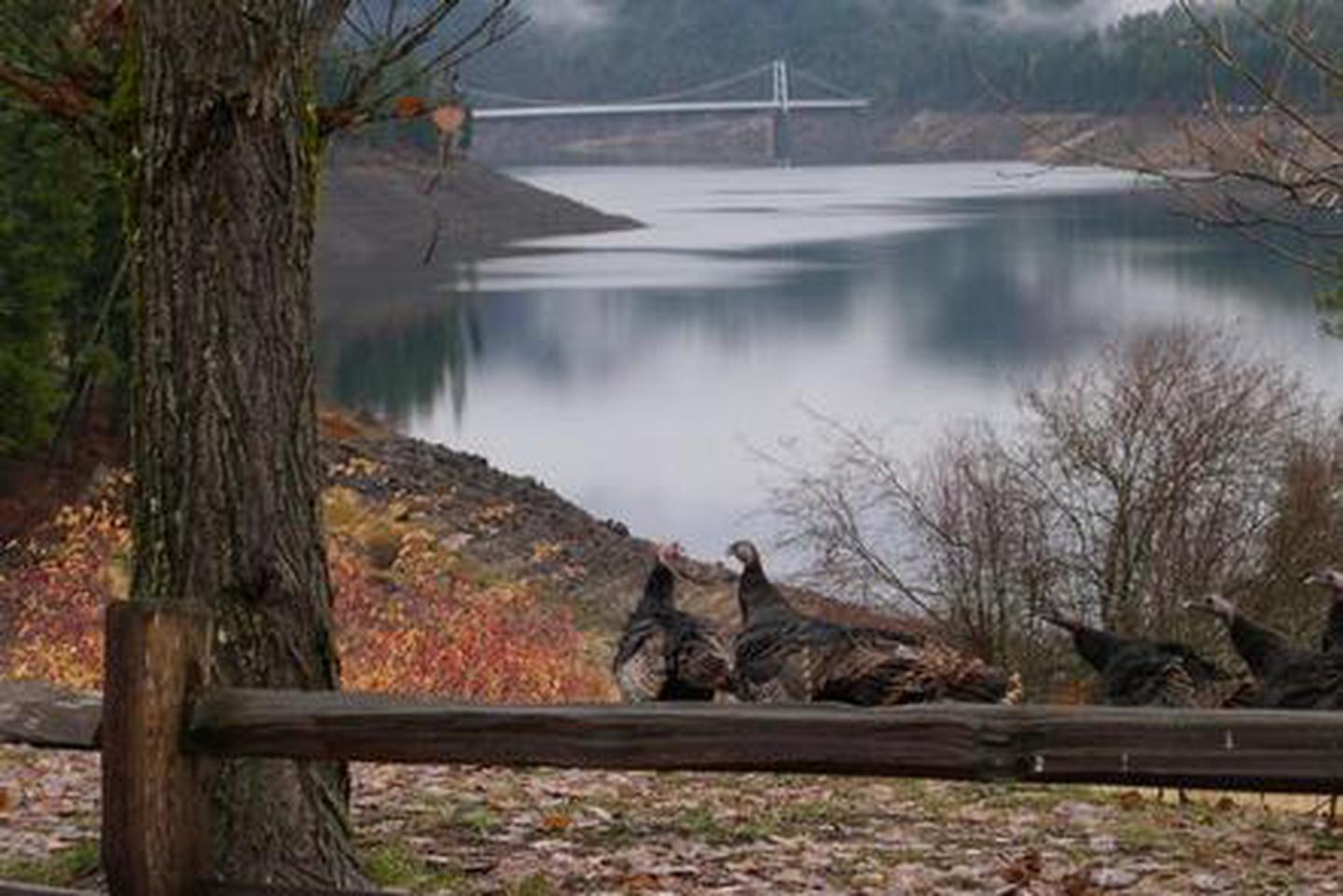
Located in northern Idaho’s beautiful Clearwater Valley, Dent acres Campground on Dworshak Lake is surrounded by forests and abundant wildlife. Dworshak Lake is 54 miles long, hosts kokanee salmon, rainbow trout and small mouth bass fishing. It has excellent boating, water skiing and hunting opportunities.

Recreation

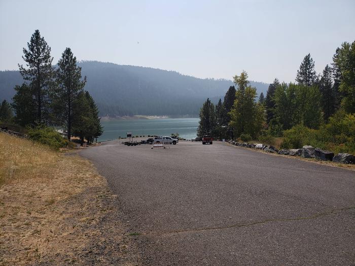
Dent Acres is an excellent location for boaters, fishermen, hunters, hikers, wildlife watching, as well as quiet relaxation. There is a boat ramp for access to the reservoir, multiple trails for hiking, and thousands of surrounding acres of public lands for the hunter.

Facilities

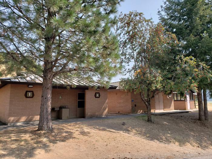
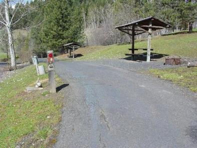
Dent Acres features 49 pull through camping sites and one back-in only site. The campground can accommodate everything from tent camping to large RVs. All sites have water and 50 amp electricity hookups as well as sewage hookups, a fire pit and a covered picnic table. The campground offers flush toilets and shower rooms. Adjacent to the campground is a playground and plenty of open space for activities. There are also flush toilet restrooms and a fish cleaning station located near the boat ramp. There are several large trash dumpsters throughout the park. There is a large open shelter which can accomodate up to 75 people.

Natural Features

Dworshak Reservoir is surrounded by steep forested, mountainous country. Numerous small creeks feed the reservoir.

Nearby Attractions

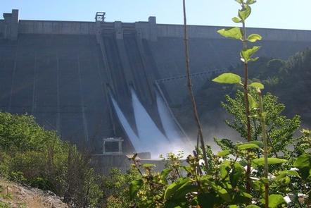
-Dent Bridge, which spans Dworshak Reservoir, is approximately one mile east of Dent Acres and is the largest cable suspension bridge in the state of Idaho. -Dworshak Dam and Visitor Center -Dworshak Hatchery -Clearwater National Forest -Clearwater Historical Society and Museum – Weippe Discovery Center -Canoe Camp -Nez Perce (National Park site at Spalding) -Orofino Chamber of Commerce

Reservation

More from CampingHiking.net:

SHUTES BRANCH, Tennessee Campground Images, Info & Reservations

Listen Directions From downtown Nashville get on I-40 E/I-65 S for .9 miles. Follow I-40 E for 12.2 miles and then take exit 221A from I-40 E. Take Andrew Jackson Pkwy which turns into Saundersville Rd for 6.5 miles. Shutes Branch Recreation Area will be located on the right side

WINSTANLEY LAKE CABIN, Alaska Campground Images, Info & Reservations

Listen Directions The cabin is located on Winstanley Lake approximately 33 air miles northeast of Ketchikan on the mainland, east of Winstanley Island. The cabin is accessible by float plane or by trail from saltwater (skiff provided at end of trail; please return it to the trail after use). Access

DAVIDOF LAKE CABIN, Alaska Campground Images, Info & Reservations

Listen Directions Accessible early June through October. Located 40 air miles southeast of Sitka, east of Whale Bay, within South Baranof Wilderness Area. Access is by float plane only, and takes 35 minutes from Sitka. For geographic features surrounding cabin, refer to USGS topographic map Port Alexander C-3. Phone 907-747-6671

TANNERS FLAT, Utah Campground Images, Info & Reservations

Listen Directions From I-215, take the 6200 South exit and travel a mile east to Wasatch Blvd. Take Wasatch Blvd 3 miles south to junction with Little Cottonwood Canyon/Highway 210. Take a left at the junction and travel up Little Cottonwood Canyon for 4.1 miles to the campground. Phone SALT

DOWDY LAKE, Colorado Campground Images, Info & Reservations

Listen Directions From Fort Collins, take Highway 287 north for approximately 24 miles to Livermore. Turn west on County Road 74 and continue about 23 miles to Dowdy Lake Road. Turn right, then another right onto Dowdy Drive and continue to the campground. Phone 970-295-6700 Activities BIKING, BOATING, CAMPING, FISHING,

LIVE OAK SOUTH, California Campground Images, Info & Reservations

Listen Directions From Bakersfield, take Highway 178 east to the town of Lake Isabella. From Lake Isabella, take Highway 155 north approximately 6 miles to Live Oak South campground. Phone 760-376-1815 Activities CAMPING Keywords LIOA,LIVE OAK,LIVE,OAK,OAK SOUTH,LIVE SOUTH,SEQUOIA NF – FS Related Link(s) Rec Area Info & Images Forest Service