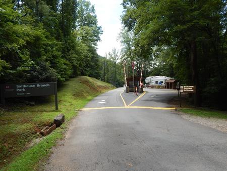
SALTHOUSE BRANCH, VA Campground Reservation, Info, Images, Map, Directions

SALTHOUSE BRANCH, Virginia Campground Images, Info & Reservations

Listen

Directions

From US 220, turn onto Henry Road (SR-605), go 6 miles; turn left onto Knob Church Road and go 2 miles. Turn left onto Salthouse Branch Road and follow signs to the entrance.

GPS Users: Do not use SR-727 (Stoney Brook Lane) or SR-894 (Johnson Hill Road).

Phone

(540) 365-7005

Activities

CAMPING, HIKING, DAY USE AREA, SWIMMING SITE

Keywords

SBRA,PHILPOTT LAKE

Related Link(s)

Rec Area Info & Images

Virginia State Tourism

Virginia State Road Conditions

Overview

Salthouse Branch Campground is nestled on the shores of Philpott Lake in the rugged foothills of Virginia’s Blue Ridge Mountains. The park is located in a rural and sparsely populated part of Franklin County near the small community of Henry.

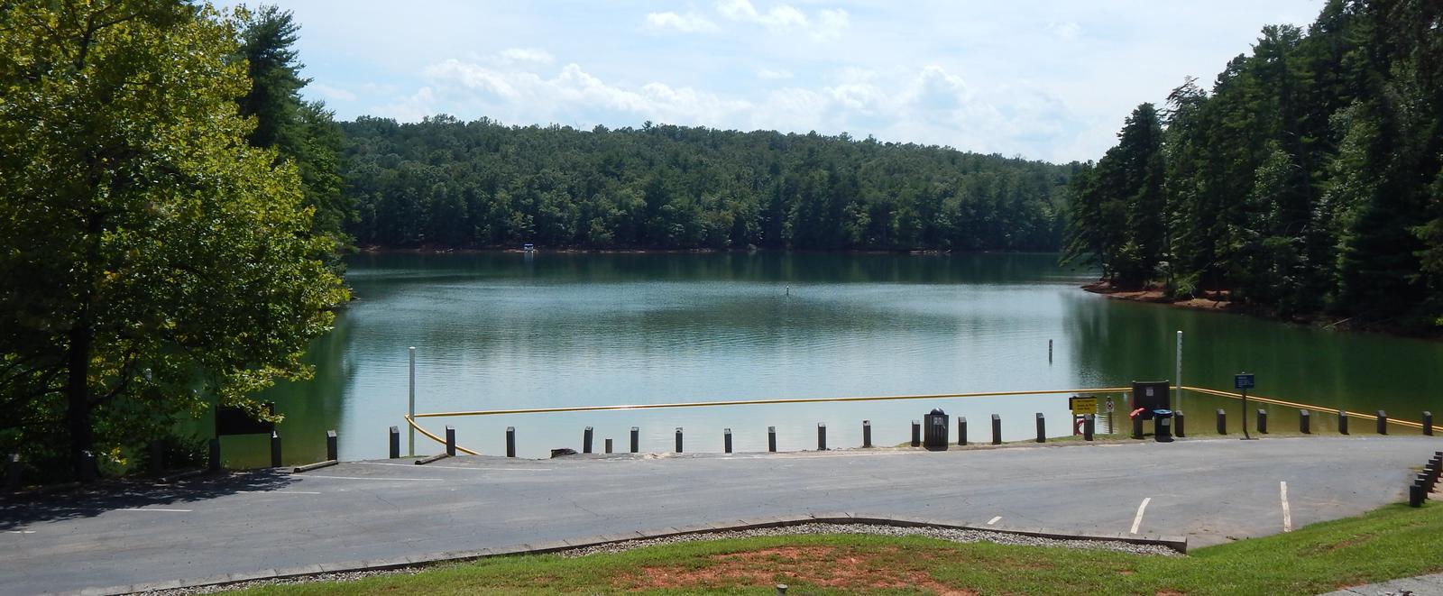
Philpott Lake’s clear water and natural shoreline make it a unique place for visitors to enjoy boating, fishing, hiking, picnicking and camping.

Click here for the Philpott Lake Virtual Tour: http://www.photographyoptions.net/images/philpott/tour.html

Recreation

The lake provides visitors with great boating and swimming opportunities. Anglers enjoy fishing for large and smallmouth bass, walleye, bluegill, crappie and catfish.

A 1/2-mile nature loop and a 1/2-mile interpretive trail are available in the campground. Many additional miles of hiking and biking trails surround Philpott Lake, allowing visitors to get out and explore this scenic area.

Facilities

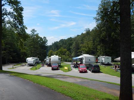
The park offers both camping and day-use facilities, including 44 family sites with electric and water hookups and one group picnic shelter with electric and water. Also available are 21 boat-in sites and 46 primitive sites without hookups.

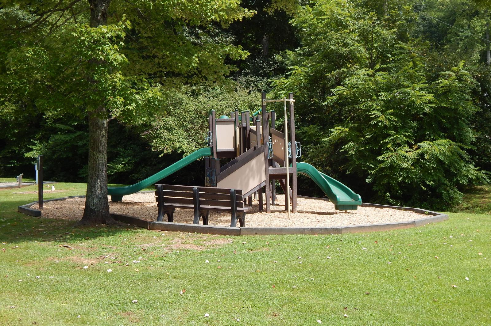
Amenities include flush toilets, showers, drinking water and a dump station. A beach, boat ramp, dock, playground, and amphitheater are also on-site.

Natural Features

Philpott Lake covers 2,900 acres and has 100 miles of shoreline. The lake’s steep, rocky banks meet beautiful mixed forests of oak, maple, hickory, pine and cedar.

Wildlife is abundant throughout the area. Deer, turkeys, squirrels, raccoons, and a variety of songbirds and waterfowl are commonly viewed.

Nearby Attractions

The lake is adjacent to Fairystone State Park and Fairystone Farms Wildlife Management Area, which includes 5,300 acres of public recreational lands.

Reservation

More from CampingHiking.net:

TAILWATER REC AREA, Tennessee Campground Images, Info & Reservations

Listen Directions From I-40, take Exit 258, travel north on HWY 53/25, turn right on SR-26 and travel for 2 miles. Turn right on Corps Lane and follow signs into recreation area. Phone 615-735-1034 Activities BOATING, PICNICKING, WILDLIFE VIEWING, DAY USE AREA, MOTOR BOAT, WATER ACCESS Keywords TARA,CORDELL HULL LAKE,SHELTER

LEPAGE PARK, Oregon Campground Images, Info & Reservations

Listen Directions From Dalles, Oregon, take I-84 east for 30 miles. Take exit 114 and follow signs to the John Day River. Phone 541-739-1135 Activities BOATING, CAMPING, FISHING, PICNICKING, WATER SPORTS, WILDLIFE VIEWING, DAY USE AREA, SWIMMING SITE, PADDLING, SWIMMING, MOTOR BOAT, WATER ACTIVITIES, KAYAKING, CANOEING, WATER ACCESS, WATER SKIING,

WOLF CREEK (UT), Utah Campground Images, Info & Reservations

Listen Directions From Woodland, Utah, travel approximately 16 miles on State Highway 35. Campground is on the southwest side of the road. Phone HEBER RANGER DISTRICT 435-654-0470 OR UTAH RECREATION COMPANY 385-273-1100 Activities BIKING, CAMPING, HIKING, WILDLIFE VIEWING, DAY USE AREA Keywords WOL1,UINTA NF – FS Related Link(s) Rec Area

BEAR CREEK CABIN, Montana Campground Images, Info & Reservations

Listen Directions From Ennis, take Highway 287 south for 11 miles, to Cameron, Montana. From Cameron, turn east on Bear Creek Loop and continue approximately 6 miles to the cabin. The last several miles are gravel or dirt roads, which may be muddy or snow-covered and may not always be

CHARBONNEAU PK, Washington Campground Images, Info & Reservations

Listen Directions From Pasco, Washington, take Highway 12 east. After crossing the Snake River Bridge, take the first exit and proceed to Highway 124. Continue east through Burbank, Washington. Turn north on Sun Harbor Drive and follow for 1.5 miles, then take a left on Charbonneau Road. Campground is on

TAILWATER, Kentucky Campground Images, Info & Reservations

Listen Directions From Glasgow, KY: Take 31-E south for 4 mi; turn right on 252, which will cross the dam in 8 mi. The Tailwater entrance road is at the south end of the dam. Follow signs into recreation area. Approximately 19 miles from Bowling Green, KY. Phone 270-622-7732 Activities