GERALD FREEMAN CAMPGROUND, WV Campground Reservation, Info, Images, Map, Directions

GERALD FREEMAN CAMPGROUND, West Virginia Campground Images, Info & Reservations

Listen

Directions

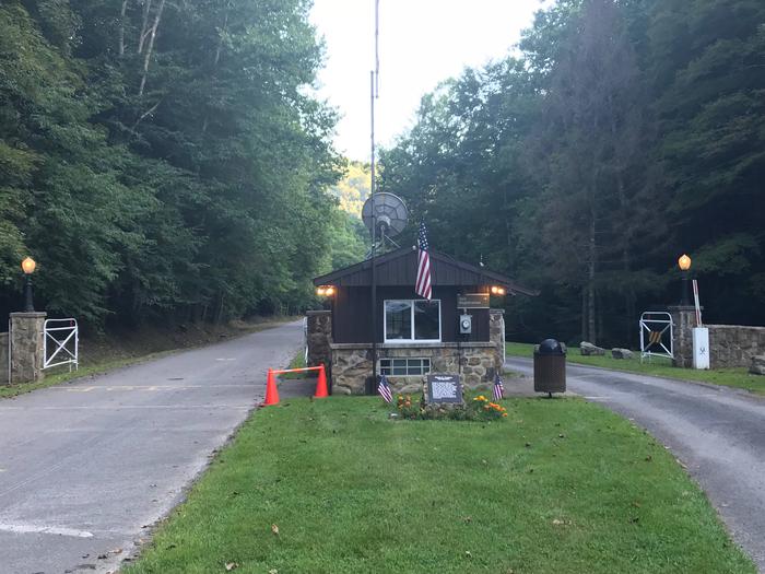
From I-79, take exit 67. Turn right on WV-4 and go 1 mile. Turn left on WV-15 and travel 12 miles to the campground. Campground will be on your right. NOTE: GPS directions are not always accurate. Call for additional information.

Phone

304-765-7756 OR 304-765-2816

Activities

BIKING, BOATING, CAMPING, FISHING, HIKING, HUNTING, WILDLIFE VIEWING, WILDERNESS, SWIMMING, MOTOR BOAT, WATER ACTIVITIES, KAYAKING, WATER ACCESS, JET SKIING, WATER SKIING

Keywords

GERA,SUTTON LAKE,KANAWHA RUN,FREEMAN,SUTTON LAKE,GERALD FREEMAN CAMP

Related Link(s)

Rec Area Info & Images

West Virginia State Road Conditions

West Virginia State Tourism

Overview

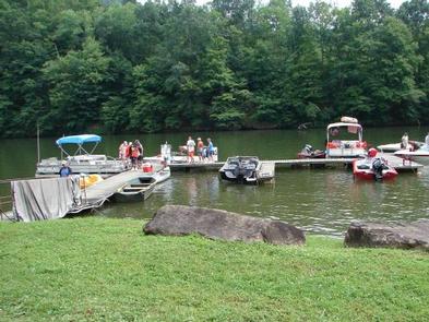
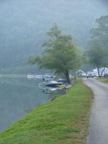
Gerald Freeman Camp is nestled in the headwaters of Sutton Lake in central West Virginia, 70 miles north of Charleston. The area provides a wide variety of recreational activities, including boating, swimming, fishing and hiking.

Recreation

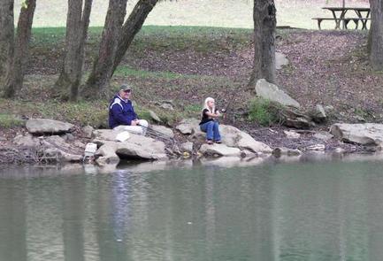
Anglers find plentiful bass, crappie, catfish and sunfish in the lake. The Elk River below Sutton Dam is well-known for its muskie and walleye fishing, and trout are stocked in the Downstream area. Fire roads and hunting trails in the surrounding lands provide great hiking and biking opportunities around Sutton Lake and at the nearby Elk River Wildlife Management Area. A variety of campground activities are scheduled throughout the summer for children of all ages.

Facilities

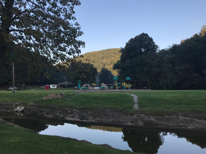
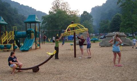
This large campground offers 158 campsites. 113 sites have electric hookups and 37 sites have full hookups. Boat ramps and a marina with a snack bar are located on-site. Younger visitors love the campground’s playgrounds and basketball courts. Other facilities include hot showers, flush toilets, water fountains, and two trailer water / dump stations.

Natural Features

Sutton Lake covers 1440 acres as it winds 14 miles up the Elk River. Many quiet coves can be found along its 40 miles of shoreline. The lake is surrounded by rolling hills wooded with mixed stands of oak, hickory, poplar and cherry trees. Wildlife, including deer, turkeys, squirrels, ruffed grouse, Canada geese and other waterfowl, is abundant in the area.

Nearby Attractions

The Elk River Wildlife Management Area contains nearly 18,000 acres of public hunting lands. The terrain is diverse and divided into the Elk River and Holly River sections. The Elk River section consists primarily of steep hills, ridges and benches, while the Holly River section is on the north side of the lake and consists of forested hills and open farmlands.

Additional camping facilities are available on a first come, first served basis at Bakers Run Campground and Bee Run Primitive Campground.

Reservation

More from CampingHiking.net:

ROCKY BRANCH CAMPGROUND, Arkansas Campground Images, Info & Reservations

Listen Directions From Rogers, Arkansas, take Highway 12 east for just under 10 miles. Turn left onto Highway 303 and travel 3.5 miles. Turn left onto Park Road and follow it to the campground. Phone (479) 925-2526 Activities CAMPING, FISHING, HIKING, HUNTING, VISITOR CENTER, WILDLIFE VIEWING Keywords None Related Link(s)

PYBUS BAY CABIN, Alaska Campground Images, Info & Reservations

Listen Directions Access to the cabin is by float plane or boat with anchor at high tide. Flight time is approximately one hour and 15 minutes from Juneau or 30 minutes from Petersburg. Access by boat via Stephens Passage or Fredrick Sound is approximately 100 miles from Juneau. Float plane

BICENTENNIAL CAMPGROUND, California Campground Images, Info & Reservations

Listen Directions Upon entering the Marin Headlands follow the signs to the Visitor Center. The campground is less than 1/2 mile drive from the Visitor Center. Phone 415-331-1540 Activities BIKING, HISTORIC & CULTURAL SITE, CAMPING, INTERPRETIVE PROGRAMS, VISITOR CENTER, MOUNTAIN BIKING, BERRY PICKING Keywords Related Link(s) Rec Area Info &

FREMONT POINT CABIN, Oregon Campground Images, Info & Reservations

Listen Directions Summer Travel: From the Paisley Ranger District Office in Paisley, Oregon: Travel north on State Route 31 for 34.2 miles, between mile posts 64 and 65, turn left (west) onto the graveled Forest Service Road (FSR) 2901. Follow FSR 2901 for 16.1 miles. Turn left (east) on FSR

TRACY RIDGE, Pennsylvania Campground Images, Info & Reservations

Listen Directions Take State Route 321 north off of State Route 59, or south off of State Route 346. Phone 814-368-4158 Activities BOATING, CAMPING, FISHING, HIKING, WATER SPORTS Keywords TRAC,ALLEGHENY NF – FS Related Link(s) Rec Area Info & Images Pennsylvania State Road Conditions Pennsylvania State Tourism Forest Service Concessionaire

Creek Pasture Group Site, Utah Campground Images, Info & Reservations

Listen Directions Turn west off US 191 onto Highway 211 and travel approximately 27 miles. The turn off to the campground is on the north side of the highway. It is located approximately 7.5 miles southeast of the Canyonlands National Park visitor’s center and 14.5 miles northwest of Newspaper Rock.