


Directions
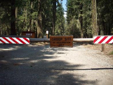
From Cle Elum, Washington, take State Highway 903 north for 15 miles. Turn left at the campground sign. At the T in the road turn right into the group site.
Phone
509-852-1100
Activities
CAMPING, FISHING, HIKING, PHOTOGRAPHY, SWIMMING, CANOEING, BIRDING, WATER ACCESS
Keywords
CLEE,OKANOGAN – WENATCHEE NF -FS
Related Link(s)
Washington State Road Conditions
Overview
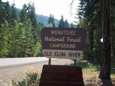
Cle Elum River Group Campground is located within the Cle Elum River Campground situated just off its namesake river in Okanogan-Wenatchee National Forest.
Set in a mixed-conifer forest at an elevation of 2,300 feet and surrounded by high mountains, this campground offers a large site suitable for large family and group camping excursions.
Recreation
In addition to being a prime location for hiking, fishing, swimming and birding in summer and early fall, the Cle Elum River area offers excellent skiing, snowshoeing and snowmobiling in the winter months.
The campground is closed during the winter months. The adjacent French Cabin Creek Sno-Park accomodates skiers, snowshoers and snowmobilers.
Anglers will find the waters teeming with rainbow trout, cutthroat trout and kokanee salmon in the river as well as the nearby reservoir.
Facilities
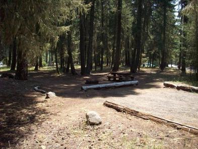
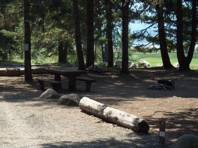
The large reservable group site is equipped with picnic tables, campfire rings with grills, drinking water and vault toilets.
Natural Features
The Okanogan-Wenatchee National Forest offers stunning scenic views, with high, glaciated alpine peaks, valleys of old growth forest and rugged shrub-steppe country making up the diverse landscape. Elevations range from below 1,000 feet to more than 9,000 feet. Precipitation varies greatly throughout the area, ranging from approximately 140 inches along the Cascade Crest to only 10 inches along the eastern edge. Visitors can expect many days of warm, sunny weather in the summer, and winters with clear skies and plenty of snow. The surrounding undeveloped wilderness, clean streams and diverse forests support an abundance of wildlife, including deer, porcupine, native fish and migratory birds.
Nearby Attractions
Speelyi Beach is a great place to spend the day. Featuring a wide sandy beach surrounded by conifer forest on Cle Elum Lake, visitors will have plenty of space to wade, swim and splash around. Those searching for deeper water will enjoy a kayak outing along the shore at sunset. The spectacular Pacific Crest Trail (PCT) is accessible near the campground. It is one of the world’s premier National Scenic Trails and showcases some of North America’s most fantastic scenery as it winds its way from Mexico to Canada through California, Oregon and Washington.