MOUNTAIN OAK, CA Campground Reservation, Info, Images, Map, Directions

MOUNTAIN OAK, California Campground Images, Info & Reservations

Listen

Directions

From Wrightwood, CA, take State Rt. 2 west 2.4 miles to Palmdale/Jackson Lake sign (County Rt. N4/Pines Highway). Turn right onto Rt. N4 and go 3.1 miles to campground sign. Turn right into campground.

Phone

760-249-3526

Activities

BOATING, CAMPING, FISHING, HIKING, WILDLIFE VIEWING, SWIMMING SITE, CANOEING, BIRDING, SCENIC DRIVE

Keywords

MOUN,ANGELES NF – FS,Mt. Oak,Mt Oak

Related Link(s)

Rec Area Info & Images

California State Tourism

California State Road Conditions

Forest Service Concessionaire

Overview

Escape to Mountain Oak Campground in the Angeles National Forest for a restful, refreshing getaway from city life. Just northwest of the Los Angeles metro area, Mountain Oak provides a scenic and relaxing destination for camping, hiking, picnicking and wildlife viewing.

The campground is also near Jackson Lake for easy access to fishing, canoeing and swimming.

Recreation

Swim or canoe in the refreshing waters of Jackson Lake, the only lake near Wrightwood. The lake is stocked with trout and bluegills. Powerboating is not permitted in the lake, so the setting is peaceful and quiet.

Hikers can find trails near the campground.

Facilities

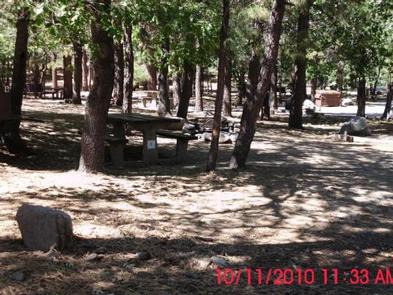
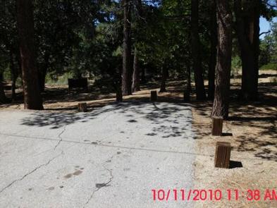
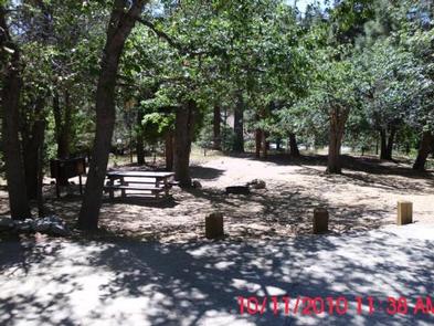
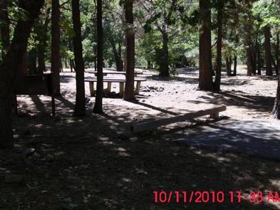
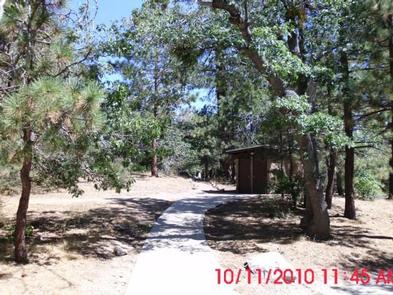
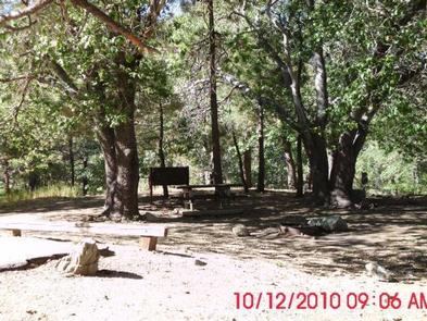
The single-loop campground provides lots of shade from towering trees but minimal privacy from neighboring campgrounds. Ground cover is mostly pine needles and leaves.

Bear-proof food containers are provided at each campground and amenities include picnic table, grills and flush toilets. Drinking water is also available.

A camp host is on-site, offering firewood for sale.

Natural Features

At an elevation of 6,400 feet, Mountain Oak is shaded by oak, ponderosa and sugar pines in the Angeles National Forest. This forest, spanning across most of the San Gabriel Mountains, provides a striking backdrop for the Los Angeles area.

Jackson Lake spans just 3 acres and lies in the San Gabriel Mountains. Formed by the San Andreas fault, the lake is primarily fed by snow runoff from the mountains and is hugged by grass and sand beaches. The lake is ideal for listening to nature’s soundtrack, complete with sounds of birds singing and leaves rustling in mountain breezes.

A diverse variety of animal life exists in Angeles National Forest, such as bobcat, mountain lion, bear and Nelson bighorn sheep. Many species of birds and smaller animals also inhabit the forest.

Nearby Attractions

The Angeles Crest Highway, part of California State Route 2, is a scenic byway that meanders through oak thickets, chaparral, high desert landscapes and pine tree forests.

Reservation

More from CampingHiking.net:

BUFFALO CAMPGROUND, Colorado Campground Images, Info & Reservations

Listen Directions From Denver, travel southwest on Highway 285. Turn south on Jefferson County Road 126 and travel 15 miles. Turn right on Forest Road 550 and drive 5 miles to the campground. Phone (303) 275-5610 Activities BIKING, CAMPING, FISHING, HIKING Keywords BUF1,RED SKIN,PIKE AND SAN ISABEL NF- FS Related

CAMEL LAKE CAMPGROUND, Florida Campground Images, Info & Reservations

Listen Directions Take SR 20 west from Tallahassee through Hosford to Bristol. Turn south on SR 12. Continue south to the Apalachicola National Forest boundary sign and look for a sign for Camel Lake soon after you pass the work station and trailhead on the left. Turn left on Forest

PRIEST RIVER, Idaho Campground Images, Info & Reservations

Listen Directions Priest River Recreation Area is 1 mile east of the town of Priest River on Highway 2. After the river it will be the first road on the right. The park is also known as the "Mudhole." Phone 208-437-3133 Activities BOATING, CAMPING, FISHING, VISITOR CENTER, WILDLIFE VIEWING, DAY

WAX, Kentucky Campground Images, Info & Reservations

Listen Directions From Louisville, take I-65 south to exit 76 and turn west onto Highway 224. After 9 miles turn left on Highway 479, then continue for another 8 miles and turn left onto Highway 88. Continue into the campground entrance. Phone 270-242-7578 Activities BOATING, CAMPING, FISHING, HIKING Keywords WAXX,NOLIN

LOG JAM BAY CABIN, Alaska Campground Images, Info & Reservations

Listen Directions Access to Log Jam Bay Cabin is by float plane or wheeled plane only, typically 45 minutes from either Cordova or Seward. Wheeled planes land on the outside beach strip at low tide. If a wheeled plane is used, access is limited by tides and gear must be

NEMO LANDING, Missouri Campground Images, Info & Reservations

Listen Directions From Springfield, MO, take US 65 north past Louisburg, MO, to NN Highway. Follow NN Highway south to Nemo, MO. Turn south at the 4-way stop and find the entrance to Nemo Landing on the left side of the highway. Phone 417-993-5529 Activities CAMPING, SWIMMING SITE Keywords NEMO,POMME