CHISHOLM CAMPGROUND, MONTANA Campground Reservation, Info, Images, Map, Directions

CHISHOLM CAMPGROUND, Montana Campground Images, Info & Reservations

Listen

Directions

From Main Street in Bozeman, take 19th Avenue south for 7 miles to the paved Hyalite Canyon Road. Turn left and continue south for 11 miles to the campground. The last mile of road is gravel.

Phone

(406)646-1012

Activities

BIKING, CAMPING, FISHING, HIKING, WILDLIFE VIEWING, PHOTOGRAPHY, SWIMMING, MOUNTAIN BIKING, OFF ROAD VEHICLE TRAILS, KAYAKING, CANOEING, BERRY PICKING, STAR GAZING, BIRDING, WATER ACCESS, MUSHROOM PICKING

Keywords

CHIM,GALLATIN NF – FS

Related Link(s)

Rec Area Info & Images

Montana State Tourism

Montana State Road Conditions

Forest Service Concessionaire

Overview

Chisholm Campground is located next to scenic Hyalite Reservoir in the Bozeman Ranger District of the Gallatin National Forest, 18 miles south of Bozeman, Montana.

The surrounding area offers many outdoor recreational opportunities, including boating, canoeing, fishing, hiking and climbing.

Recreation

Hyalite Reservoir offers many recreational activities, including boating, canoeing and fishing opportunities. Anglers fish for Yellowstone cutthroat, Arctic grayling and brook trout. Hyalite Creek and the East Fork offer fishing as well.

Many hiking trails are found in Hyalite Canyon, including the popular Hyalite Peak Trail. This 7.5-mile one-way trail gains 3,450 feet in elevation as it climbs past numerous waterfalls, to beautiful Hyalite Lake and Peak.

Facilities

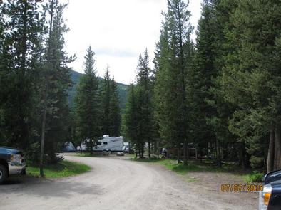
This fully accessible campground offers single-family campsites, each equipped with a picnic table and campfire ring. Vault toilets, drinking water and trash collection are provided. Roads and parking spurs are gravel. A boat ramp is located 1 mile away at Hood Creek Campground. Firewood is available for $6.00 per bundle at Hyalite Youth Camp.

Natural Features

The campground is situated in a forest of pine and fir trees, next to Hyalite Reservoir, at an elevation of 6,700 feet. The East Fork Hyalite Creek runs alongside the north side of the campground.

Reservation

More from CampingHiking.net:

HAWTHORN BLUFF, Oklahoma Campground Images, Info & Reservations

Listen Directions From Tulsa, Oklahoma, take U.S. Highway 169 north for 27 miles to Highway 88. The campground is 2 miles east of the town of Oologah on Highway 88. Phone 918-443-2319 Activities BOATING, CAMPING, FISHING, HIKING, VISITOR CENTER, WATER SPORTS, DAY USE AREA, SWIMMING SITE Keywords HAWT,OOLOGAH LAKE,OOLOGAH LAKE

CANYON RIM, Utah Campground Images, Info & Reservations

Listen Directions Located on Forest Road 095/Red Canyon Road off Highway 44, approximately 40 miles north of Vernal, Utah. Phone 435-784-3445 Activities BOATING, CAMPING, FISHING, HIKING, WILDLIFE VIEWING Keywords CANR,RED CANYON COMPLEX,THE RIM,FLAMING GORGE,ASHLEY NF – FS,Flaming Gorge National Recreation Area Related Link(s) Rec Area Info & Images Utah State

UINTA RIVER GROUP, Utah Campground Images, Info & Reservations

Listen Directions From Roosevelt, Utah, take State Highway 121 north to Neola, then travel on Uinta and Ouray Indian Reservation Road to Forest Road 118. Phone 435-722-5018 Activities BIKING, CAMPING, HIKING, WILDLIFE VIEWING Keywords UNIR,ASHLEY NF – FS Related Link(s) Rec Area Info & Images Utah State Road Conditions Utah

GROUSE CREEK GROUP SITE, Washington Campground Images, Info & Reservations

Listen Directions Grouse Creek Campground is located approximately 7 miles up the Forest Service Road 6200/Chiwawa River Road. There is a gated spur road just off the main paved road on the left. The campground is at the end of the road alongside Grouse Creek. Phone 509-763-0700 Activities BIKING, CAMPING,

FRUITA CAMPGROUND, Utah Campground Images, Info & Reservations

Listen Directions Traveling westbound on Interstate 70: Take Utah State Highway 24 west towards Hanksville (exit 149). Stay on Highway 24 for 80 miles to reach the park Visitor Center. Traveling on Interstate 15: Take US Highway 50 east at Scipio (exit 188) towards Salina for 30 miles. At the

LOST BRIDGE NORTH, Arkansas Campground Images, Info & Reservations

Listen Directions From Rogers, Arkansas, take Highway 62 east for about 13 miles to Garfield. Turn right on Highway 127 and continue for 6 miles. Turn left on Marina Road and follow signs to the park. Phone 479-359-3312 Activities BOATING, CAMPING, HIKING, WATER SPORTS, SWIMMING SITE Keywords LOST,BEAVER LAKE,NORTH PARK,BEAVER