


Directions
From Reedsport Oregon, travel 11 miles south on Highway 101 to Spinreel Road. Turn right on Spinreel Road and proceed for a half mile to the campground entrance which will be on the left.
Phone
541-271-6000
Activities
CAMPING, HIKING, WILDLIFE VIEWING
Keywords
SPIN,TEST,SIUSLAW NF – FS
Related Link(s)
Overview
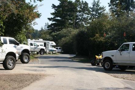
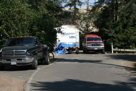
Spinreel Campground is an off-road vehicle rider’s dream, located in the Oregon Dunes National Recreation Area along Tenmile Creek in Coos County. Campers can rely on conveniences like drinking water and paved roads, with prime access to the expansive off-road trails along the sandy dunes.
Recreation
Spinreel ultimately attracts off-road vehicle enthusiasts. Thrill-seekers have their choice of riding on designated routes like the Coast Guard Trail and ATV Trail #430, or cruising in the open riding sections. Swimming and beachcombing are also enjoyed along the Pacific coast. Fishing is available in the creek; Winter steelhead love the cold waters.
Facilities
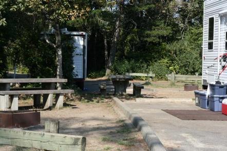
Drinking water, flush toilets, trash collection, recycling, picnic tables, fire rings and boat ramp are available for campers. The ramp is designed for small boats entering Tenmile Creek. There are no electric hookups or dump stations in this campground.
Natural Features
Spinreel Campground is in the heart of the Oregon Dunes National Recreation Area, known for its wind-sculpted sand dunes towering to 500 feet above sea level. The dunes cover 1,076 acres of land, surrounded by forests and the Pacific coast. It lies in the southern edge of Siuslaw National Forest.
Nearby Attractions
Explore the waterways of the region, including Tahkenitch Lake and Siltcoos Lake.