
Directions
From the west, take Highway 2 east through Monroe and over Stevens’ Pass. The Tumwater campground is approximately 20 miles east of the top of Stevens’ pass, on the left side of the highway.
From the east, take Highway 2 west through Leavenworth. The campground is 10 miles west of Leavenworth on the right hand side of the highway.
Phone
509-548-6816
Activities
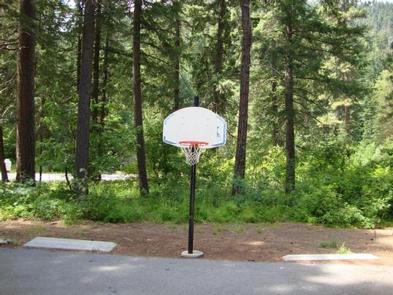
BIKING, BOATING, CAMPING, HIKING, WILDLIFE VIEWING, SWIMMING SITE
Keywords
TUMW,OKANOGAN – WENATCHEE NF -FS
Related Link(s)
Washington State Road Conditions
Overview
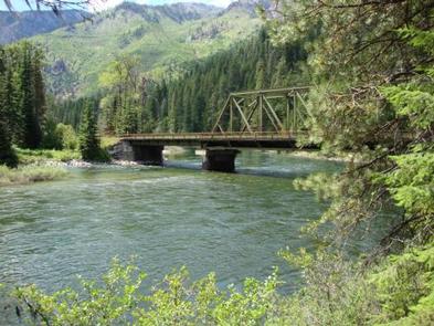
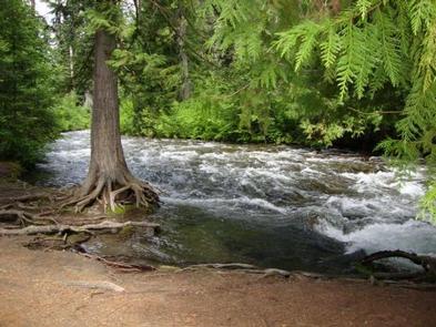
Tumwater Campground, located at the confluence of Chiwaukum Creek and the Nenatchee River in the Okanogan-Wenatchee National Forest, offers a serene setting for groups and large gatherings.
Recreation
Tumwater Group Campground offers outdoor enthusiasts the opportunity to hike, fish, ski and enjoy a long list of outdoor recreational activities throughout the year.
The confluence of Chiwaukum Creek and the Nenatchee River offers anglers a scenic backdrop as they cast their lines into the pools along the shore. Populations of trout and salmon find habitat along its banks.
Skiing, snowmobiling, tubing and skijouring are popular winter activities for visitors to the Wenatchee Ranger District. Both motorized and non-motorized Sno-Parks in the area offer access to both groomed trails and natural settings for those wanting to explore the winter wonderland.
Facilities
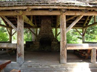
Tumwater Group Campground has one large site that can accommodate up to 70 people and 40 vehicles. The site is equipped with picnic tables, campfire rings, drinking water, accessible flush toilets and electric hookups.
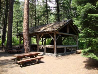
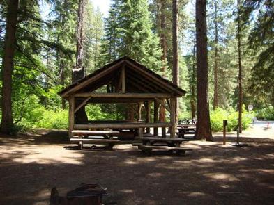
The campground also has a covered shelter and picnic area, complete with a wood stove and fireplace.
Natural Features
Okanogan-Wenatchee National Forest offers stunning scenic views, with high, glaciated alpine peaks, valleys of old growth forest and rugged shrub-steppe country making up the diverse landscape. Elevations range from below 1,000 feet to more than 9,000 feet.
Precipitation varies greatly throughout the area, ranging from approximately 140 inches along the Cascade Crest to only 10 inches along the eastern edge. Visitors can expect many days of warm, sunny weather in the summer, and winters with clear skies and plenty of snow.
More than 700 lakes and mountain ponds dot the glacier-carved terrain of nearby Alpine Lake Wilderness. Tree-covered valleys give way to rocky ridges and rugged peaks along the crest of the Cascades. Many peaks and slopes are permanently cloaked in snowfields. From wet forests of Douglas fir, cedar, and an understory of salal and berries, to firs and mountain hemlock, the landscape opens up to expansive meadows matted with low growth and ends with dry forestland of ponderosa pine and grasses.
The surrounding undeveloped wilderness, clean streams and diverse forests support an abundance of wildlife, including deer, porcupine, native fish and migratory birds.
Nearby Attractions
Visitors enjoy the Mt. Rainer National Park, where interpretive programs and exhibits offer education about the diverse landscape and history of the area.
The spectacular Pacific Crest Trail (PCT), one of the world’s premier National Scenic Trails, showcases some of North America’s most fantastic scenery, winding its way its way from Mexico to Canada through California, Oregon and Washington, and is accessible near the campground.